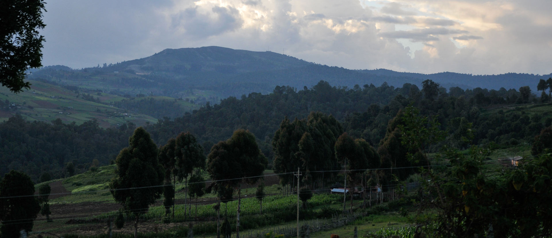
The majestic Cherang’any Hills form a formidable barrier that conceals some of the world’s most beautiful alpine scenery within its woods. These untamed, densely wooded hills are a far way from the main tourist circuit that has beautiful mountain scenery. They are Kenya’s fourth tallest mountain range, with undulating hills and towering mountain peaks, and they constitute the Rift Valley’s highest, most magnificent, and beautiful escarpments. The Cherang’any Hills, unlike most of Kenya’s mountains and ranges, are not volcanic in nature.
The Kameleogon, at 3580 meters, is the highest peak in the Cherang’any and Kenya’s fourth-tallest mountain after Mt. Kenya, Mt. Elgon, and the Aberdare Range.
But, in addition to Kameleogon, there are other additional peaks to conquer, including Chebon, the second-highest crest at 3375 meters, Chepkotet in the north-central part at 3370 meters, Alaleigelat at 3350 meters, and Sodang at 3211 meters.
They are flanked on three sides by steep rock walls and are located on a wooded escarpment. They are crisscrossed with walking pathways, and the country’s easy navigation and gentle slopes make it ideal for pleasant hill walking. The pathways run across open fields, through protected valleys, and up to wooded summits.
The Forest Reserves on Cherang’any are divided into 13 administrative blocks with a total gazetted size of 95,600 hectares.
Closed-canopy forest covers around 60,500 hectares, with the remainder consisting of bamboo, scrub, rock, grassland, moorland, or heath, as well as c.4,000 ha of agriculture and plantations.
The Kapkanyar, Kapolet, and Kiptaberr Forest Reserves create a huge western forest block with a total area of c.20,000 hectares. The Lelan, Embotut, Kerrer, Kaisungor, Toropket, Chemurokoi, Kupkunurr, Cheboit, Sogotio, and Kapchemutwa Forest Reserves are less well linked to the east. The woods here are scattered and divided by substantial natural grasslands, scrub, and (particularly in the middle area) farms, with the exception of a huge south-eastern block along the escarpment crest.
The Cherang’any forests, which lay astride the watershed between the Lake Victoria and Lake Turkana basins, are essential for water catchment.
Streams in the watershed’s west feed the Nzoia river system, which empties into Lake Victoria, while streams in the east feed the Kerio river system.
This region also includes Kapenguria, a tiny hamlet hallowed to Kenyan nationalists, where the colonial administration staged Mzee Jomo Kenyatta’s bogus show trial in the 1950s. The courtroom where the trial took place is now a memorial to the nation’s founding father, while the jail, complex, and cell where he was imprisoned are now national monuments.
Getting there
Some summits may be reached nearly entirely by car, while others need difficult high-altitude trekking.
All major roads pass over the 3000 m contour, which results in reduced oxygen supply.
The altitude may have an unfavorable effect on automobile engine performance, and it is necessary to bring additional gasoline supplies because consumption is high.
There are two ways to get there: either by the Kapenguria-Marich Pass route, which takes you down a scary deep valley, or via the Kito Pass and the Tot Escarpment. The major route, known as the Cherang’any Highway, is one of Kenya’s most dangerous and difficult highways. On top of the Kaisungur Range, there are grave mounds that are revered and treasured by the locals.
So, what makes visiting here so unique? The fact that you will feel like an explorer on a genuine adventure is one of the main reasons.
If you have a 4WD vehicle, you may drive through the highlands and up to some of the hills, such as Mount Kipteberr, and enjoy the view that stretches all the way to Mount Elgon on the Kenya/Uganda border.
Chesewe viewpoint is an ideal spot for a sundowner, with a 180-degree view over the Kerio valley and the Laikipia-Plateau in the distance, as well as the Tugen Hills.
Kipkunur Hill is a 3063m high hill that may be walked from Kapsowar. The vista from the summit is well worth the effort. As you get closer to the top of the hill, you’ll notice the tropical mountain forest with numerous high-value wood trees and bamboo forest.
The hills are also an important bird area (IBA) because of the richness of bird species present in the area, making it a birding hotspot for serious ornithologists and amateur birders alike. Locally, there are some great bird guides. You’re also likely to come across colonies of monkeys like the messy Colobus and the uncommon De Brazza’s monkey, which was thought to only exist west of the Rift Valley until it was discovered residing in the Mathew’s Range.
Chepkiit Waterfalls & Conservancy is located near the town of Eldoret. This is a magnificent waterfall that may be seen from a variety of vantage points and platforms, both above and below.
The waterfall is surrounded by thick flora and rocks. It’s the perfect spot for a family picnic, with the rocks, woodland, and river to explore. Public transportation is also available if you take a matatu from Eldoret for Kshs.50 or a boda boda for Kshs.100 from the Mulango Shopping Centre. The waterfall is accessible through the route between Eldoret and Kapsabet. Eldoret is 26 kilometers away, while Eldoret International Airport is around 6 kilometers away. If you’re driving from Eldoret to Kapsabet on the main road, turn right at the Mulango Shopping Centre and follow the murram road for approximately 2 kilometers.