Majority of East African mountains form part of the Eastern Arc chain of mountains that run from Tanzania to Kenya. Kenya, Tanzania, Uganda, the Democratic Republic of the Congo, Rwanda, and Burundi all have mountainous regions in East Africa. The mountains are inextricably linked to the East African Rift System, whose fractures run from the Zambezi River valley to the Red Sea and are surrounded by highlands in several places. Except for the Ruwenzori (Rwenzori) Range, all of the major mountains are volcanic in origin. Despite their proximity to the Equator, the tallest peaks, which rise majestically from the surrounding plateaus to elevations of nearly 16,000 feet (4,900 meters), are ice-capped.

Mount Kenya, the Aberdare Range, and the Mau Escarpment are all in Kenya to the north of Nairobi; Mount Elgon is on the Uganda-Kenya border; Kilimanjaro runs the length of Tanzania’s northern border with Kenya, and Mount Meru is in northern Tanzania. The Ruwenzori Mountains run between Lakes Edward and Albert on the Uganda-Congo border, and the Virunga Mountains run along Uganda’s, Rwanda’s, and Congo’s contiguous borders.

In the summit zones of Kilimanjaro, Mount Kenya, and the Ruwenzori, relict glaciers have minimal erosive power. Their more powerful forefathers, on the other hand, reached heights of 12,000 to 10,000 feet and even lower, forming arêtes (sharp-edged ridges), cirques (glacial amphitheaters), rock tarns (rock basin lakes), U-shaped valleys, and moraines (boulders and other debris deposited by glacial action). Mount Elgon and the Aberdare Range were both impacted by early glaciers.

More than 30 tiny glaciers span 1.5 square miles (4 square kilometers) on the Ruwenzori, most of which are on Mounts Stanley and Speke; the lowest valley glacier drops to roughly 14,000 feet. Lewis and Tyndall glaciers, which encompass less than 0.3 square miles and stretch down to roughly 15,000 feet, are the biggest of the surviving glaciers on Mount Kenya. Kibo crater on Kilimanjaro is studded with massive ice blocks, and the outer rims are coated with ice that extends down to around 16,000 feet on the moist southwestern moorlands. East Africa had a fast glacial retreat over the twentieth century, although it was neither steady nor continuous.


Kenya Mountains

The Aberdare Range and the Mau Escarpment climb abruptly from the eastern portion of the Eastern (Great) Rift Valley, with Mount Lesatima (Satima) reaching a height of 13,120 feet. Mount Elgon rises gently from a level of about 6,200 feet to the west, beyond the Uasin Gishu Plateau; yet, the dramatic cliffs of its western face dominate the lower plains of eastern Uganda, which are at around 3,600 feet. Elgon’s crater rim is around 5 miles (8 kilometers) in circumference and features multiple peaks, the highest of which is Wagagai at 14,178 feet.

The Aberdare Range is separated from Mount Kenya by the Nyeri-Nanyuki corridor. Mount Kenya, Africa’s second-highest peak, has a girth of 95 miles at 8,000 feet, from which it rises aggressively to its restricted summit zone. Lenana is closely followed in height by the rugged twin peaks of Batian (17,057 feet) and Nelion (17,022 feet) (16,355 feet).

Tanzania Mountains

Kilimanjaro is Africa’s highest mountain, rising to 19,340 feet (5,895 meters) at Uhuru Peak on the Kibo cone amid low plateaus.

The smooth features of Kibo’s cratered dome contrast sharply with the jagged shape of Mawensi, or Mawenzi (17,564 feet); the two peaks are linked by a saddle at around 14,500 feet. Mount Meru, roughly 40 miles southwest of Kilimanjaro, rises to 14,978 feet in altitude.

The smooth features of Kibo’s cratered dome contrast sharply with the jagged shape of Mawensi, or Mawenzi (17,564 feet); the two peaks are linked by a saddle at around 14,500 feet. Mount Meru, roughly 40 miles southwest of Kilimanjaro, rises to 14,978 feet in altitude.

Uganda Mountains

The Ruwenzori Range runs parallel to and sharply descends into the Western Rift Valley. The descent into western Uganda’s uplands, on the other hand, is more gradual. The range is about 80 miles long at its base and about 30 miles wide at its widest point. Six major mountain massifs are separated by well-defined passes and deep river valleys in the summit zone. Mounts Baker and Gessi are completely within Uganda, whilst Mounts Stanley, Speke, Emin, and Luigi di Savoia are located on the Uganda-Congo border. All but one of the ten peaks over 16,000 feet are on Mount Stanley, which includes the highest peak, Margherita, at 16,795 feet.

The Virunga Mountains, as well as the lava flows that accompany them, stretch across the Western Rift Valley. Nyamulagira, Nyiragongo, and Mikeno are in Congo; Karisimbi, the tallest of the Virunga volcanoes at 14,787 feet, and Visoke are in the center of the Congo-Rwanda border; and Sabinio (Sabinyo), Mgahinga (Gahinga), and Muhavura, also known as the Mufumbiro Mountains, are in Rwanda. Although not all of the cones end in craters, a few do contain crater lakes.

Mount Elgon is part of Uganda’s Eastern Volcanics, which are made up of soda-rich lavas, fragmental tuffs, and agglomerates. The Virunga Mountains, of which Nyamulagira and Nyiragongo have remained active until the twenty-first century, constitute the Western Volcanics. In 1912, 1938, 1948, the 1970s, and 2002, major eruptions occurred. A lava flow has reached the beaches of Lake Kivu on many occasions. Much of Goma, Congo, was devastated by the Nyiragongo eruption in 2002.

The shoulders of the rift valleys have risen and fallen, forming highlands on which lavas erupted from fissures on the Earth’s surface have added substantial height in certain cases. The Ruwenzori, the only non-volcanic East African mountains, has the most spectacular rise. The old gneisses and schists plateau surface was upfaulted on the west and up-warped on the east. The faults are still moving, and the Ruwenzori system is a major earthquake epicenter.

Kilimanjaro is a complicated volcano with alkaline lavas that sits near a fault line junction.

Shira was the first of the group’s volcanoes to go dormant, followed by Mawensi and Kibo. The latter preserves its caldera, which is 1.5 miles across and 600 feet deep, and has consecutive inner cones and craters, as well as fumaroles (holes or vents that emit gases).

Mount Kenya’s long-extinct volcano has been heavily depleted, and the highest peaks are made up of crystalline nepheline-syenite (a granular rock made up of alkalic feldspar, nepheline, and other minerals) that filled the previous vent. Lavas, agglomerates, and tuffs gently dip around the core.

Vegetation around the Mountains of East Africa

In the East African mountains, vegetation frequently appears in a series of altitudinal zones. On Mount Kenya, where it emerges from the surrounding savanna (grassland with scattered shrubs or trees) and begins on the lower slopes with a crescent of cultivated land, this succession is highly developed. The montane forest stretches from roughly 6,000 feet to 10,000 feet above sea level and is home to big trees including camphor and different figs, cedar, yellowwood, and the East African olive. The forest consists of montane bamboo from around 8,000 feet, and parkland and low thicket surround the succeeding zone of gigantic heather at its top limit.

The heather zone gives place to the Afro-Alpine zone between 11,000 and 12,000 feet, where tree groundsel and gigantic lobelia emerge from a ground vegetation of tussocky grassland and everlastings (composite plants, the flowers of which can be dried without loss of colour or form). Mosses and lichens may live up to 15,000 feet, but above that point, naked rock and ice are exposed.

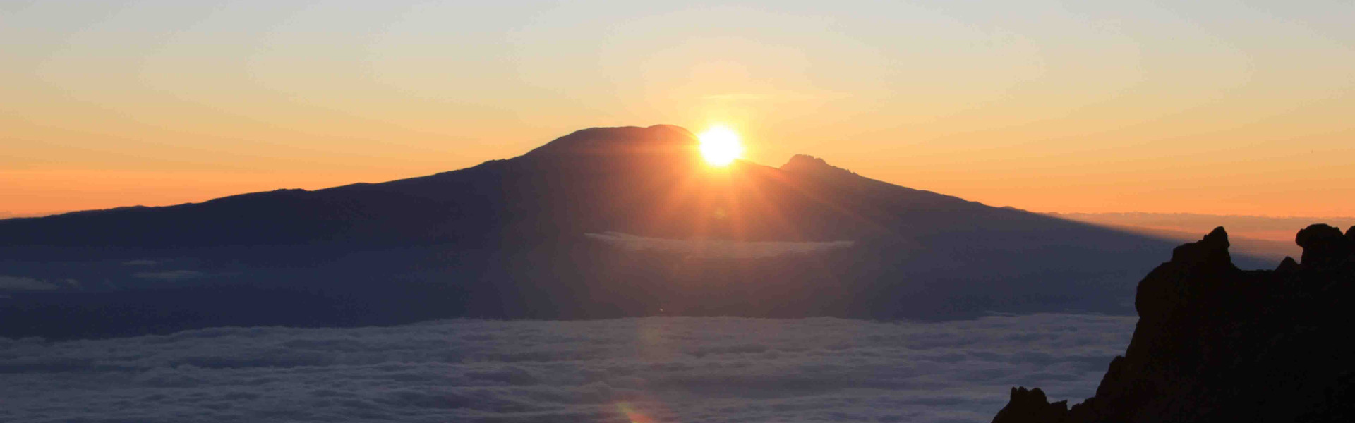
Mount Kilimanjaro’s montane vegetation is drier than Mount Kenya’s. There is no parks zone, and bamboo is scarce, despite its abundance on neighboring Mount Meru. The heather zone is well-represented, but blooming plants are few in the Alpine semidesert.

Mount Elgon, like the Aberdare Range’s peaks, reaches into the Afro-Alpine zone. The lower slopes of the Ruwenzori meet the equatorial forest in the northwest, and the flora is moister and more luxuriant than in the eastern highlands. The Virunga Mountains extend into the heather zone and, in the three highest volcanoes, into the Afro-Alpine zone above the bamboo forest and woodland parkland.

The East African mountains have a distinctive Afro-Alpine vegetation. Cold-loving plants fled to the mountains in post-Pleistocene periods (about 11,700 years ago) when temperatures rose, where they were conserved and somewhat altered.

Despite the vast distances between the mountains, flora in the different Afro-Alpine zones are very similar. All of the mountains have lobelia and Alchemilla (lady’s mantle) species, while tree groundsel species are only found in neighboring mountains. Giantism is a regular occurrence, while dwarfism occurs only at the highest elevations.

Wildlife of the East African Mountains

The montane forest is home to elephants, rhinoceroses, buffalo, antelope, hyrax, bush pigs, and monkeys, notably the black-and-white colobus. Because of its lack of bamboo forest and remoteness from the mountains to the north, the bongo (forest antelope) and the big forest hog have not been seen on Kilimanjaro. The Virunga Mountains are home to mountain gorillas and golden monkeys, while the Ruwenzori Range is home to chimps. Trout have been introduced to the more accessible alpine streams.

Upper forest mammals, such as the leopard and antelope like the duiker and eland, make their way into the moorland and Afro-Alpine zones, where the hyrax and groove-toothed rat are the most visible residents. The scarlet-tufted malachite sunbird, a songbird, and the lammergeier (one of the biggest birds of prey, resembling the eagle and vulture) are among the birds (a small, brilliantly coloured songbird). Animal life, like flora, displays similarities that point to a shift in distribution from the bordering plateaus to the refugee montane islands.

The People of the East African Mountains

The population is restricted to the lower slopes, with habitation reaching a maximum altitude of around 7,000 feet. Bananas and millet are widely grown subsistence crops, but coffee is a valuable commercial crop. The Chaga (Chagga) people of Kilimanjaro’s southern and eastern slopes have long relied on an excellent irrigation system based on the mountain’s ridge-and-valley relief. On the slopes of the Aberdare Range and around the southern and eastern edges of Mount Kenya, high population densities among the Chaga are matched by those among the Kikuyu and allied tribes. The Gisu have thickly populated below the forest zone on the western slopes of Mount Elgon.

On each side of the Ruwenzori’s northern snout, population density is significant; the Konjo hillmen reside mostly on the range’s eastern flank. The Pygmy Twa live in the Virunga Mountains’ woods, which are cultivated by the considerably more numerous Hutu on the lower slopes.

Tourism in the East African Mountains

Mountains are a popular tourist destination. Mount Kenya above 10,200 feet, the Aberdares moorland zone, and a section of the Kenyan part of Mount Elgon are among the parks that encompass the mountain from 6,000 feet to the peak. The Kigezi Gorilla Game Reserve is located on the northern slopes of Mounts Muhavura and Mgahinga in Uganda’s Virunga Mountains (Gahinga). Gorillas are protected in the Volcanoes National Park and the Virunga National Park, respectively, in the Rwandan and Congolese parts of the Virunga Mountains.

Where are the East African Mountains

The Ruwenzori Mountains act as a barrier to east-west travel, and road connections between Uganda and Congo cross via the range to the south. The main highways are deflected to their northern and southern flanks by the Mau Escarpment and the Aberdare Range, though each is traversed by a subsidiary road. The Nyeri ridge, located between the Aberdares and Mount Kenya, serves as a northern entrance. Mounts Kenya and Elgon have round paths, and the bases of all the mountains are relatively accessible.