There are various routes to climb Mont Elgon, some run on the Kenyan side while others run on the Ugandan side. Since the mountain is located on the border of Kenya and Uganda, you can climb from either side.
Climbing Mount Elgon for Uganda
On the Ugandan side, we recommend the Sasa River Path, which may be the finest route up the mountain.
The itinerary includes side treks to waterfalls, hot springs, the crater bottom, and other summits, as well as a fair opportunity of spotting Colobus and Blue Monkeys and other animals.
Five to six days is suggested because to all of the amazing side trips available.
The Pisawa Route is another popular route that runs from Uganda to the north and from Kapwata. It’s believed to be longer and easier than the Sasa River Route.
The round trip distance is 49 kilometers, and it is advised that you take seven days to complete the journey.
The Sipi Route, which begins near Sipi Falls, is a brand-new route. This would be a great addition to the Sasa River Route to form a circle.
The round trip distance is 56 kilometers, and it is advised that you take four to six days to complete the journey.
Another less-traveled path that is progressively gaining appeal is the Suam Trail.
Climbing Mount Elgon from Kenya
On the Kenyan side, there are three popular routes. One goes through Mount Elgon National Park, which requires a 4wd vehicle (walking along the road is not permitted). Another option is to go from Kitale, Endebess, and Masara. A third option is to travel through Kimilili, which is regarded to be the ideal route from Kenya’s perspective.
Note that the tallest peak is entirely on Ugandan territory, and you may be advised not to cross the border. Unfortunately, a complete circumnavigation of the peak is not possible at this time.
More about Elgon Routes
All the various routes leading to the summit of Mount Elgon, may be different but they are uniques in their own ways.
Piswa trail Mt. Elgon Trailhead
Piswa path is known for its tall podocarpus forest, which is a great spot to see animals. Sipi and Piswa, on the other hand, begin at significantly higher elevations and have a lengthier, more gradual ascent to the summits. The Piswa path leads to the hot springs within the park. You can either return over the same trails or descend via a different path after seeing the summits. Each trial/route includes camping sections with adjacent water sources, tent pads, and latrines. On the Sasa path, the park is building a hikers’ cabin at Mude cave.
Sasa Trail Mt. Elgon Trailhead
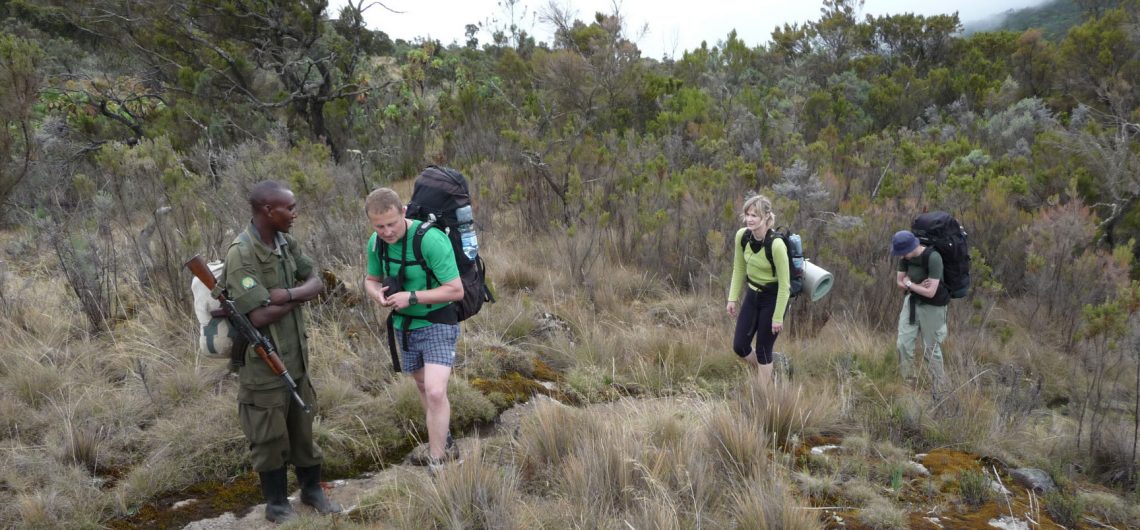
This path begins in Budadiri and is the most accessible; it leads directly to Wagagai Peak. Bumasola is the starting point for your mountain trek on the Sasa route, where you may get your permit and begin. To save a few hours walking along a road, you might take a boda-boda (motorbike) with your guide from here to the start of the journey up the escarpment into the National Park. You’ll go off early in the morning to escape the noon heat while still at a low altitude.
The first day of climbing the Sasa trail may be a struggle, as you gain 2000 meters by the time you reach Mude Cave Camp at 3500 meters, where the first walk is through community gardens with cabbages, passion fruits, tomatoes, sweet potatoes, and bananas, demonstrating how amazing the flowers are in the tropical rainforest, as well as in the alpine forest. While the massive trees are nowhere like as large as those in the forest, getting to the border will take over an hour and a half. You’ll travel a short way from the boundary to the Wall of Death, then go up and down various hills, climbing over 1600 meters before reaching the Sasa River.
Sipi trail Mt. Elgon Trailhead
Sipi This trail begins at the Kapkwai Forest Exploration Center, a few kilometers upstream from the Sipi Falls, just outside the park. The walk leads to the amazing Tatum cave, which is buried deep within the forest. On this route, the foliage is more diverse, and I noticed more primates (blue monkeys, black-and-white colobus monkeys, and baboons). The anticipation center is also the starting point for day treks into the dense montane forest to see Chebonet waterfall, Kapkwai cave, and a stunning view of the plains from a vantage point far above.
Suam trail Mt. Elgon Trailhead
The Suam Trail begins at the settlement of Suam, which is located on the Uganda-Kenya border. It follows the Suam River via the beautiful Suam Gorge to the Kapkwata Trail’s hot springs on the caldera’s eastern side. It’s a beautiful trek that takes you through bamboo, heath, and moorland before reaching at the Piswa Camp at 2850 meters.
It takes 4-5 days to complete the whole hiking circle to the summits. Visitors are recommended to talk to an Information Clerk at the Male, Budadiri, or Kapkwata Visitors’ Centres about their choices.
Everything of these routes are one-of-a-kind in nature, and they have it all: beautiful scenery, incredible diversity, tough terrain, plentiful animals and plants/flowers, unspoiled by tourists, and, best of all, you have it all to yourself for 99 percent of the time.