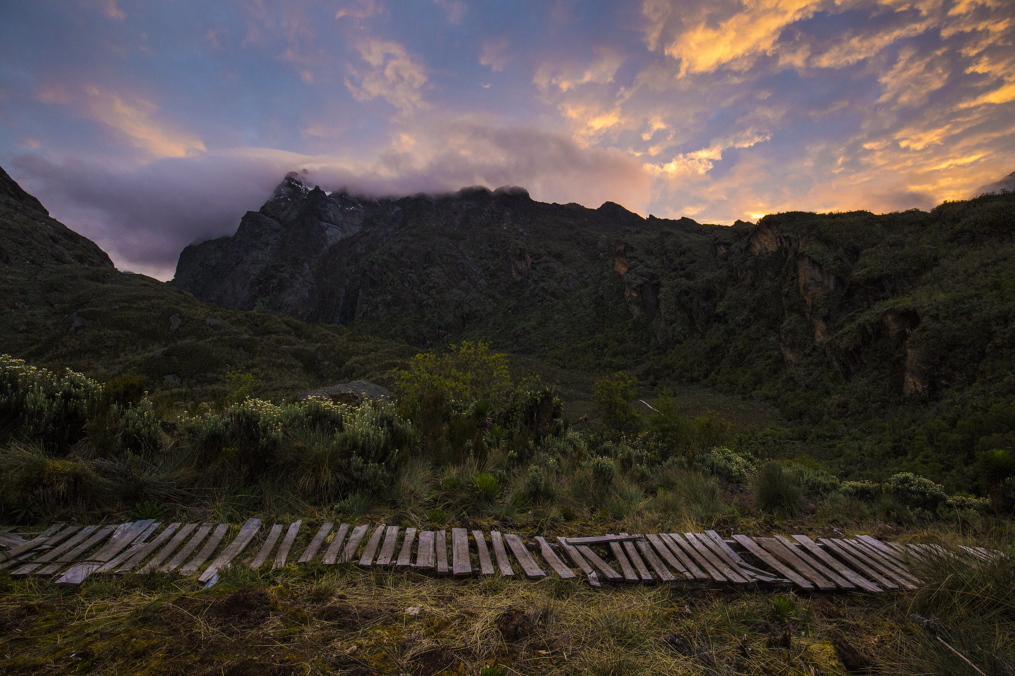
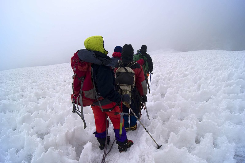
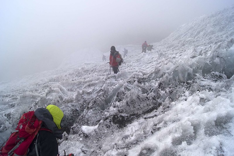
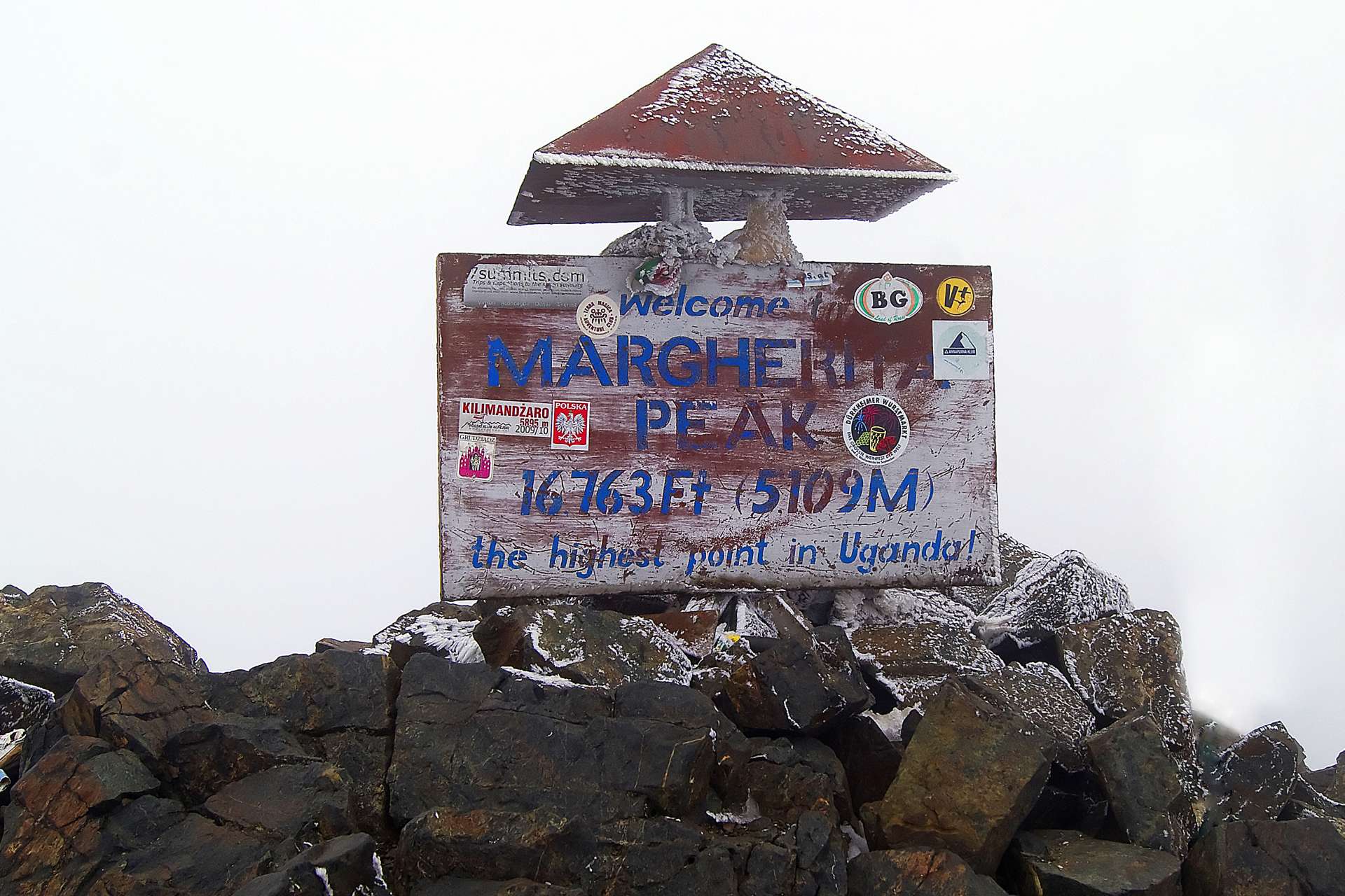
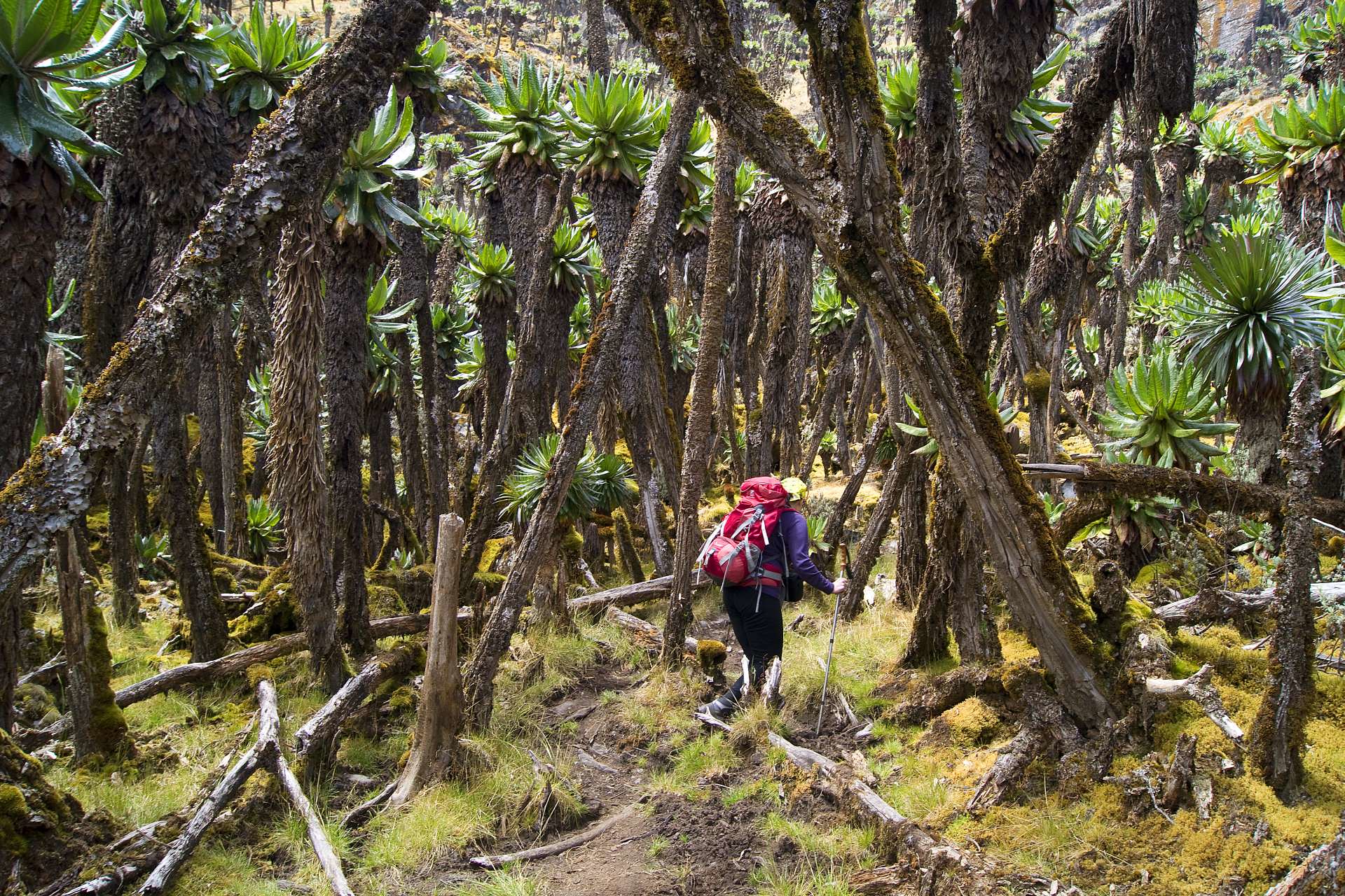
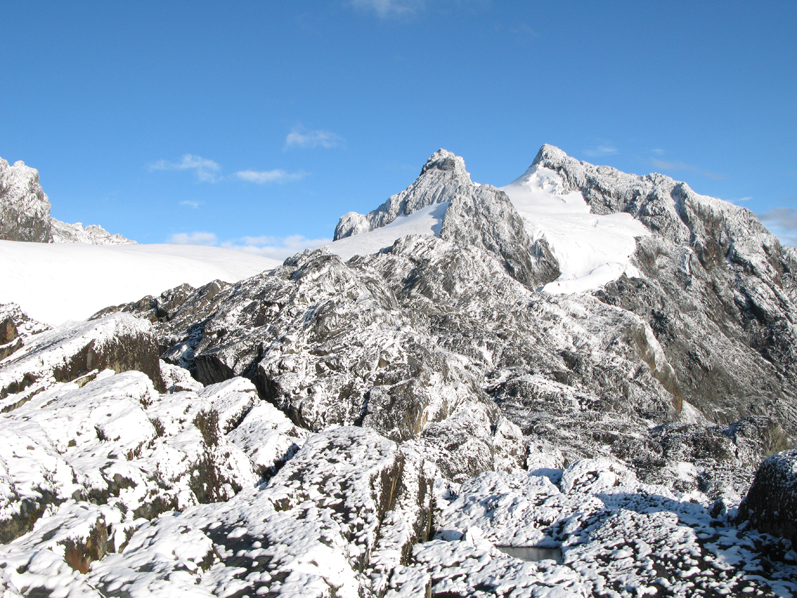
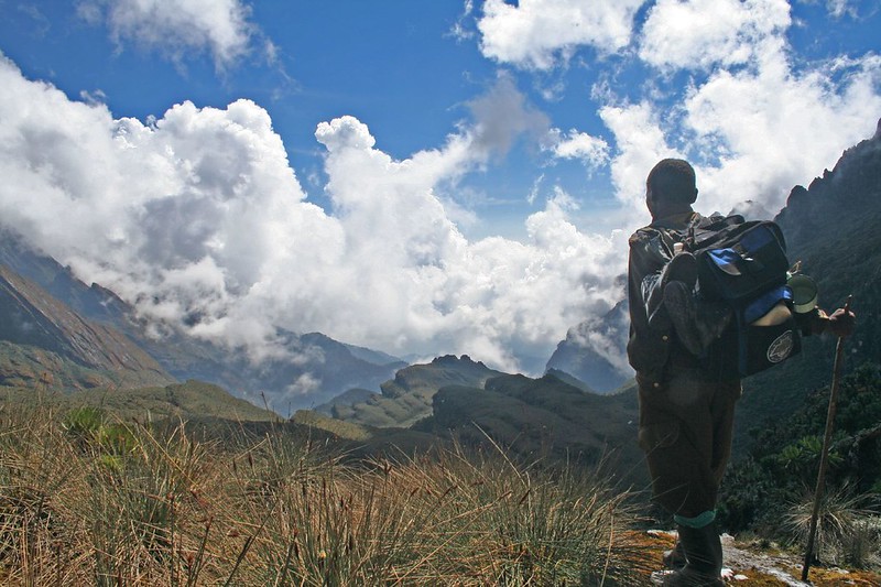
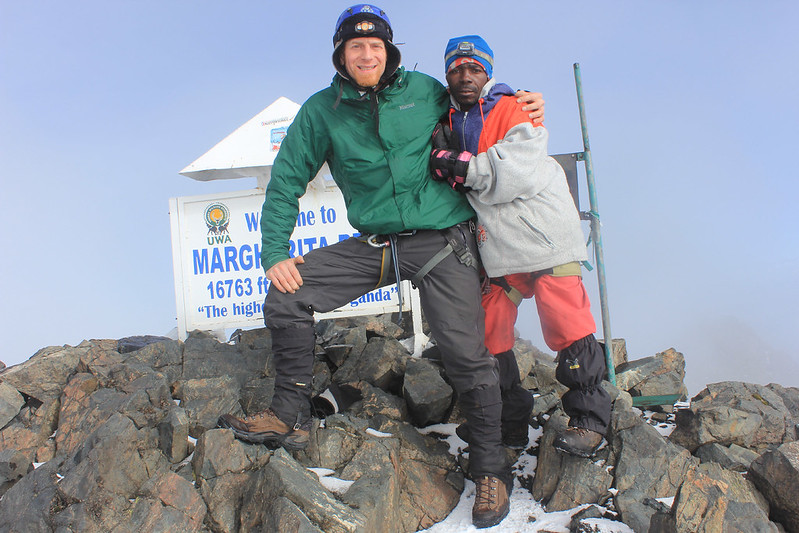
The 9 days central circuit hike to the Rwenzori Mountains is a popular route for avid mountaineers attempting to take up the Rwenzori challenge. The central circuit trail is one of the main activity that people opt for when visiting the Rwenzori in Uganda-Congo DRC border. The hiking expedition starts with a trip from Entebbe or Kampala and it includes a hike that takes a duration of about 6 nights and 7 days, starting from the Nyakalengija, that acts as the headquarters of the Rwenzori Mountains Park. This trail also follows a circular path around Mount Baker where you will spend nights in five different huts while gaining an altitude of about 5109m at the Margherita hut.
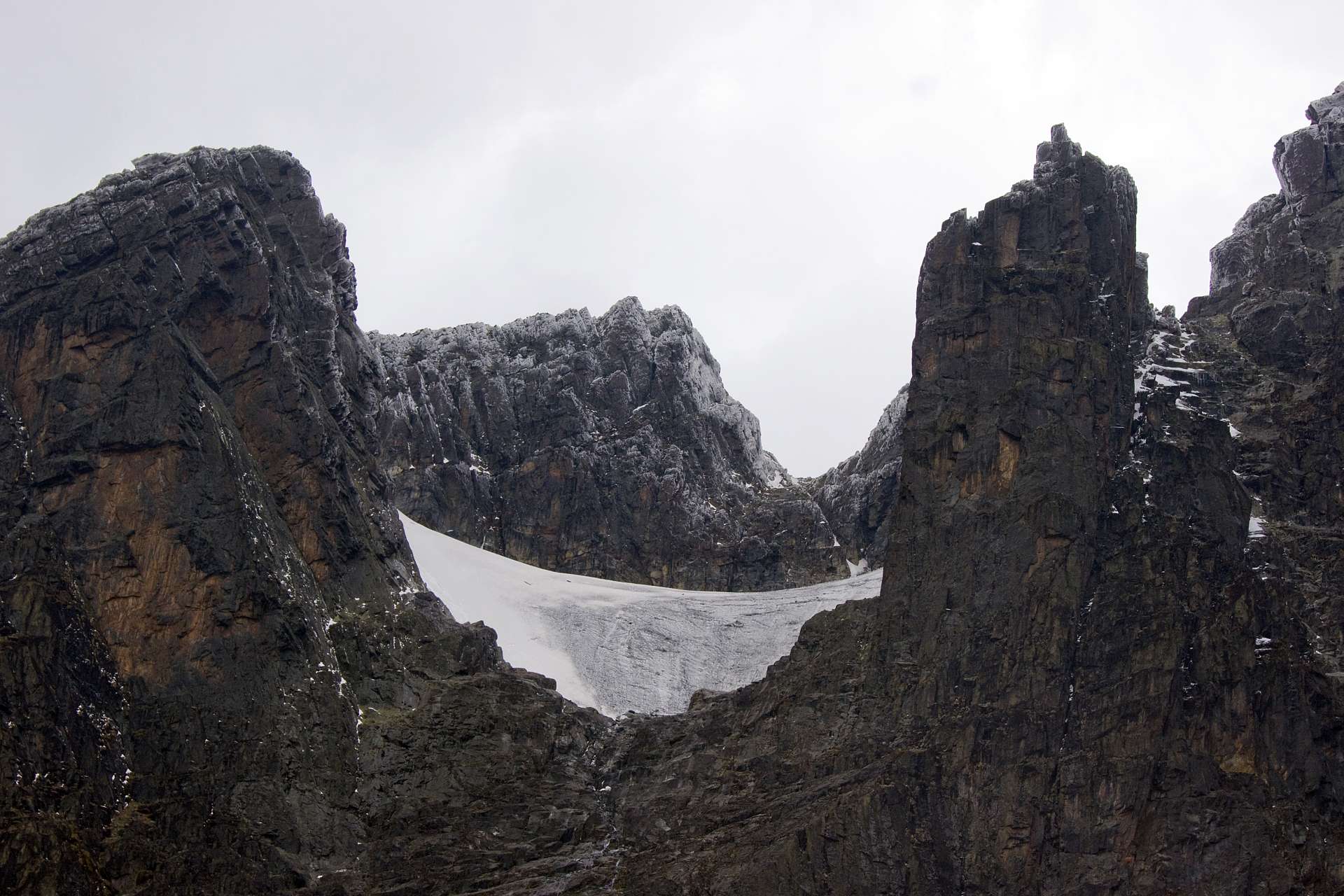
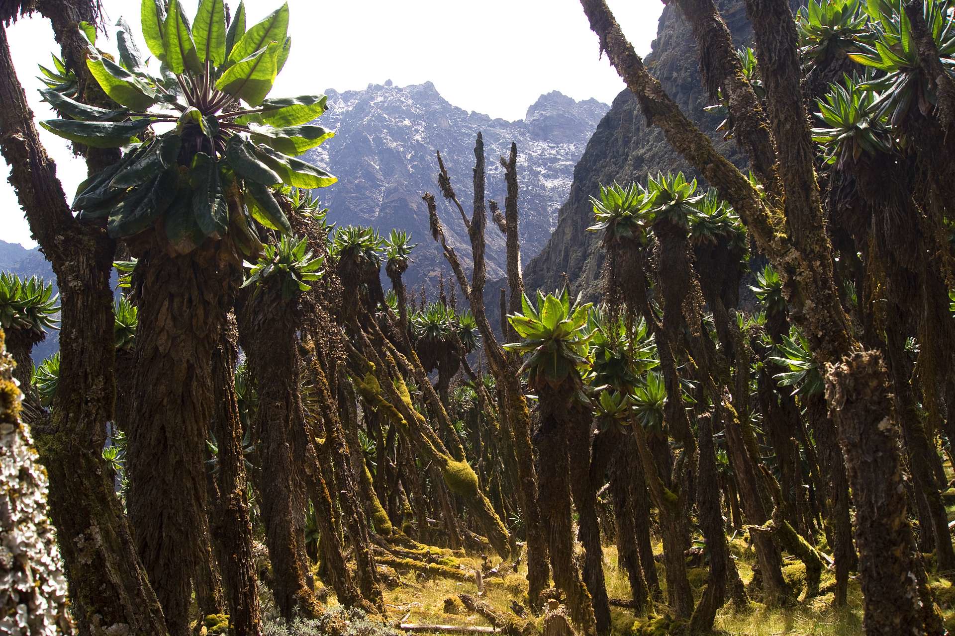
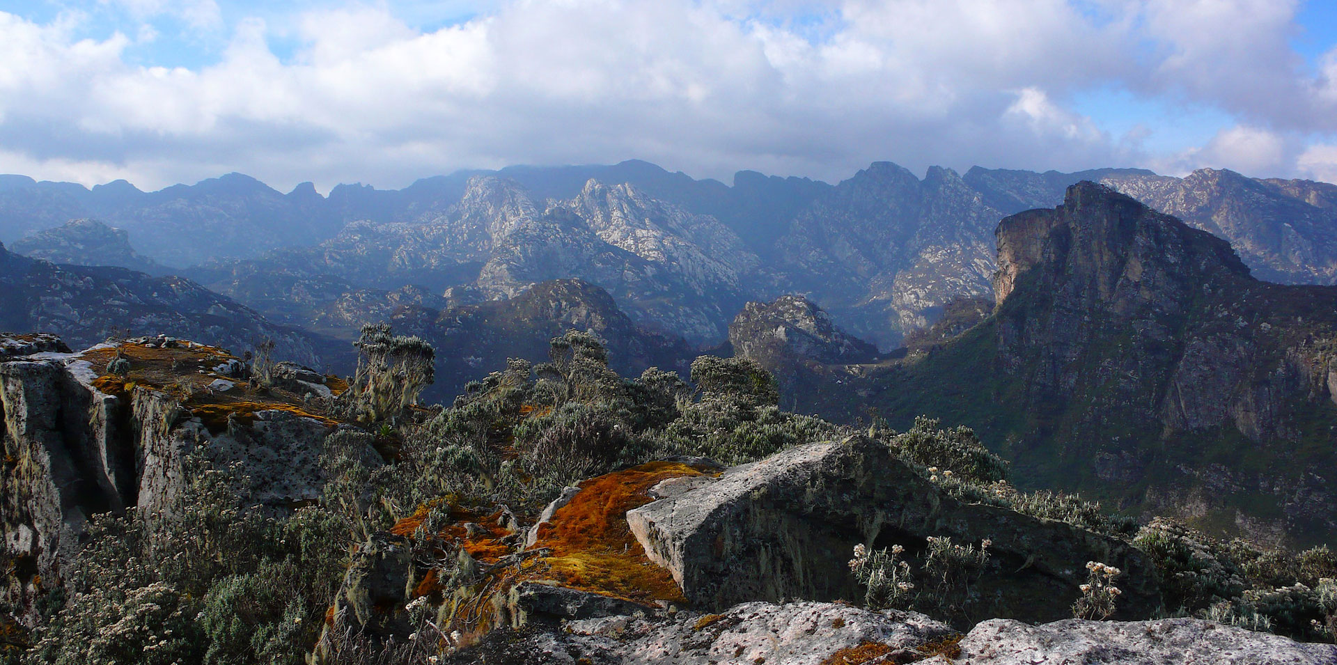
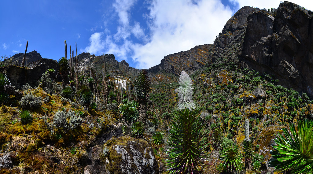
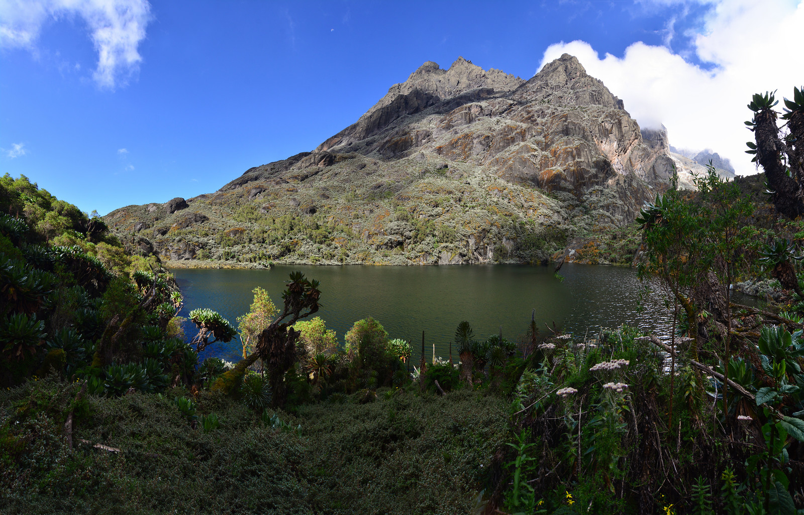
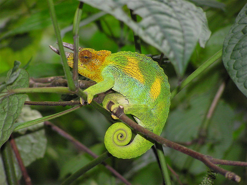
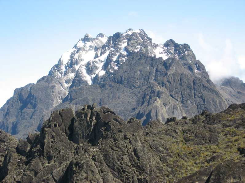
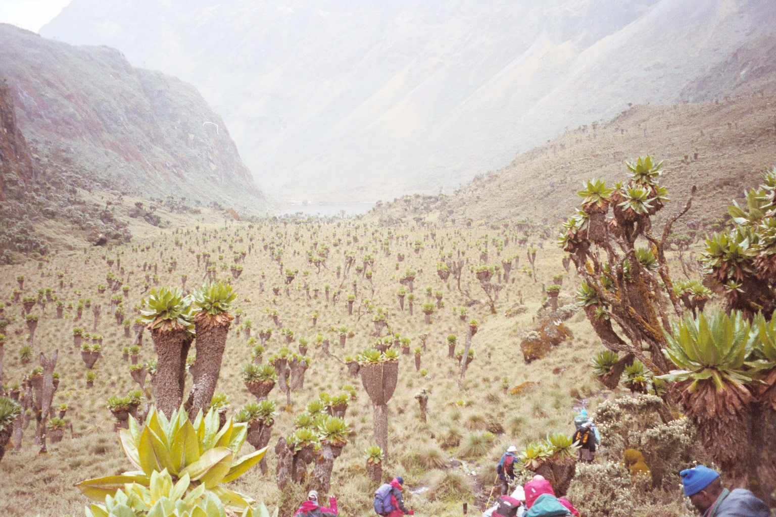
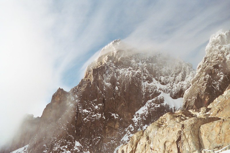
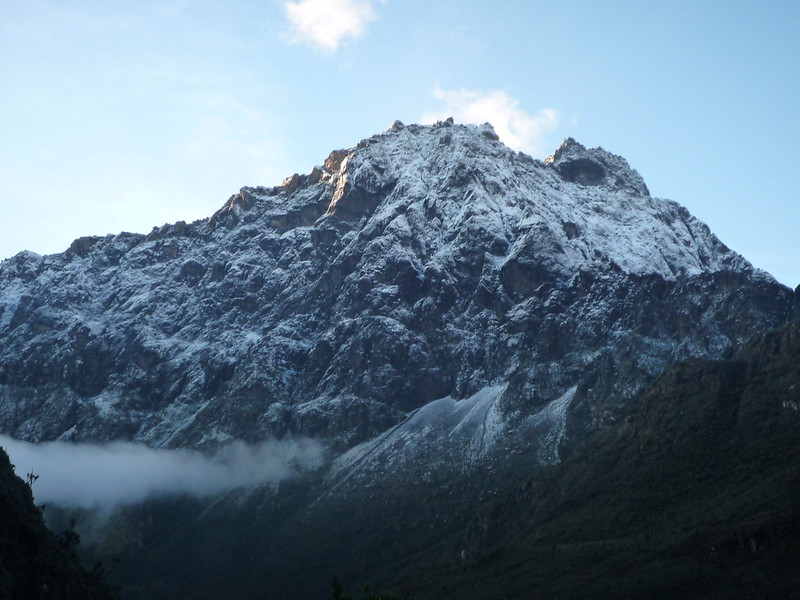
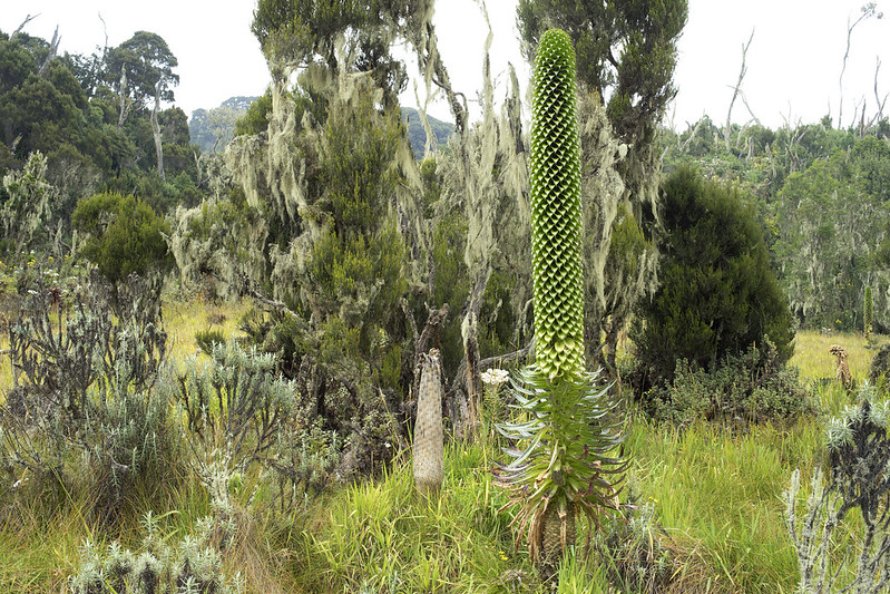
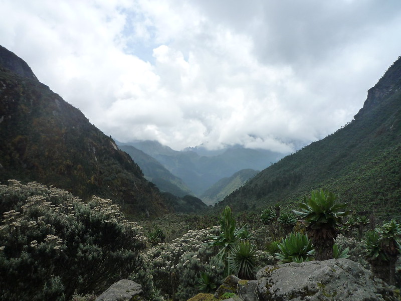
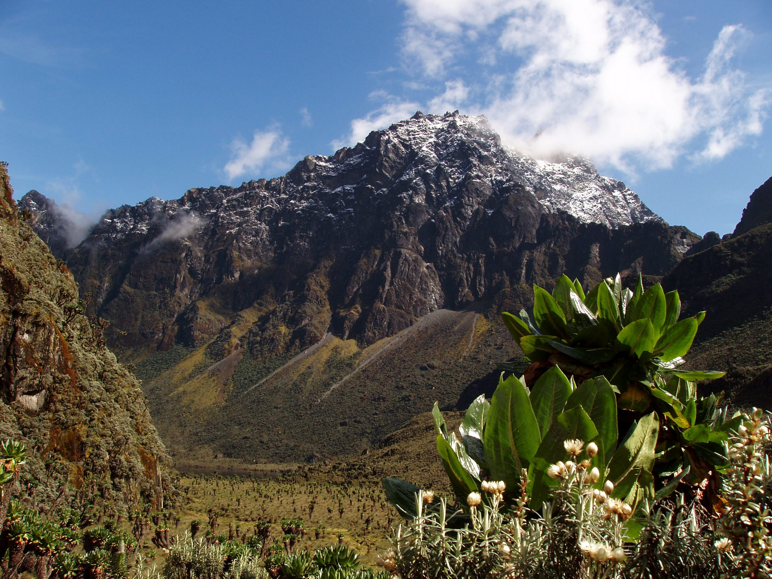
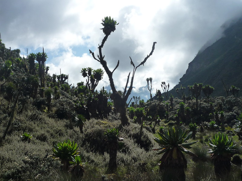
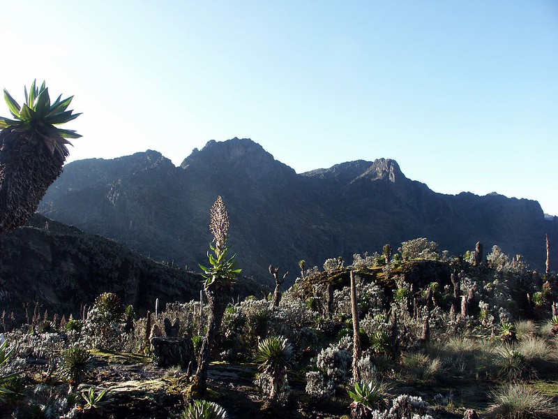
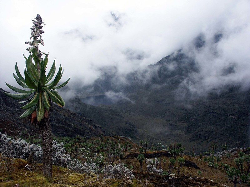
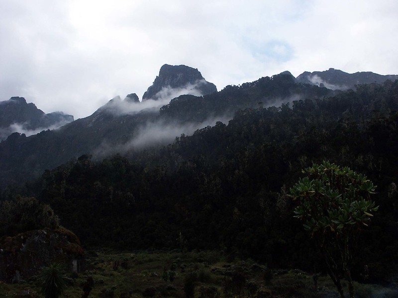
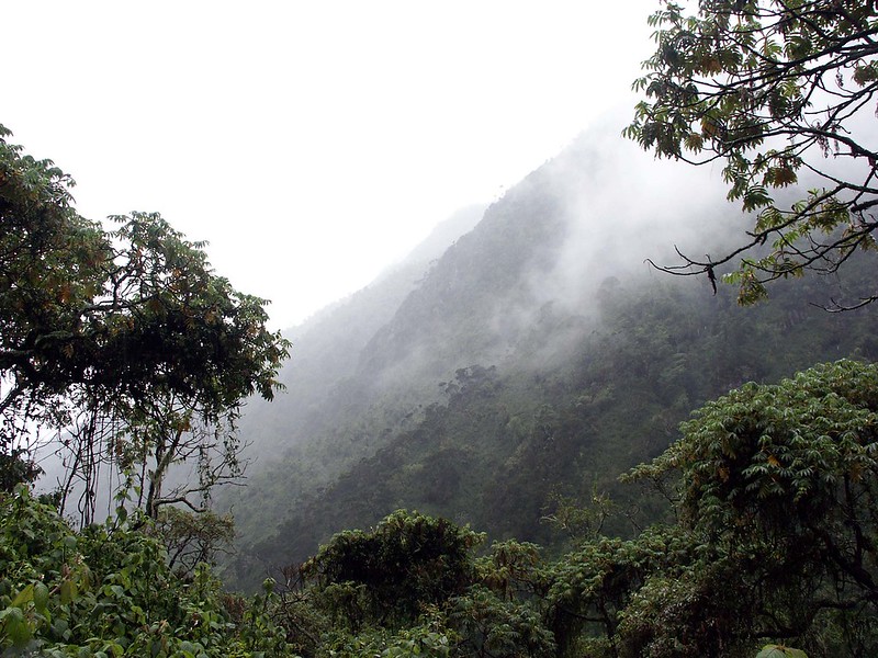
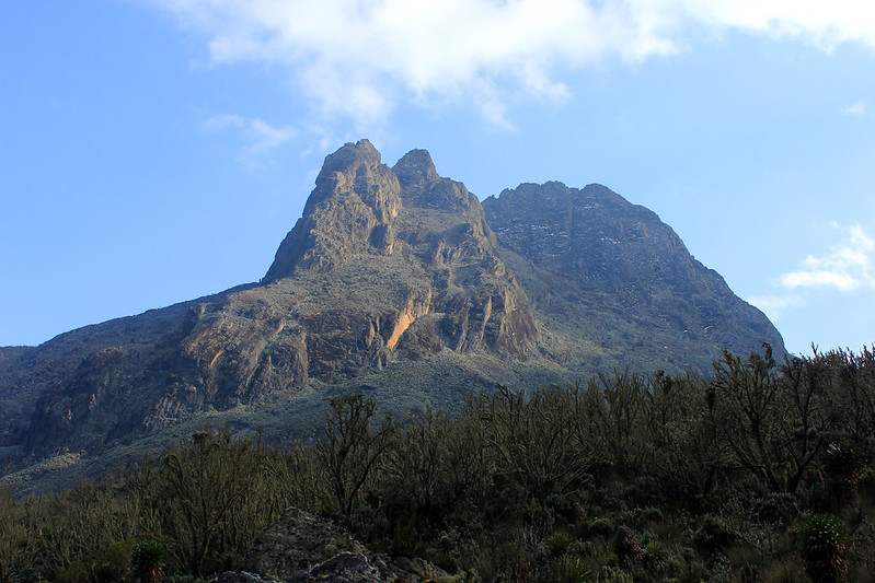
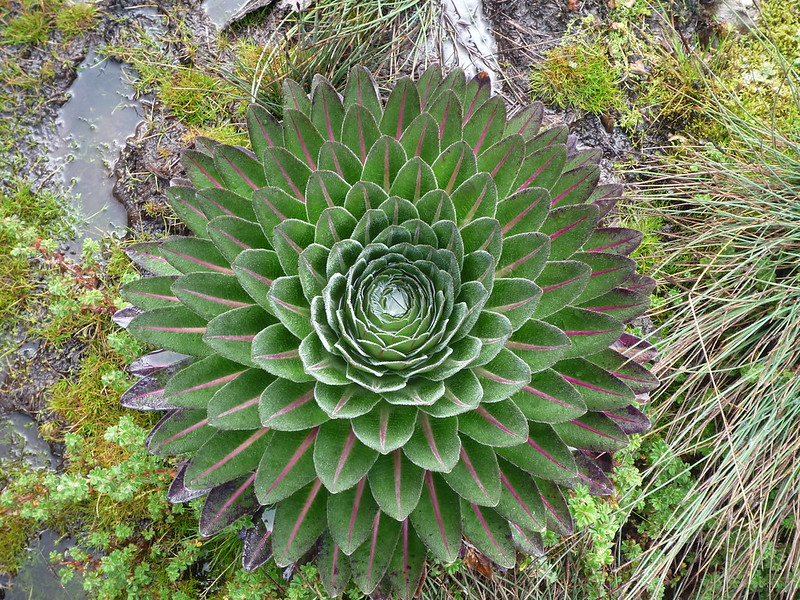
The Central Circuit trail on the Rwenzoris awards you with close-up views of the peaks as well as the glaciers of Mount Speke, Stanley, Mount Luigi di Savoia and of course Mount Baker. This reason alone places the central circuit as the best experience of the trekking the Rwenzori, its vegetation and Landscape.
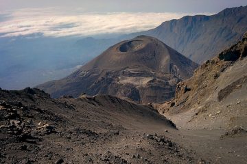
About the Rwenzori Mountains
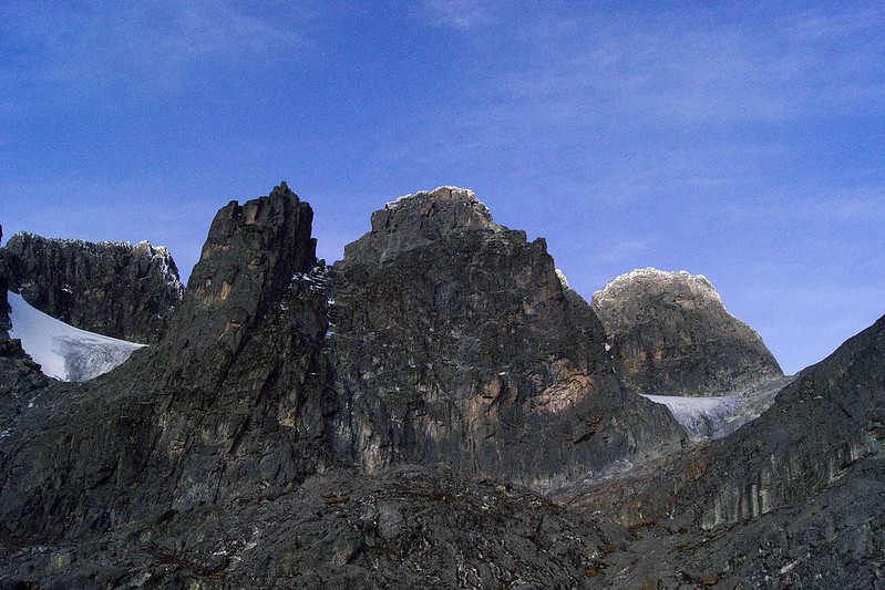
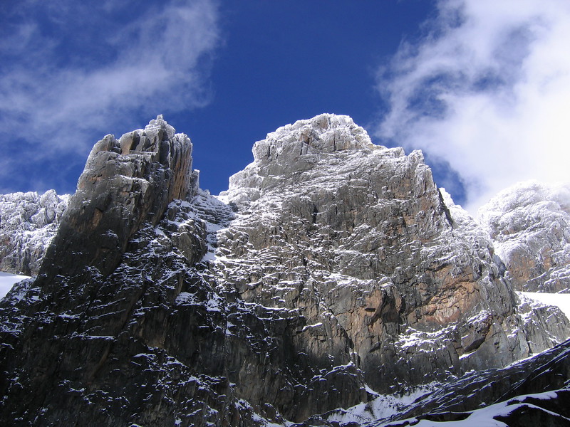
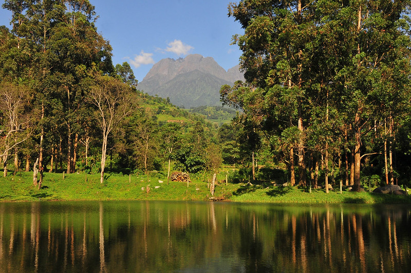
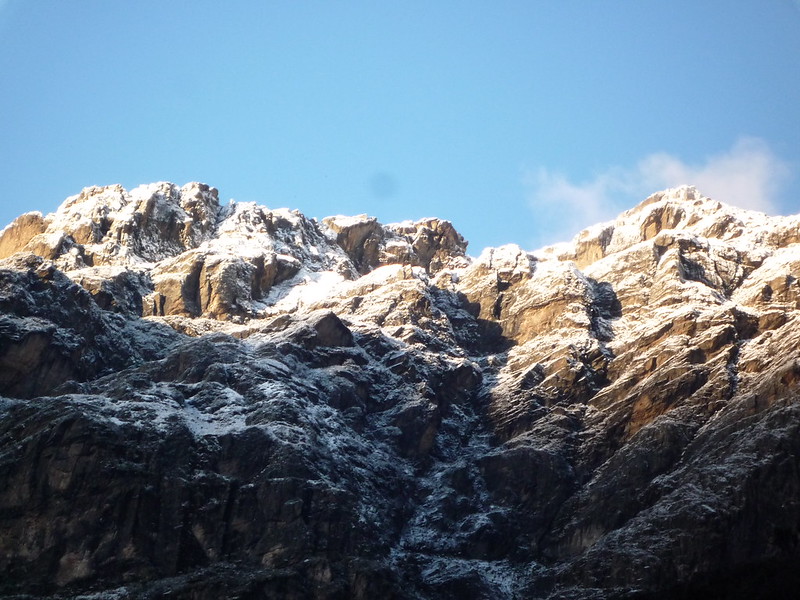
Rwenzori Mountains National Park was officially declared a national park in the year 1991 and is both recognized as a World Heritage site and a Ramsar site. The park covers an area of about 996km2. . The highest point on Rwenzori Mountain is the Margherita Peak that stands 5,109m above sea level and it stands on Mt Stanley, a mountain that stands on the border that separates Uganda and the Democratic Republic of Congo. one amazing fact about the Rwenzori is that in AD 150, geographer Ptolemy from Alexandria in Greece, gave these mountains the name “Mountains of the Moon”.
Getting there
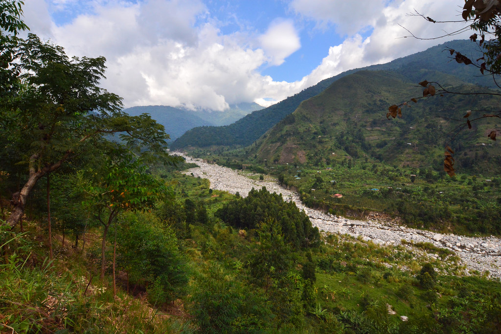
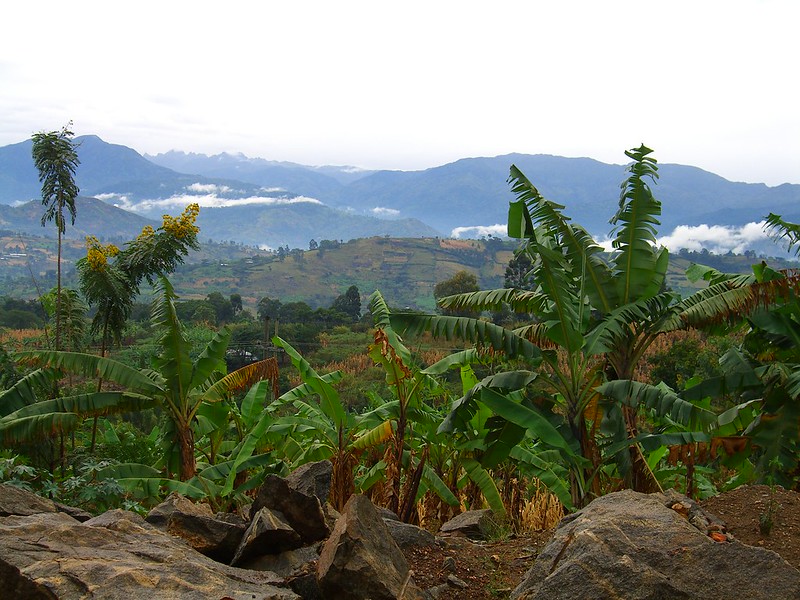
Rwenzori is located in the South-Western part of Uganda and Entebbe International Airport is the nearest airport to Rwenzori National Park. From the airport, you can take a shuttle or minibus to Rwenzori or to Kampala, another minibus to Kasese then Kalembe if you are using public transport.
Best time to trek the Rwenzori Mountains
The best time to hike the Rwenzoris is during the dry months between December and March or from July to September.
Need to know
You will need a tourist visa for entering Uganda, a process that can be done easily done online and usually take a few hours to be sent to you via email. For a 90 days visa, it would cost you about $50 (USD currency only)applications can be done online here – visas.immigration.go.ug.
Why choose the Rwenzori over Mount Kilimanjaro?
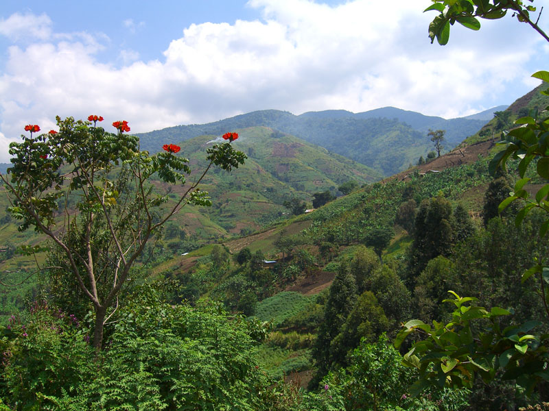
Since the Rwenzori mountains are not as popular as Mount Kilimanjaro, they do not attract as many climbers as Mount Kilimanjaro, meaning that, the routes are less crowded and the high altitude vegetation is more lively. Even though Tanzania’s Mount Kilimanjaro is the highest in Africa, Uganda’s Rwenzori mountain range is one of Africa’s top hiking destination, holding three of Africa’s five highest peaks.
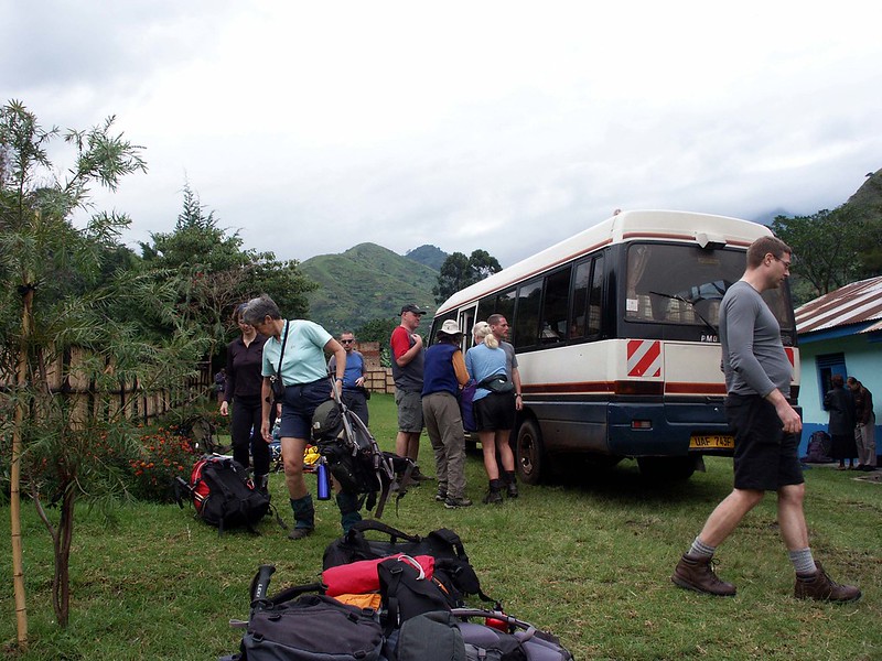
Transfer from Kampala to Kasese
After a briefing by the Tranquil Kilimanjaro team about your 9 Days, Rwenzori trek via the Central Circuit Trail, you will head for Uganda’s capital city, Kampala and drive to Kasese, making a brief stop for lunch at Mbarara town which is located on the equator. This trip will have you arrive in the early afternoon at Kasese whereby you will carry out shopping for you Mount Rwenzori necessities like food and things of personal use.
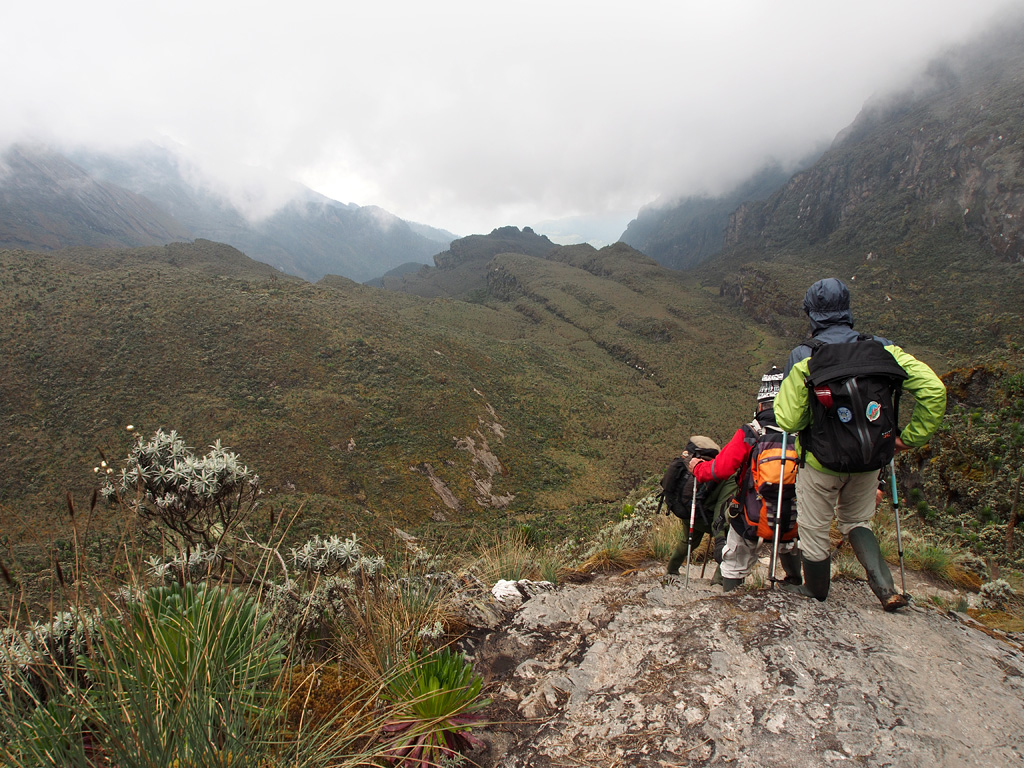
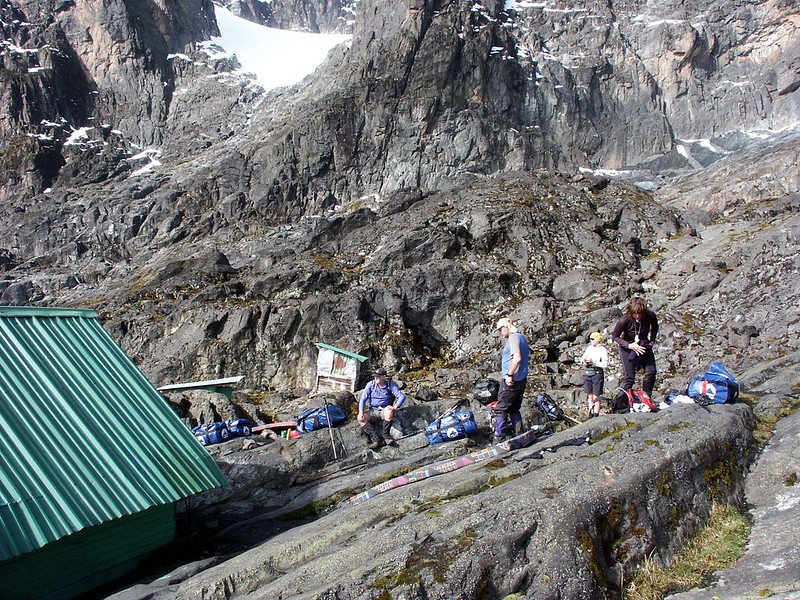
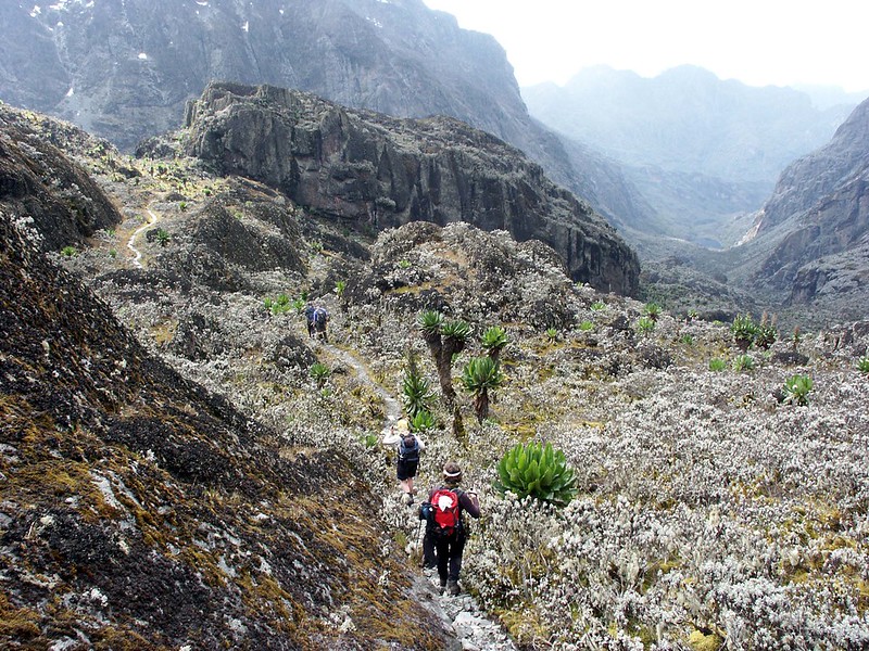
From Nyakalengija to Nyabitaba Hut (8, 7000 ft – 2500m – 4 to 5 hours)
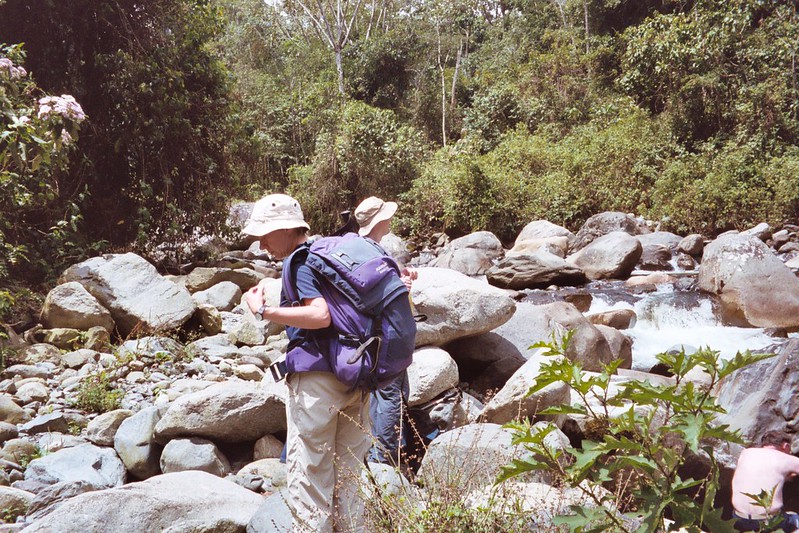
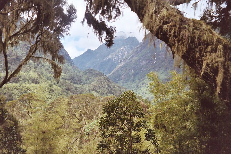
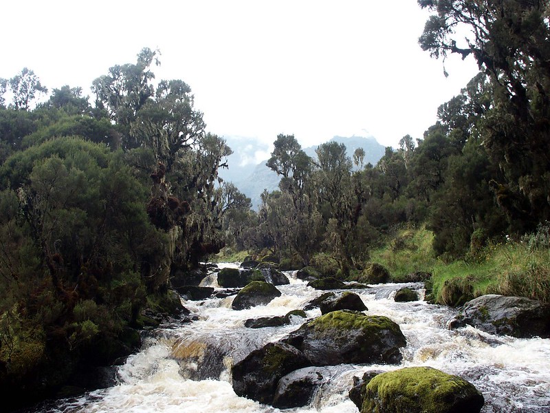
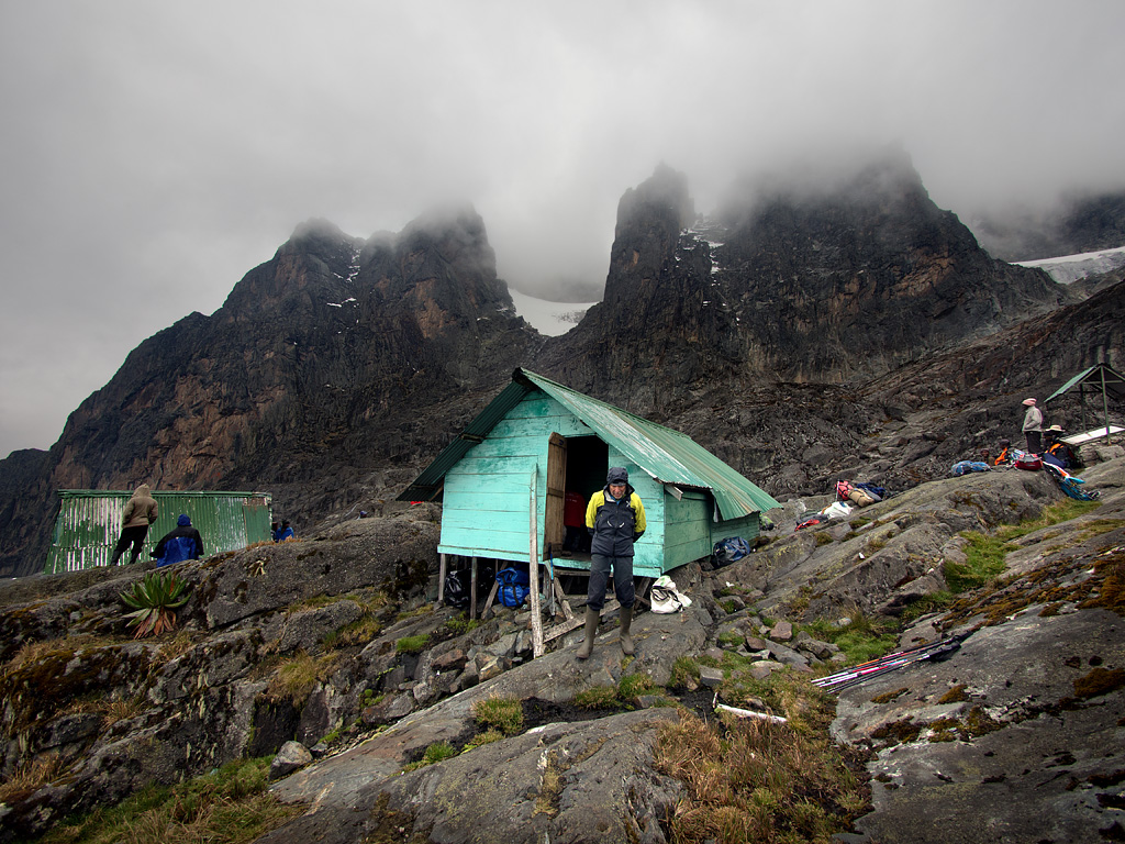
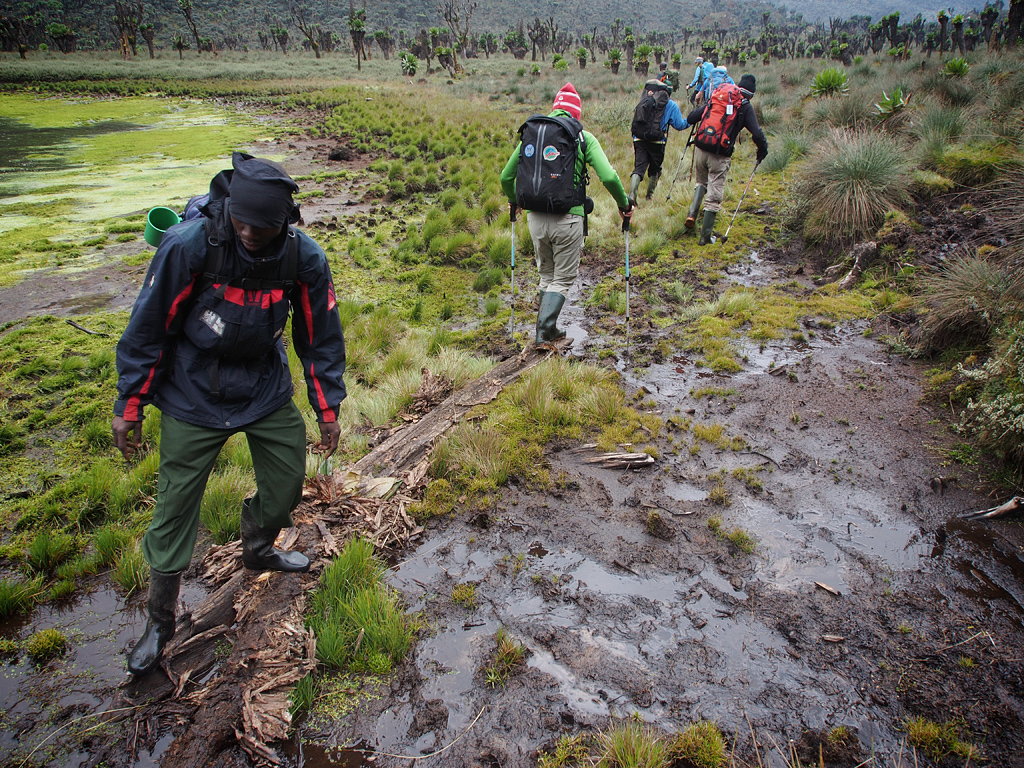
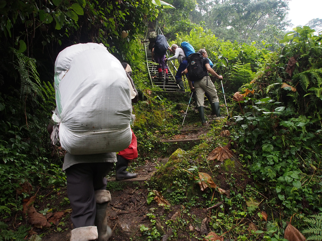
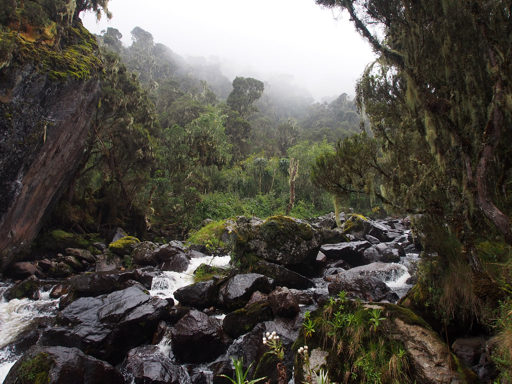
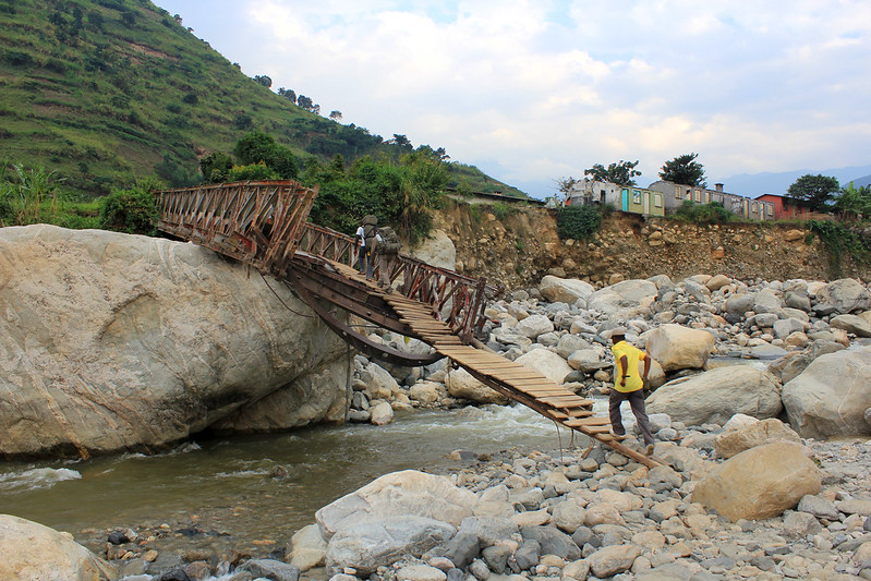
Your trekking will begin immediately after finishing the paperwork, making payments and registering at the park headquarters located at Nyakalengija _5,400 ft to 1646m). This is also where you get to meet and greet you’re your mountain crew that includes the porters and guides. This trail will follow the Mubuku River, that crosses the recent land slide areas and also need climbing over the rocks and bluffs before arriving the Mahoma River. Immediately after crossing the river, you will have a very steep hike through an open fern slopes and the podocarpus forest up to the Nyabitaba hut at 87000 ft – 2 652m.. The slow hikers can take longer, therefore you must leave the headquarters before noon in order to avoid reaching the hut before the hut.
From Nyabitaba Hut to John Matte Hut – 4 to 5 hours
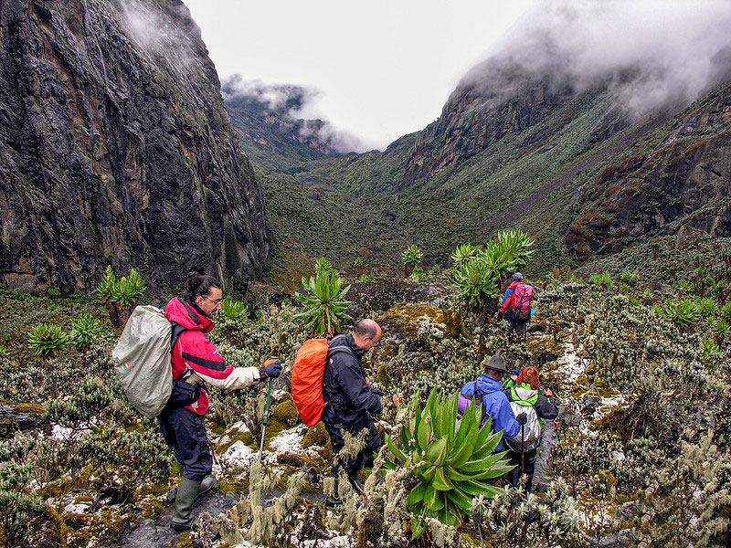
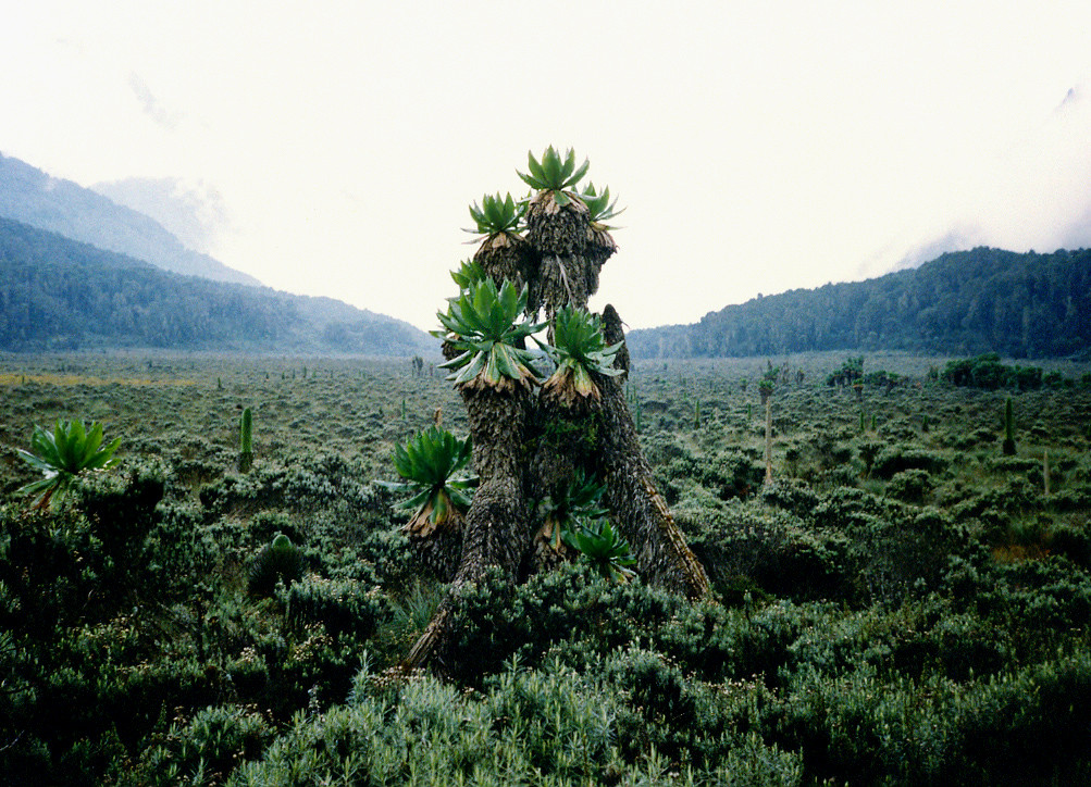
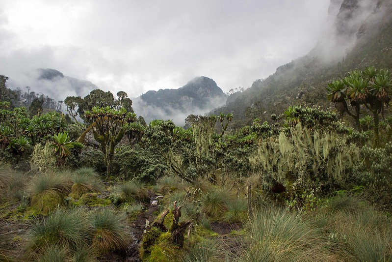
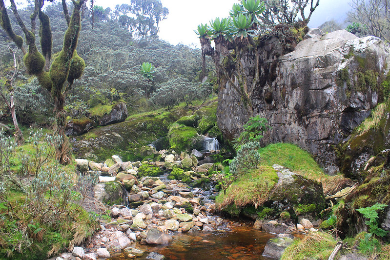
From here, the trail will lead you west wards for 1 and half km and then continue north steeply to Kurt Shafer Bridge, as you cross below the confluence of the Bujuku and the Mubuku Rivers. You will arrive at the poor condition hut at Nyamileju and it’s also accompanied by rock shelter.you can walk to John Matte hut at 3414m which is new , comfortable, large though its muddy around the site. Many of the hikers also consider this the most tiring and the longest day of the hike there for an early start is advisable. More so, the loss of altitude to Kurf Shafer Bridge also means the total elevation to be gained on this day is at 3,000ft. The hikers who also consider reaching this point consider John Matte as a stopping point. You can also enjoy this unique vegetation with in the bog and also the great views as well as the following day beginning the return to Nyabitaba.
From John Matte at 3,44m to Bujuku Hut at 3,962m
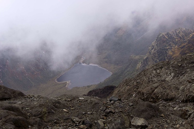
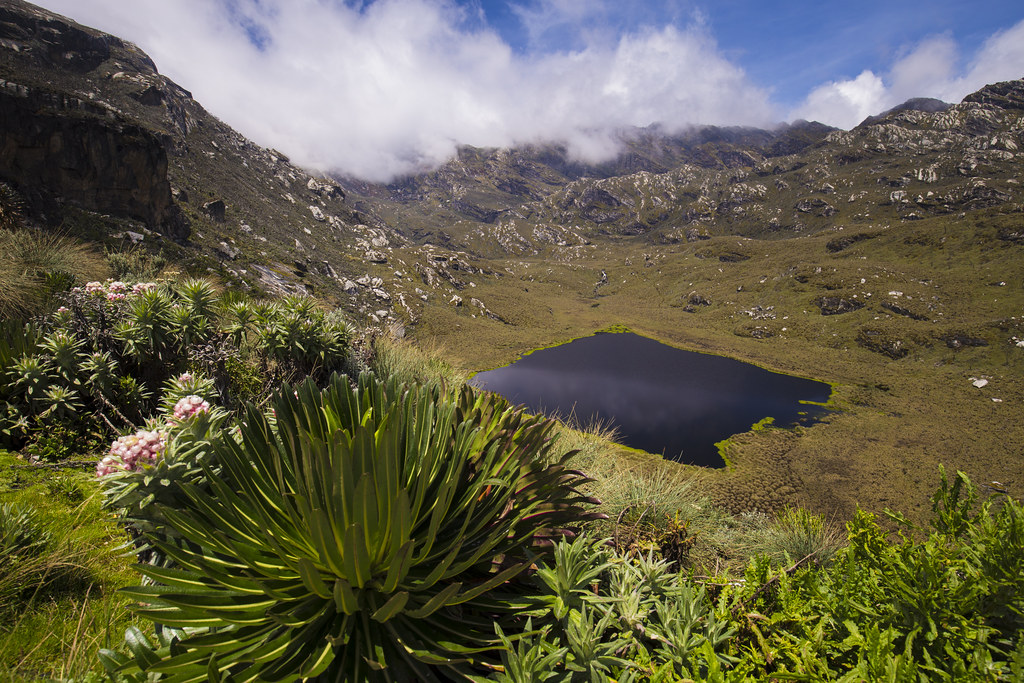
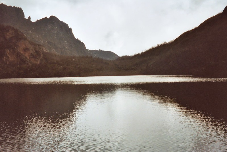
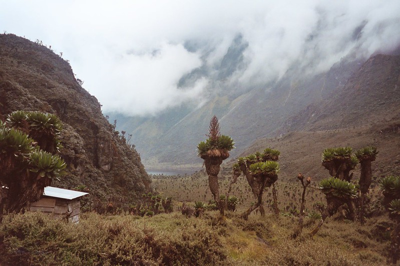
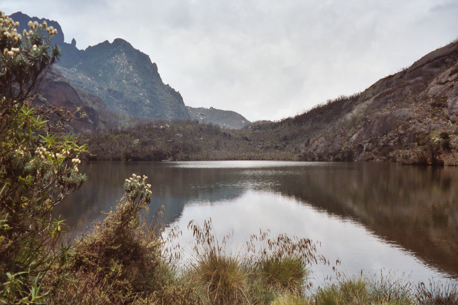
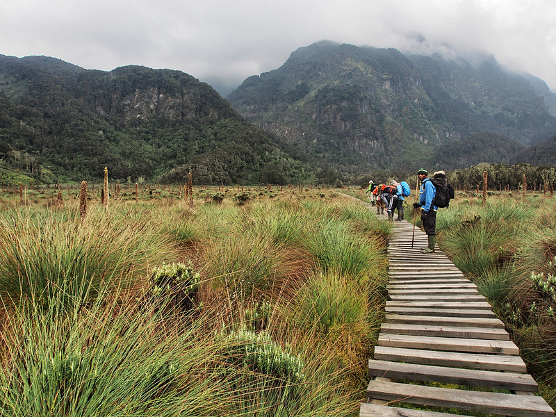
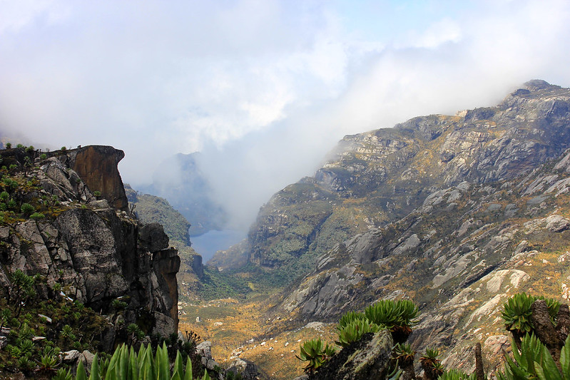
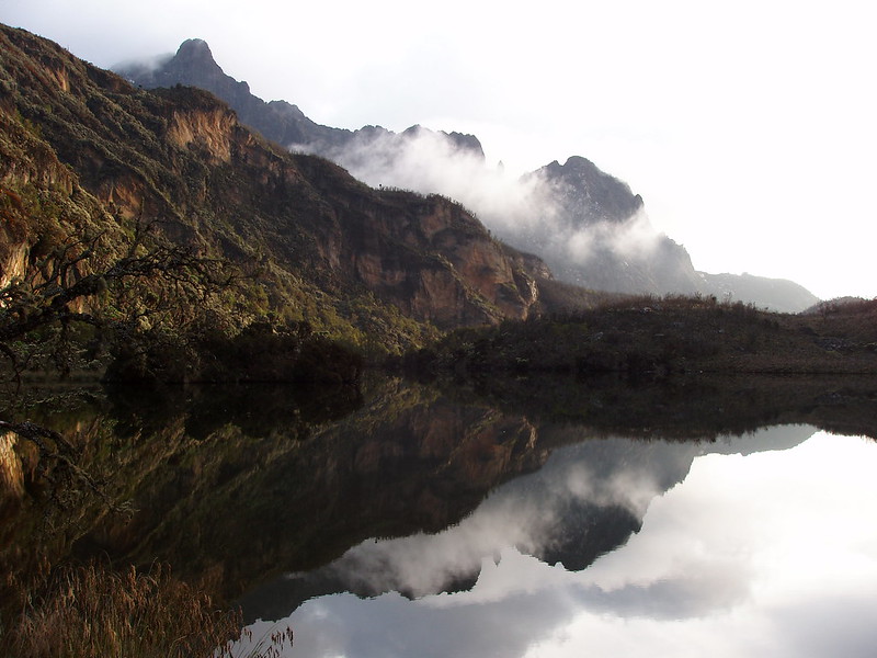
You will leave John Matte and cross to the Bujuku River and then enter the lower Bigo gogs. This trail is also muddy and follows the left edge of the lower Bigo hut and its shelter. You have lunch at the upper edge of Bigo near Bujuku Lake and here there is a rock shelter called Cooking pot and a shorter distance to Bujuku hut. The shaded area and the mists can make the hut of Biujuku so uncomfortable and cold for the hikers and most especially the guides and the porters with just simple blankets and light clothing’s.
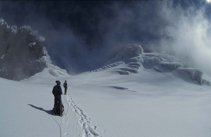
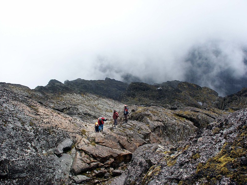
From Bujuku Hut to Elena Hut
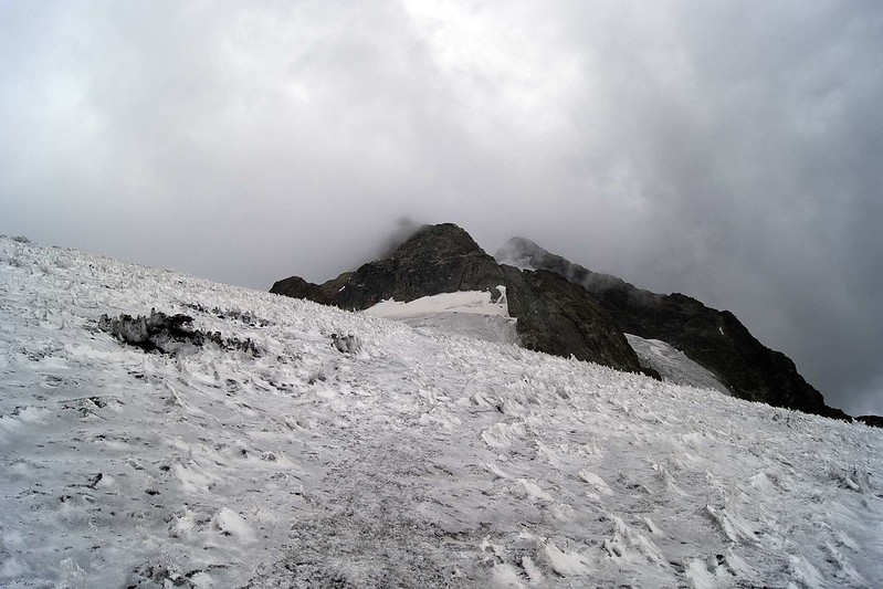
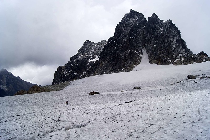
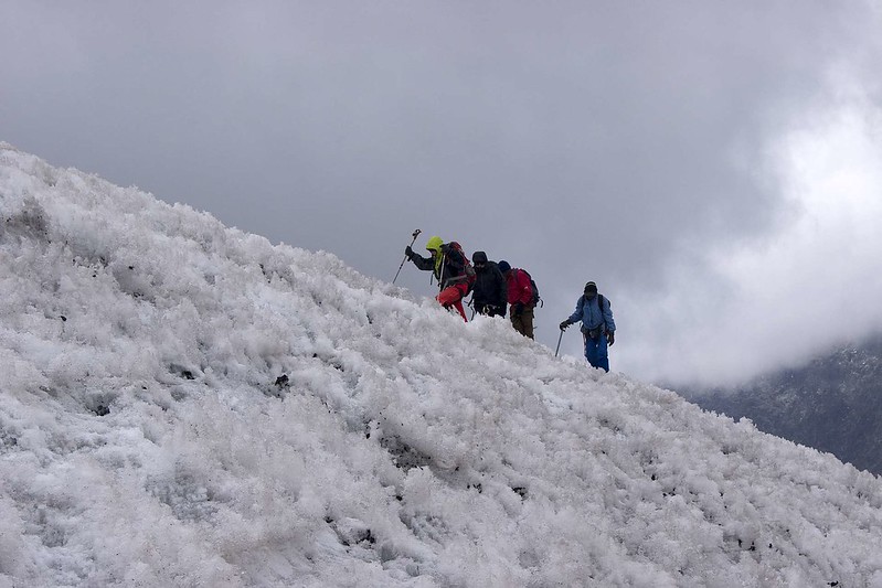
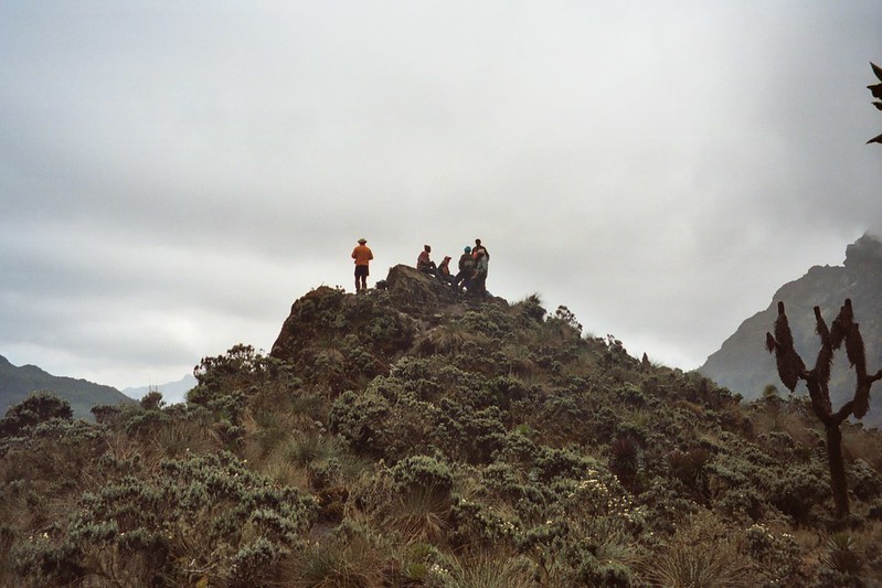
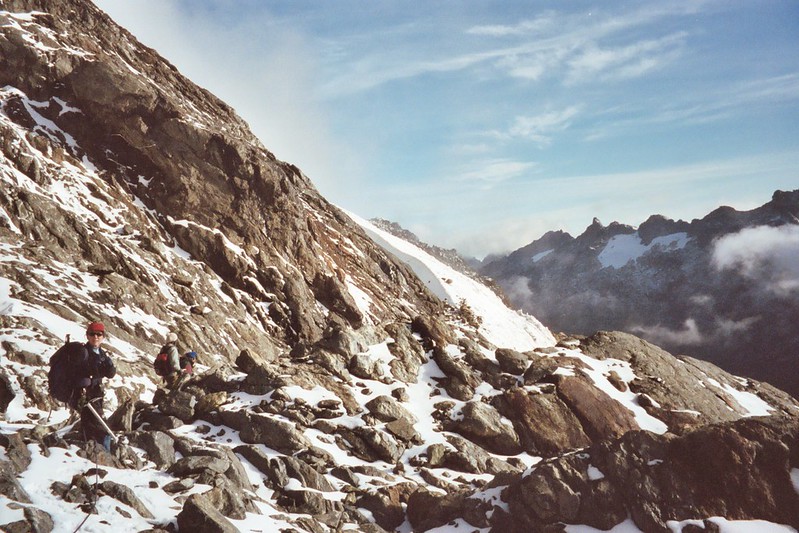
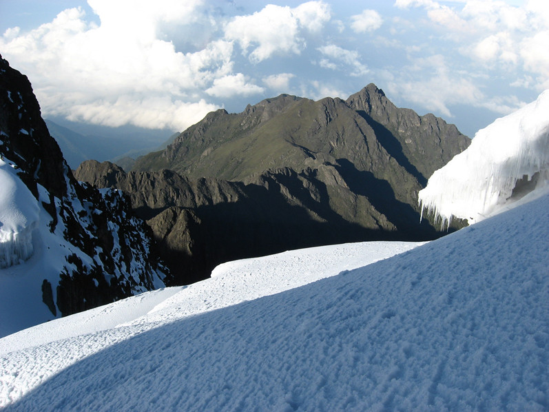
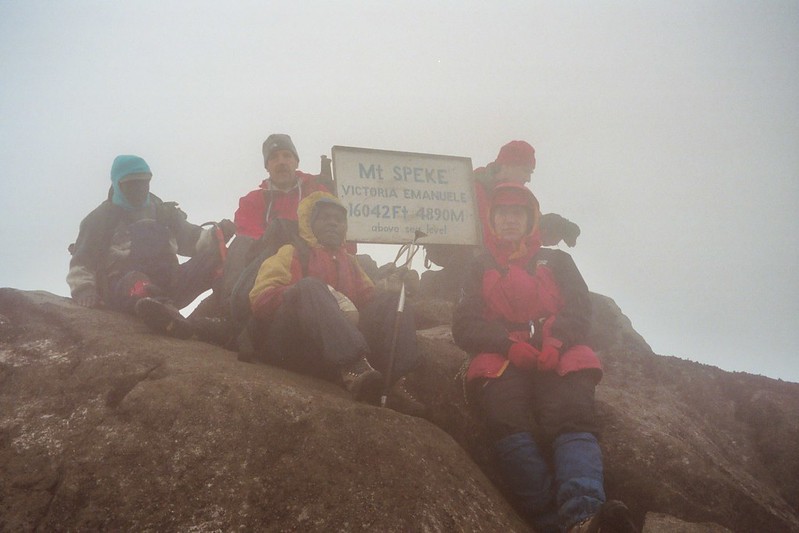
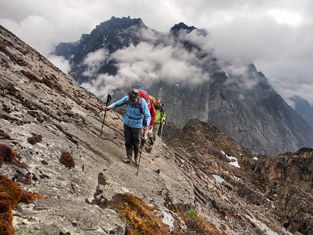
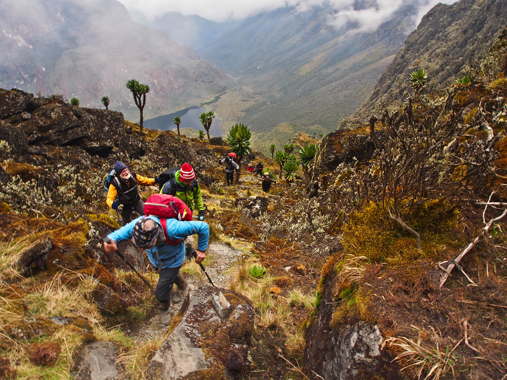
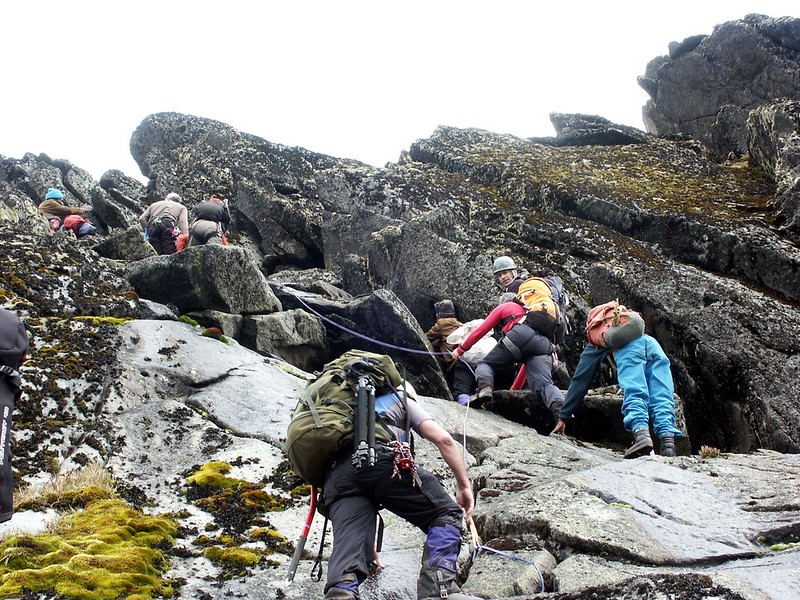
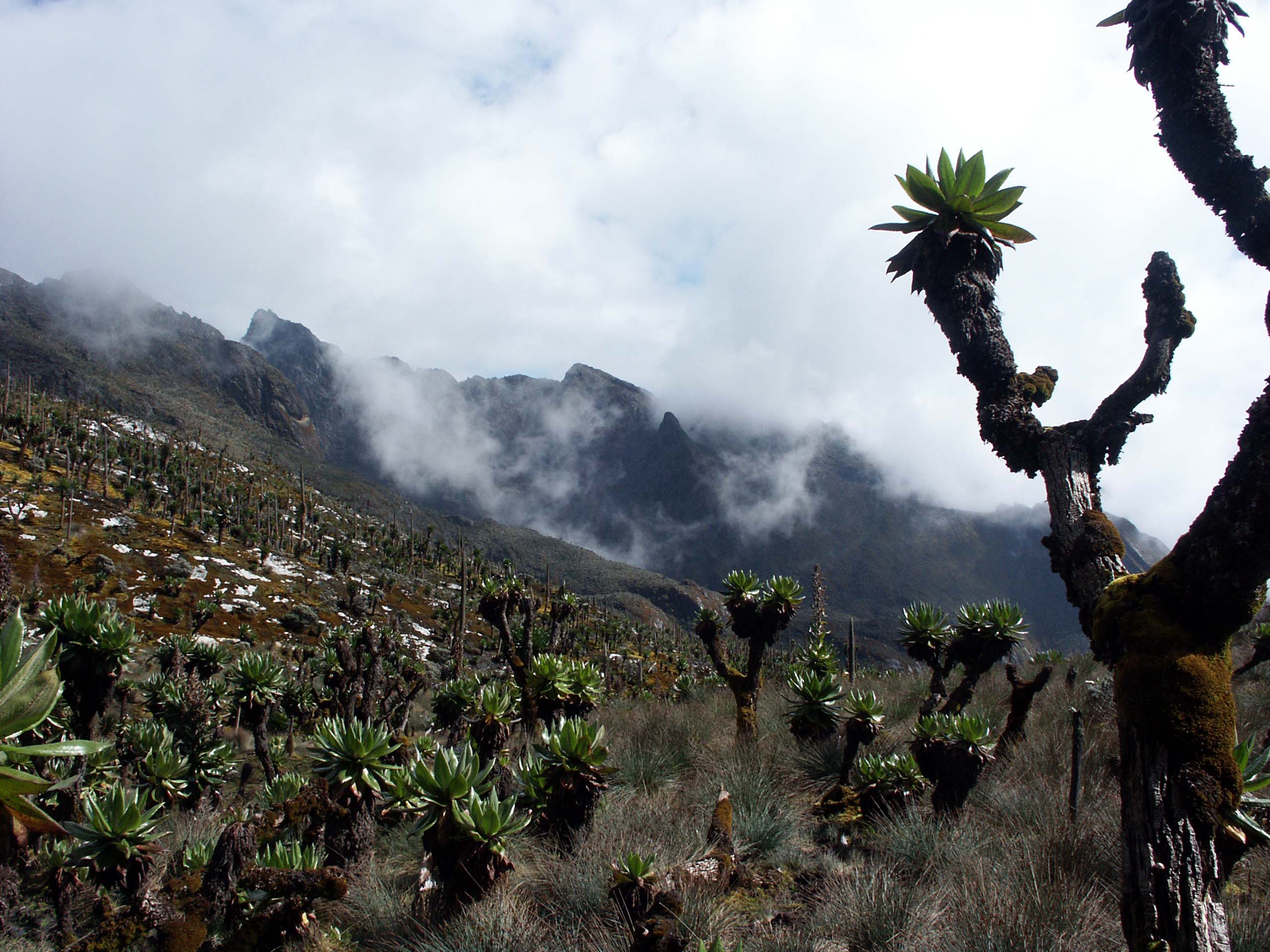
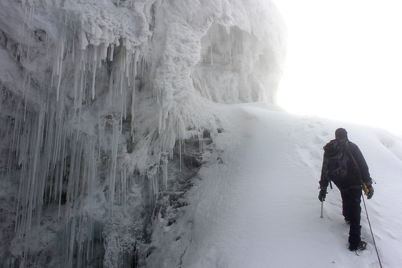
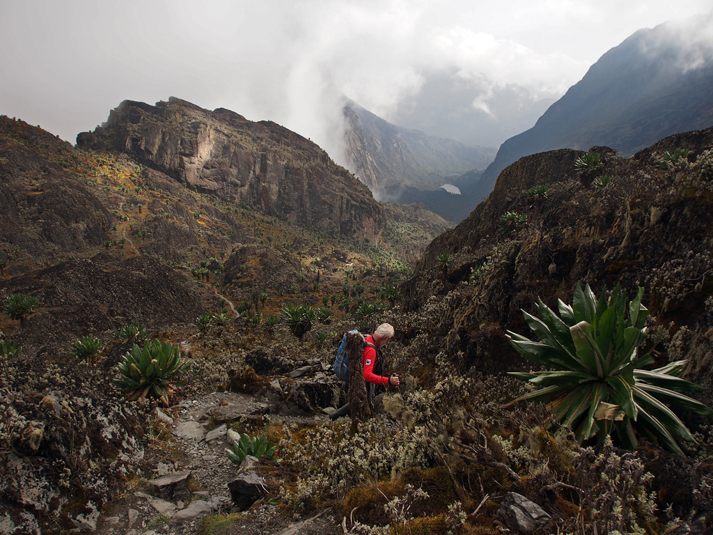
Today, we continue with the circuit and then leave west from Bujuku hut to scott Elliot at 4372 m after a right hand branch that would lead you to Elena hut at 4,372m. as you depart the Elena and savoia glaciers as well as mt Baker, this trail slopes past the upper Kitandara lake thrigh the bad mud to the lower lake as well as the kitandara hut at 4,023m. the elevation to the pass from Bujuku is also modest and the downs and up double that amount. And since Scott Elliot is the most high point, therefore some hikers will be slower due to the efforts that are needed at these altitude.
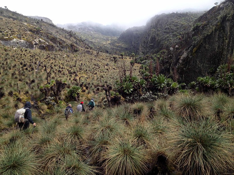
From Elana Hut to Guy Yeomen Hut
You can climb from the lake at 4,292m and fresh field pass. The fresh field is a long flat navigate through the fantastic high alpine mossy glades until half an hour and the trails begin the circuit’s two day climb. The rock shelter at Bujongola and Babamba are also optional at night but is best to extend through the seeming ensless mud to the newly constructed Guy Yeomen Hut at 3,261m)
Descend back to the Ranger post
You begin very early in the morning in case you decide to go to the park headquarters as you complete the trek. The other alternative is to stay a night at Nyabitaba and each other very slowly facing the slope. From in case you are friend especially as you reach Kichuchu down the dry dusty crevice. From here, the trail matches and twice crosses the Mubuku River in deep mud until the last few kilometers of good dry trail that follow the ridge down to the Nyabitabe that completes the whole circuit. According to what has been happening with your body, you will need a comfortable bed and bath.
From Nyabitaba hut (25000m) to Kasese town.
From Nyabitaba hut, slope to Nyakalengija , near the park headquarters, you will also meet your driver to drive back to Kasese town to your hotel or you can go to Queen Elizabeth National park and relax at the lodge.
From Kasese town to Kampala
Have breakfast and after drive to Kampala considering the flight time. And in case you stay with Queen Elizabeth, you will enjoy a game drive in the morning after you will transfer back to Kampala.
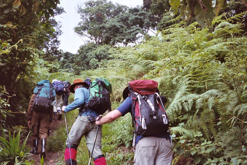
English speaking trekking guide and Porters
During the trek, you will be accompanied at all times by a Rwenzori Mountains guide. Porters will join the group as well to help to carry the luggage. There will be 1 porter per hiker to carry his/her personal luggage. The other porters carry food, charcoal, cooking utensils, and a gas cylinder among others.
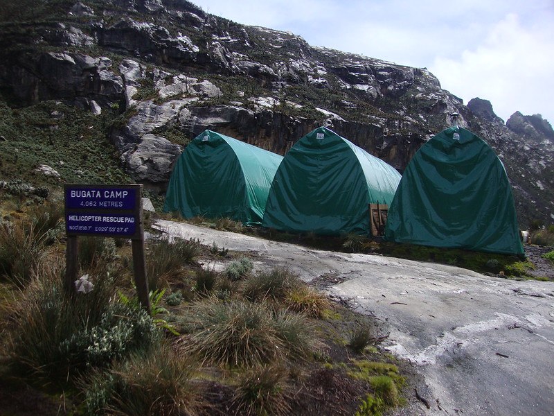
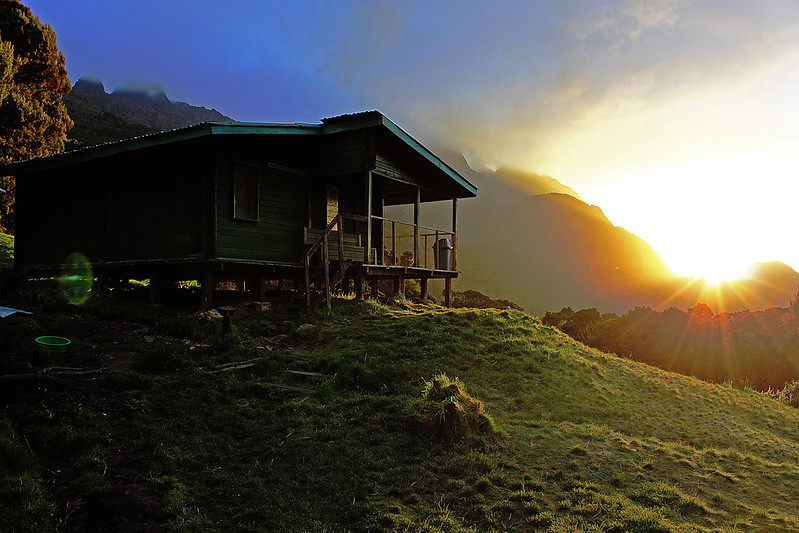
Accommodation
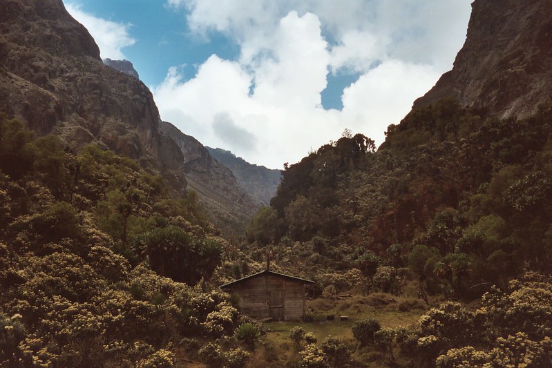
Accommodation during the trek is included in the price. You will spend your nights on the mountain in huts along the main circuit of the Rwenzori, such as the Nyabitaba hut, the John Matte Hut or the Bujuku Hut.
Meals
All meals are included during the trek. Breakfast, lunch, and dinner are served every day while on the trek. There is always powdered milk, chocolate drink, bread, sausages, packed juice, apples, chocolates, beef, rice, Irish potatoes, peas, and sandwiches. Lunch is not included on the first day of the trek.
Permits and Entrance Fees
In order to trek in the Rwenzori Mountains national park, you need a hiking permit and you need to pay the park’s entrance fees. These are included in the price of the trek.
Hiking Equipment
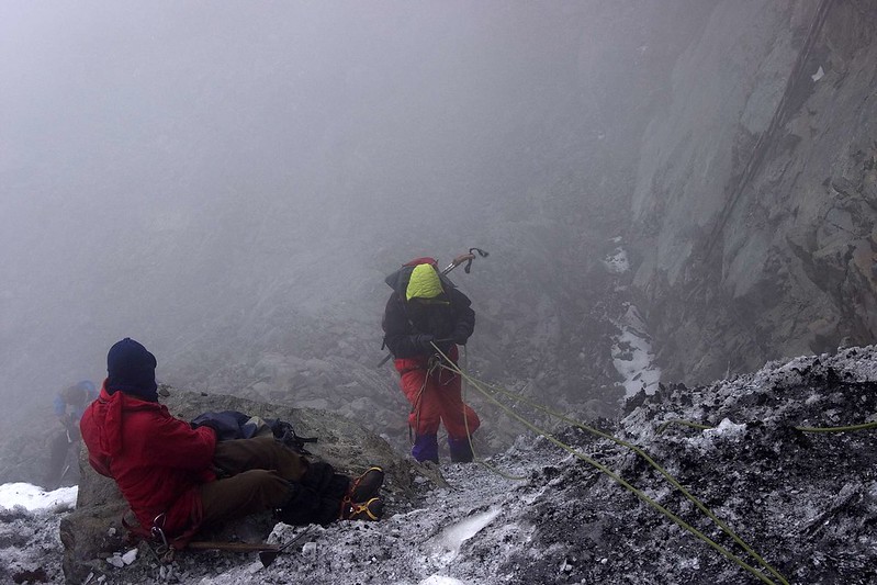
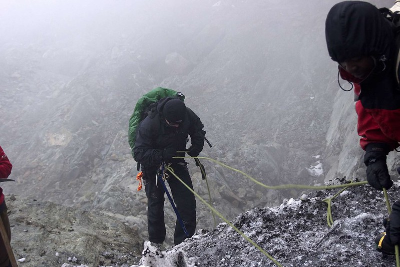
Hiking equipment such as crampons, ice ax, harness, helmet, gumboots are included in the trek.
Not included:
Airfare
You will have to make your way to Kampala, the starting point of this trek. Flight tickets to Uganda are not included in the price of the trek. In order to know which airlines fly to Entebbe International Airport (EBB), you can have a look at their website.
Transfer to Nyakalengija
This trek starts from Nyakalengija. You will have to make your way to this town. If you need help with the transfers, let us know and we can arrange it for you.
Accommodation before and after the trek
Before and after the trek you have to take care of your own accommodation in Kampala.
Travel Insurance
Your international travel insurance is your own responsibility. It is important that your travel insurance also covers adventures at a high altitude. Discuss your itinerary with the insurance company before your trek.
Sleeping bag and other equipment
Sleeping bags are not included in the trek, you will have to bring your own. Other necessary trekking equipment such as trekking boots, and warm gear are not included.
Personal expenses
Any personal expenses that may take place during the trek, such as buying snacks, souvenirs or alcoholic drinks are on your own account.
Water
As you hike the Rwenzori, you will not be provided with bottled water. You will get the water from the rivers and streams in the mountains because it’s clean. The locals drink it and they are okay. But if you don’t trust it, it’s okay to add some water filters to your water to avoid any inconveniences (these won’t be provided by your trekking company).
Tipping
Tips for the guide and porter are not included in the price of the trek. You decide how much to tip, but if you got a good service from your guide, be generous.
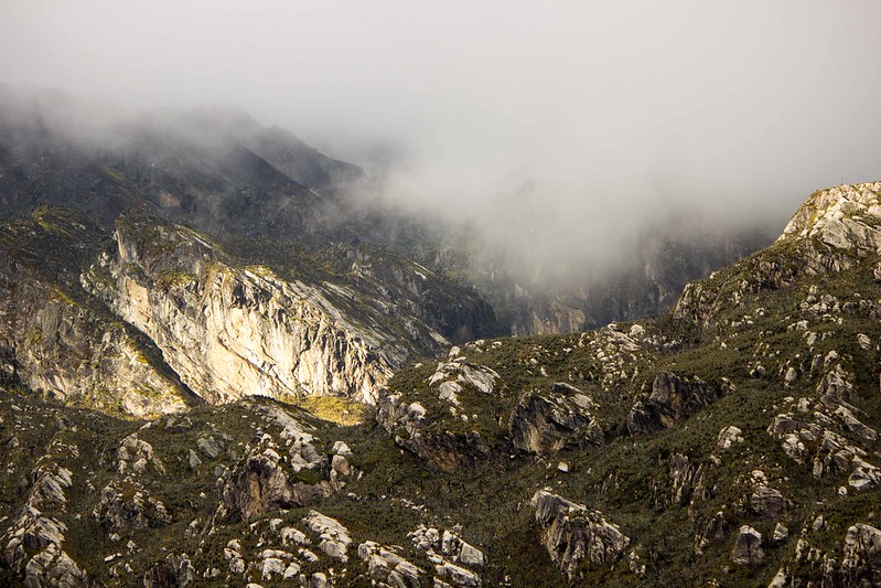
The formation of the Rwenzori mountains dates way back to about 3 million years ago. Unlike other volcanic mountains, the Rwenzori ranges are formed by uplifted blocks of crystalline gneiss, quartzite, amphibolite, and granite rocks.
How much does it cost to trek the Rwenzori Mountains?