This 12 days Rwenzori mountain trek is the perfect trek for avid mountaineers that intend to summit all the peaks on Mount Rwenzori that lies at the boundary of these two countries, Uganda and the Democratic Republic of Congo. This itinerary takes a duration of twelve days giving you sufficient time to experience Rwenzori Mountains National Parks, the entire mountain and its towering peaks as you pass through a variety of vegetation zones, explore different species of plants and wild animals as you ascend to the top.
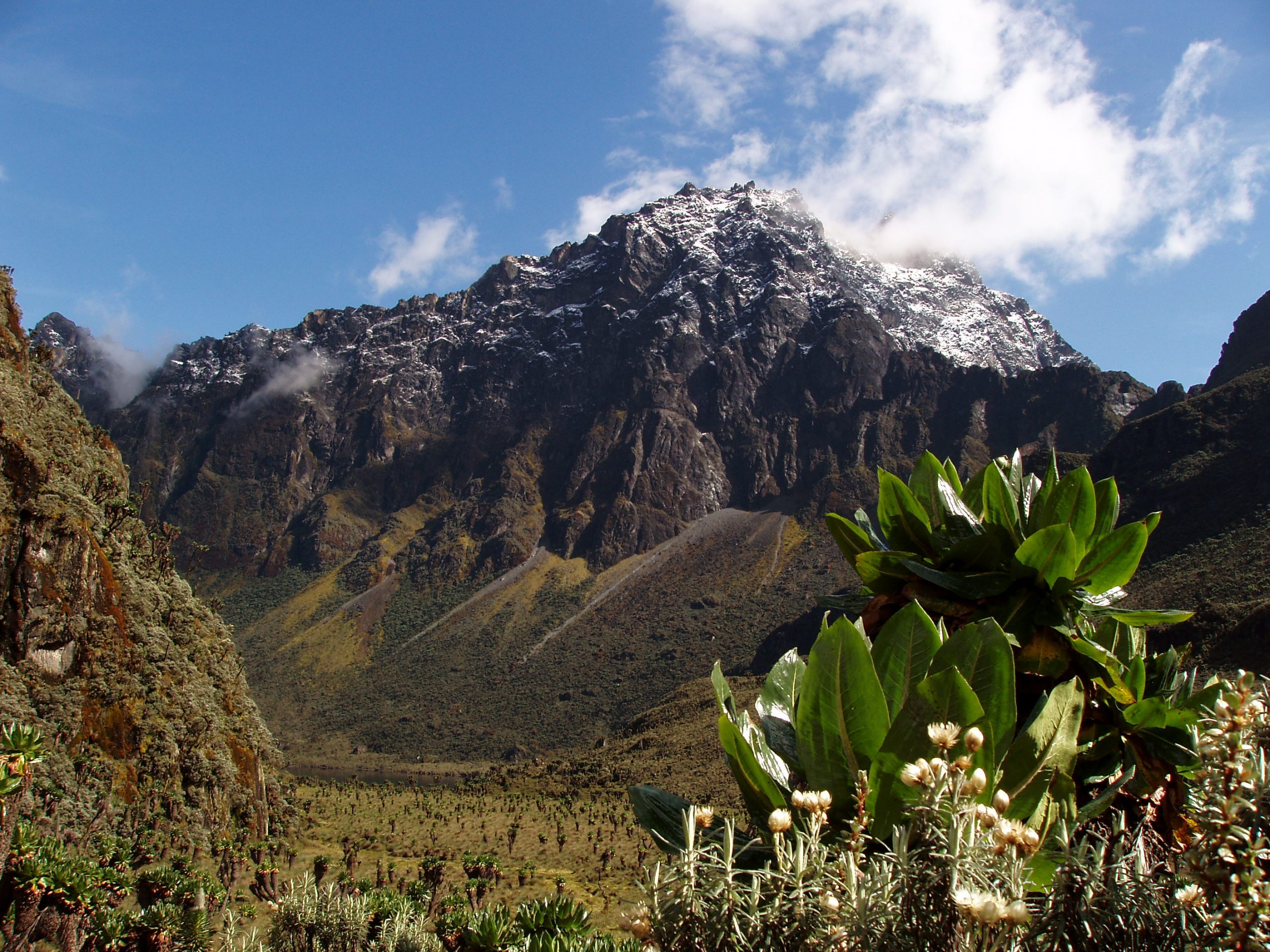
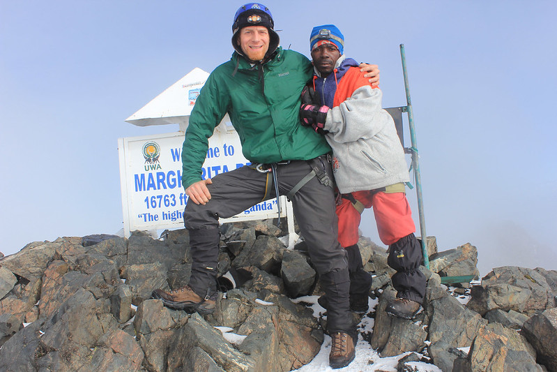
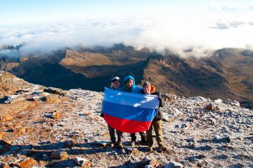
This 12 days mountain climbing experience of the Rwenzori Mountains offers you the opportunity to explore all of the 6 peaks, otherwise known as the 6 mountains that make up the Rwenzori. These 6 mountains that you will visit include Mount Gessi, Emin, Speke, Stanley, Luigi Savoia and Baker by following the central circuit trail which includes climbing the constantly snow-capped Margherita Peak, the highest peak on Rwenzori’s Mount Stanley.
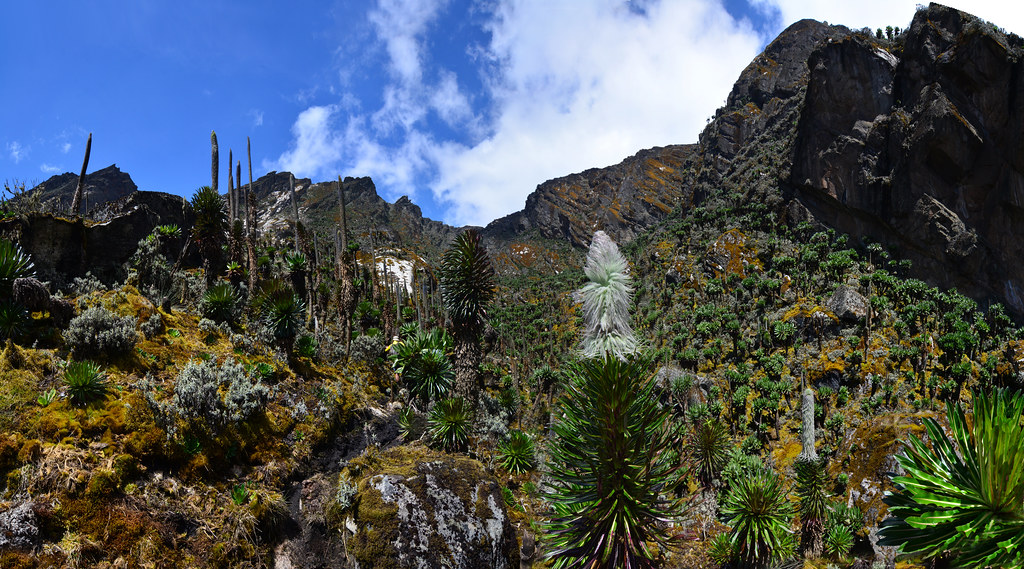
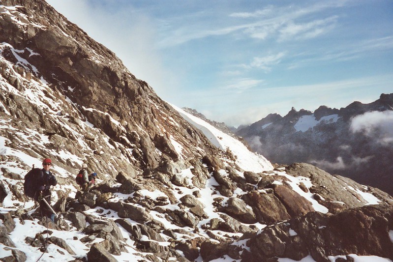
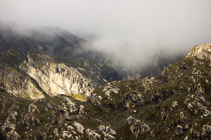
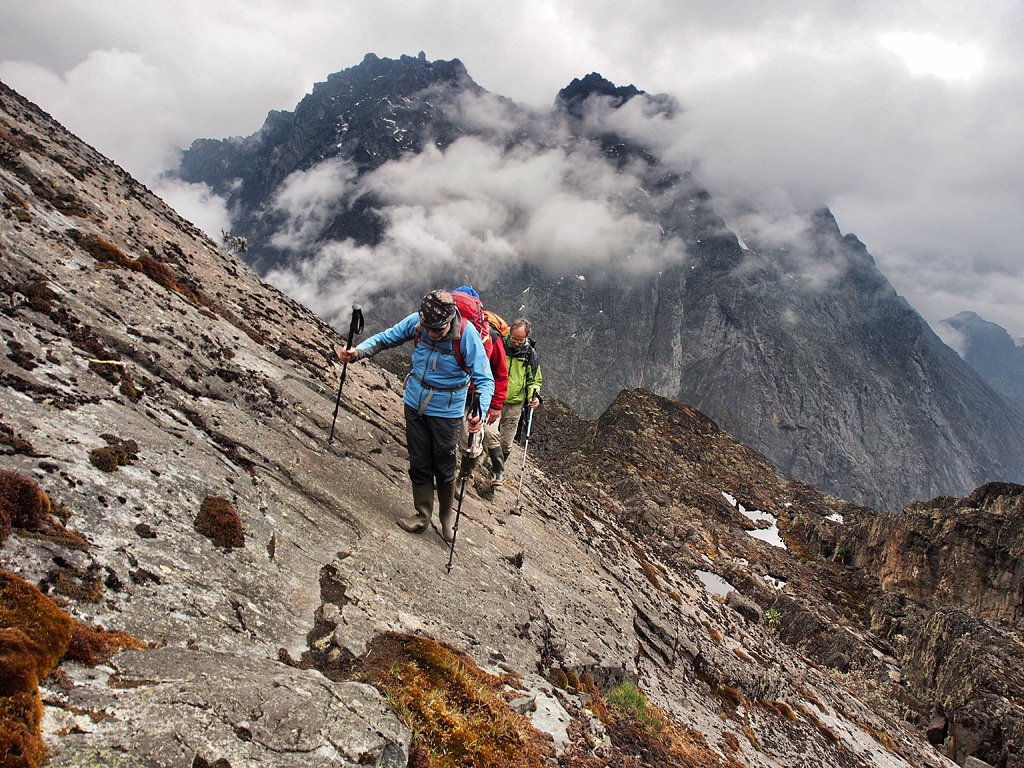
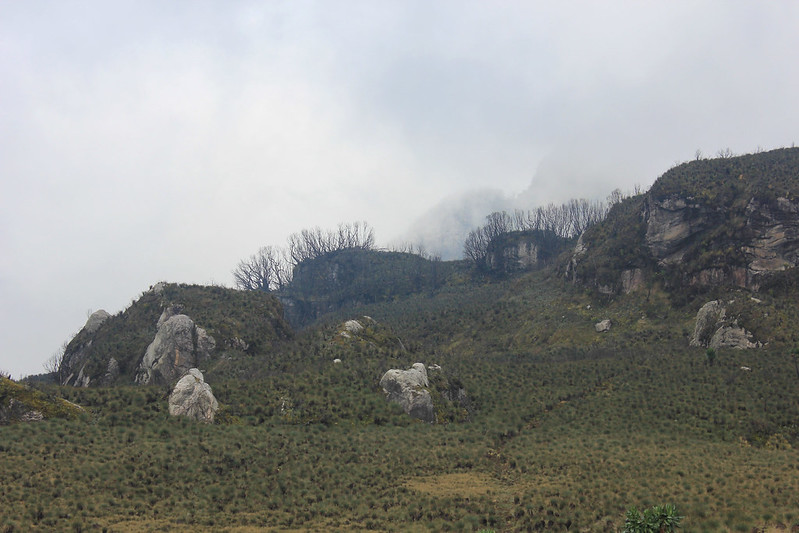
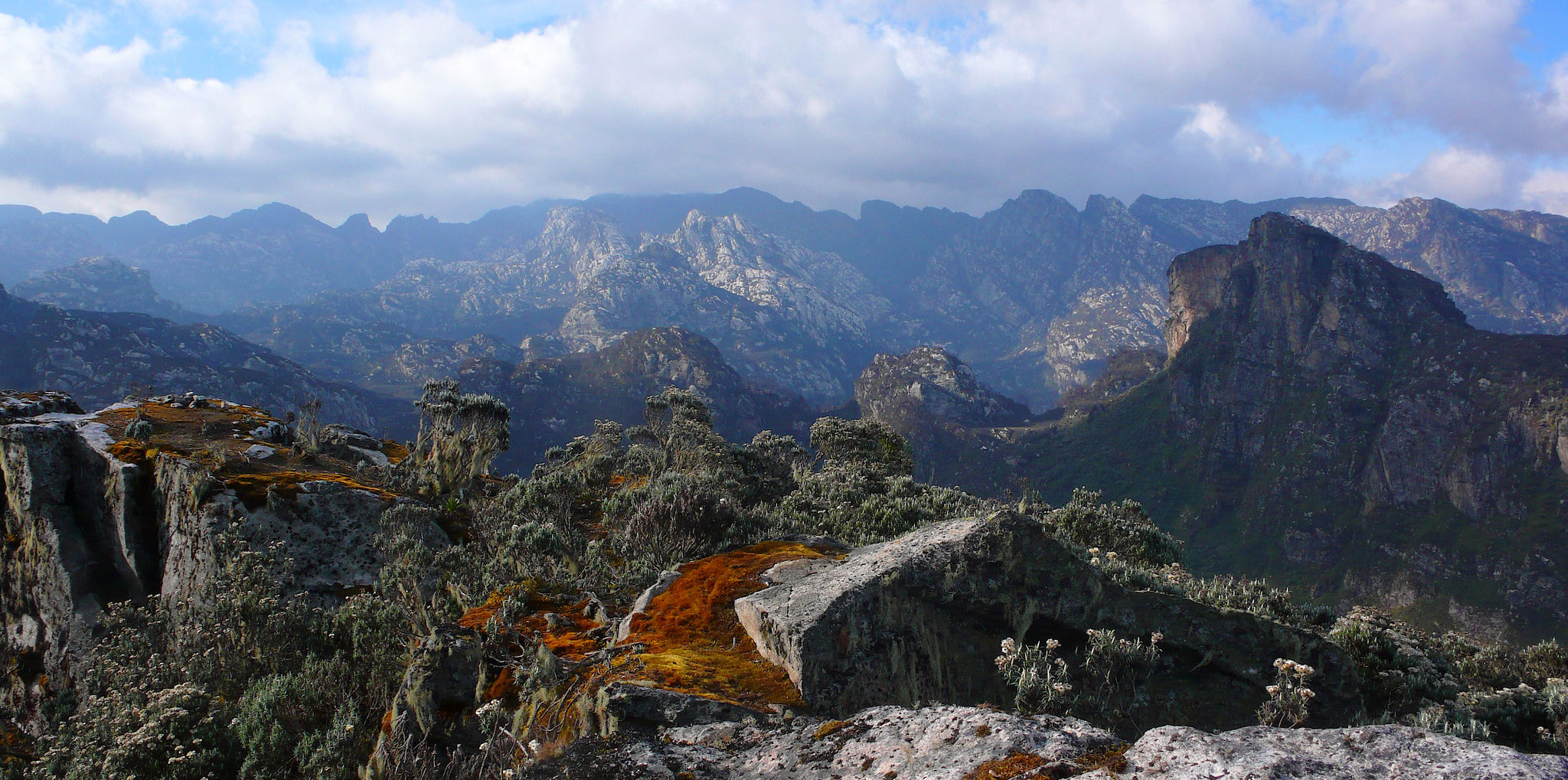
Rwenzori’s other peaks have a more rocky terrain filled with rock outcrops, making the climbs on this mountain more challenging due to slippery conditions. The bright side, however, you will be rewarded by stunning views of the Rwenzori massif.
This 12-day mountain expedition can be booked as a group tour or a private trek with more flexibility of choosing your best time to climb, number of people and other addons like safaris and gorilla trekking.
About the Rwenzori Mountains
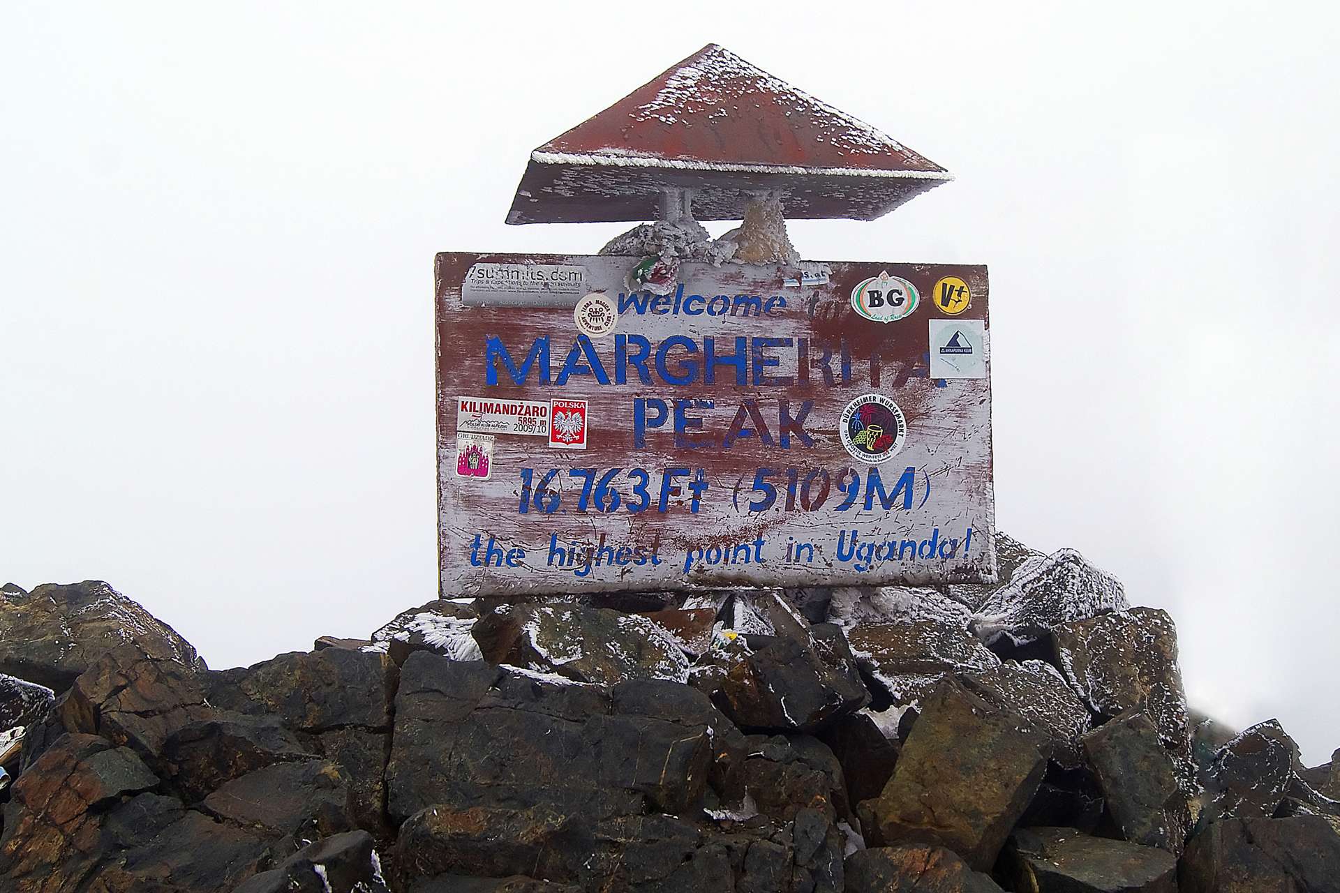
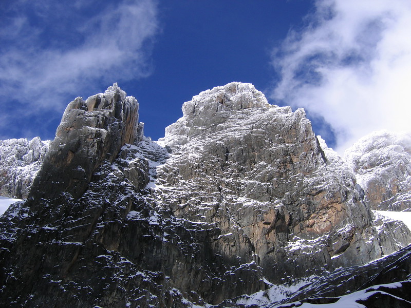
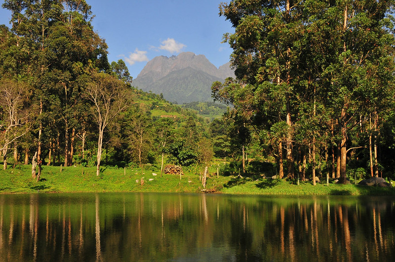
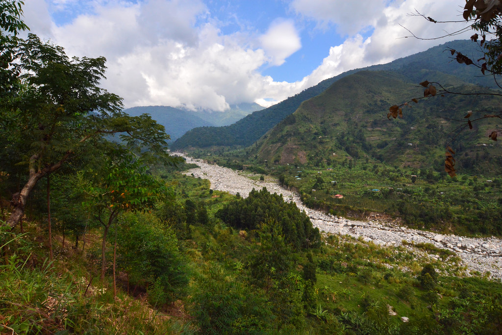
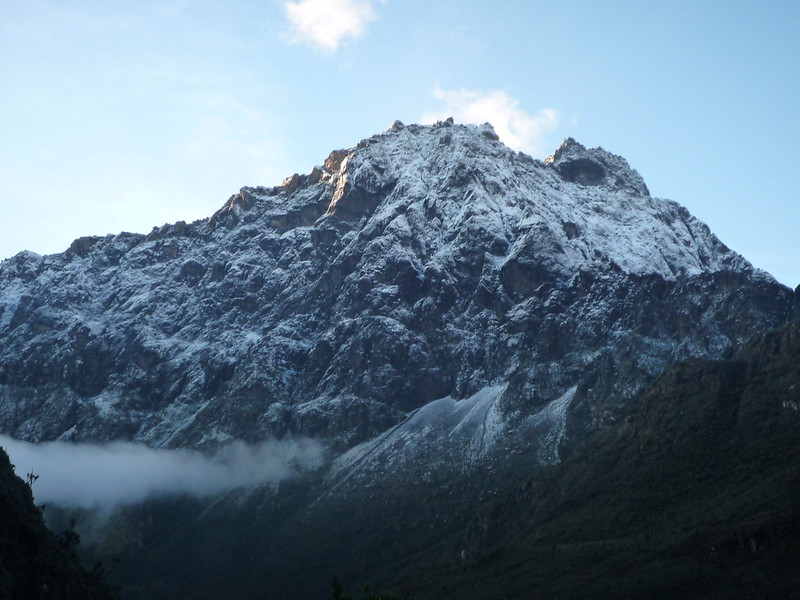
Rwenzori Mountains National Park was officially declared a national park in the year 1991 and is both recognized as a World Heritage site and a Ramsar site. The park covers an area of about 996km2. . The highest point on Rwenzori Mountain is the Margherita Peak that stands 5,109m above sea level and it stands on Mt Stanley, a mountain that stands on the border that separates Uganda and the Democratic Republic of Congo. one amazing fact about the Rwenzori is that in AD 150, geographer Ptolemy from Alexandria in Greece, gave these mountains the name “Mountains of the Moon”.
Getting there
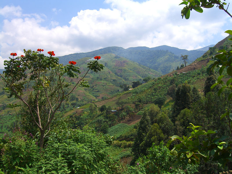
Rwenzori is located in the South-Western part of Uganda and Entebbe International Airport is the nearest airport to Rwenzori National Park. From the airport, you can take a shuttle or minibus to Rwenzori or to Kampala, another minibus to Kasese then Kalembe if you are using public transport..
When to go
The best time to hike the Rwenzoris is during the dry months of between December and March or from July to September.
Need to know
You will need a tourist visa for entering Uganda, a process that can be done easily done online and usually take a few hours to be sent to you via email. For a 90 days visa, it would cost you about $50 (USD currency only)applications can be done online here – visas.immigration.go.ug.
Why choose the Rwenzori over Mount Kilimanjaro?
Since the Rwenzori mountains are not as popular as Mount Kilimanjaro, they do not attract as many climbers as Mount Kilimanjaro, meaning that, the routes are less crowded and the high altitude vegetation is more lively. Even though Tanzania’s Mount Kilimanjaro is the highest in Africa, Uganda’s Rwenzori mountain range is one of Africa’s top hiking destination, holding three of Africa’s five highest peaks.
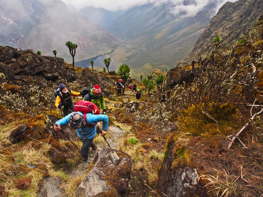
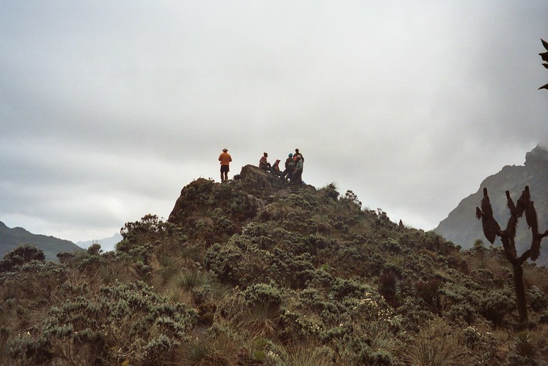
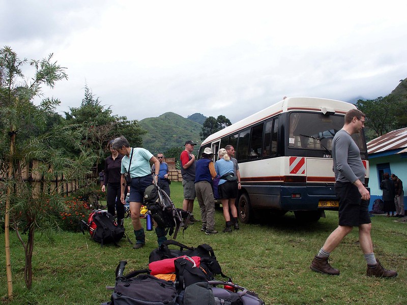
Nyakalengija (1600m) to Nyabitaba hut (2650m)
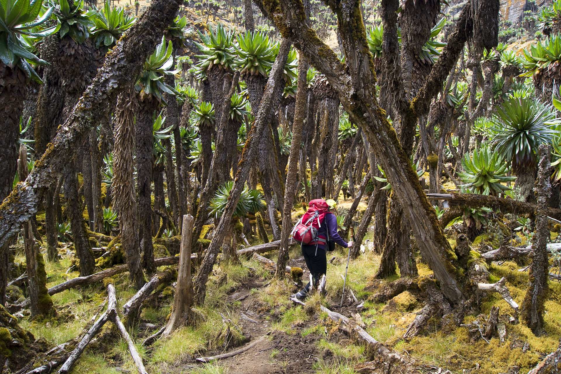
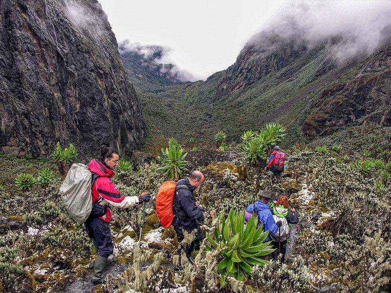
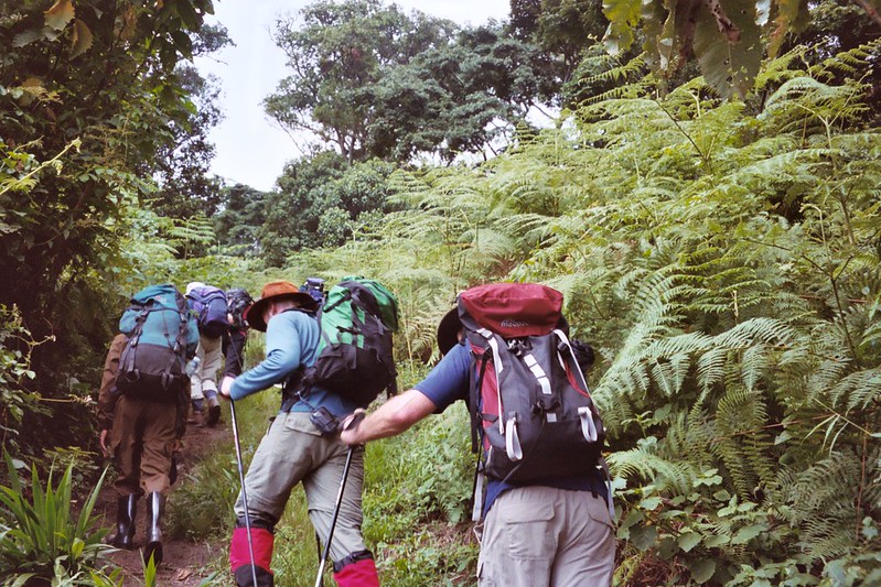
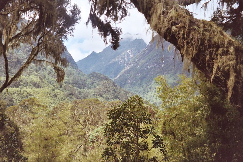
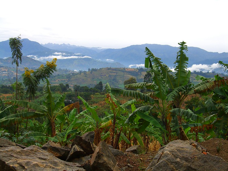
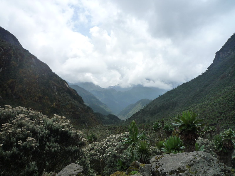
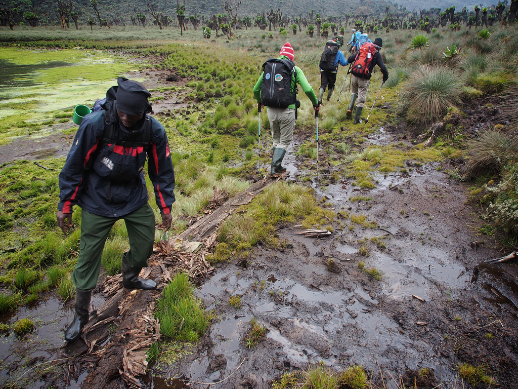
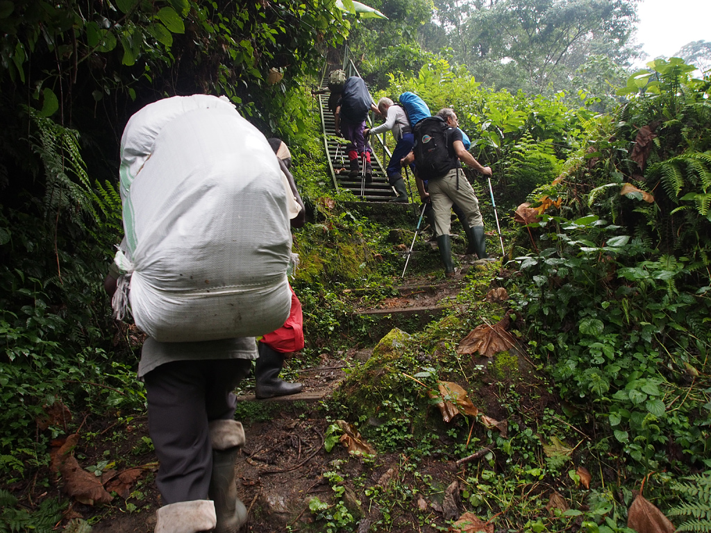
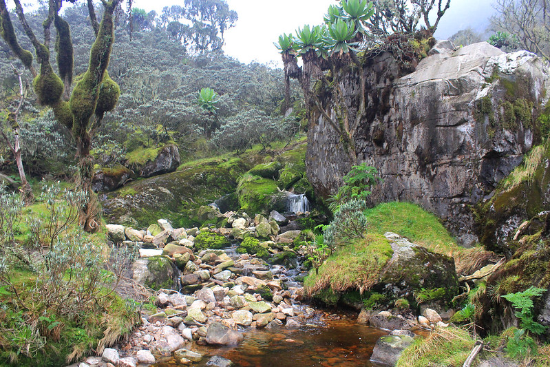
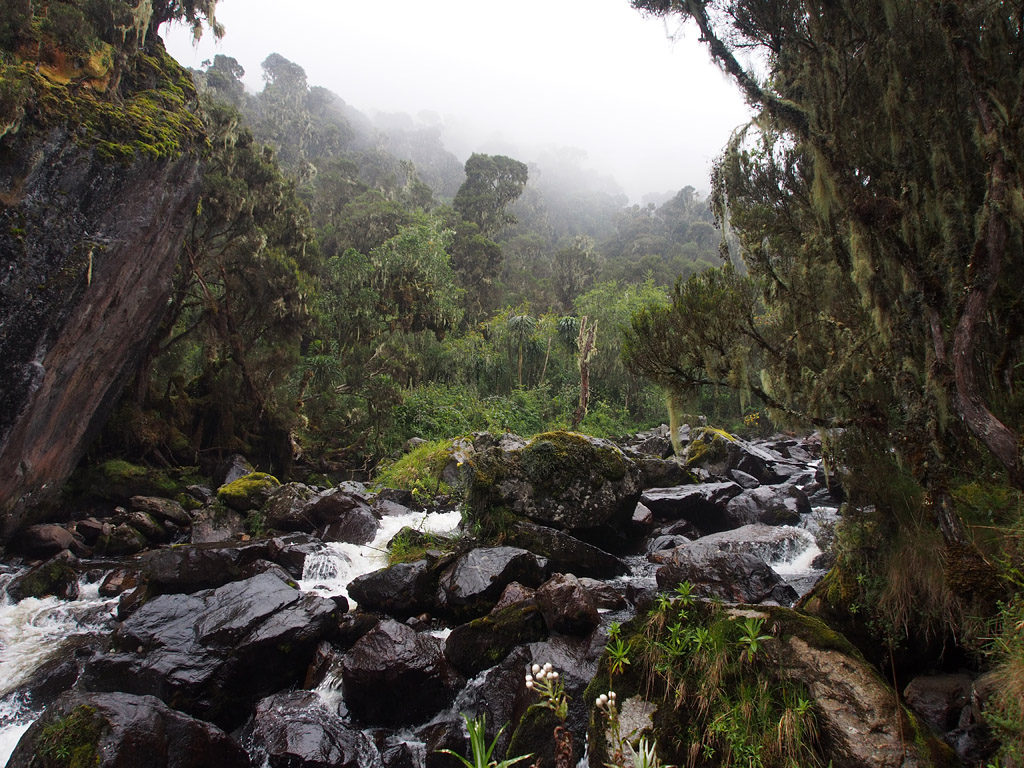
Your 12 days Rwenzori trek begins from Nyakalengija (RMS park headquarters) with a walk through the Bakonzo settlements of Uganda to Mount Rwenzori National park entrance where you will be obliged to register and do some paperwork that allows you to enter the park and climb Rwenzori. After registration at the gate, your hike begins by taking the central circuit trail trek through the dense tropical forest that is characterised by dense bushes and high elephant grass.
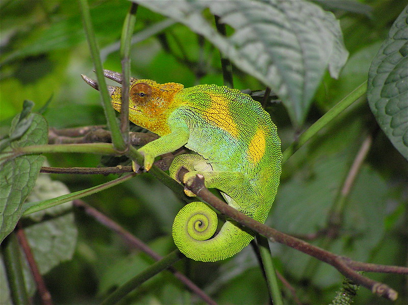
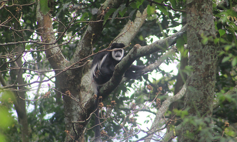
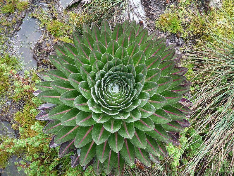
The tropical forest at the base of the mountain is a natural habitat to various species of wild animals, among them:- elephants, black and white colobus monkey, chimpanzee, hyrax, L’Hoest’s monkeys, duiker, and three-horned chameleon among other animals. The forest is also home to various bird species like the resident Rwenzori Turaco, Handsome Francolin, Long-eared Owl, Cinnamon-chested Bee-eater, Strange Weaver, Archers’ Robin-chat, Barred Long-tailed Cuckoo, Rwenzori Batis which is endemic to the base forest of the mountain among many others as well as various tree and plant species. You will expect to see some of them.
Distance covered: 8km from Nyakalengija to Nyabitaba hut. Dinner and overnight at Nyabitaba hut.
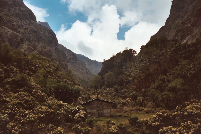
Nyabitaba to John Matte Camp (3420m)
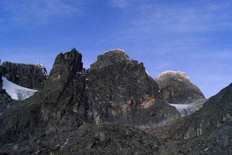
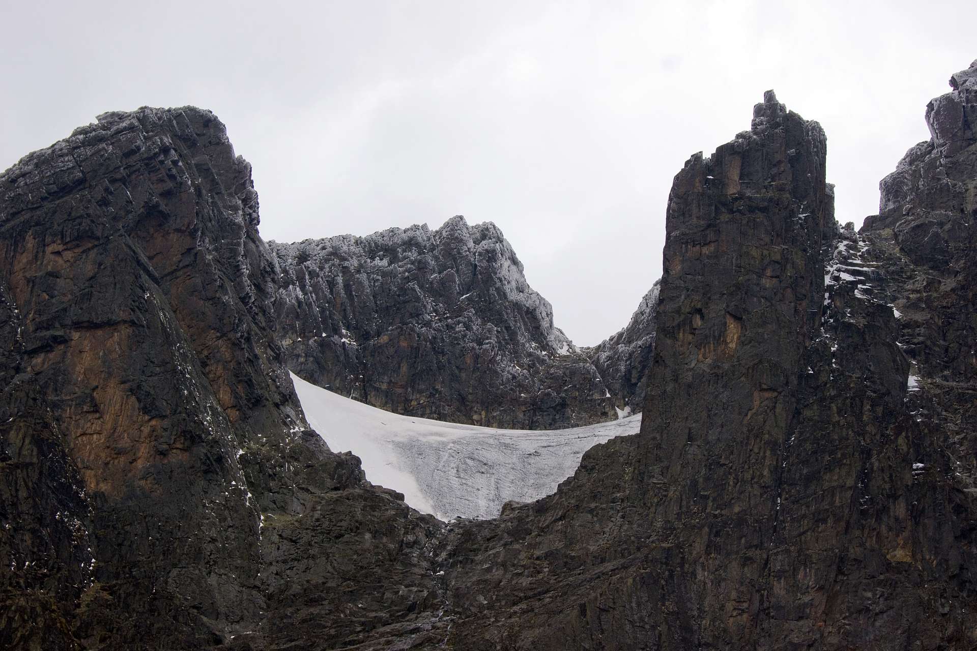
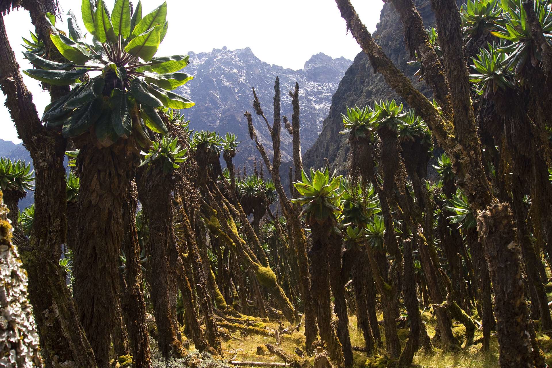
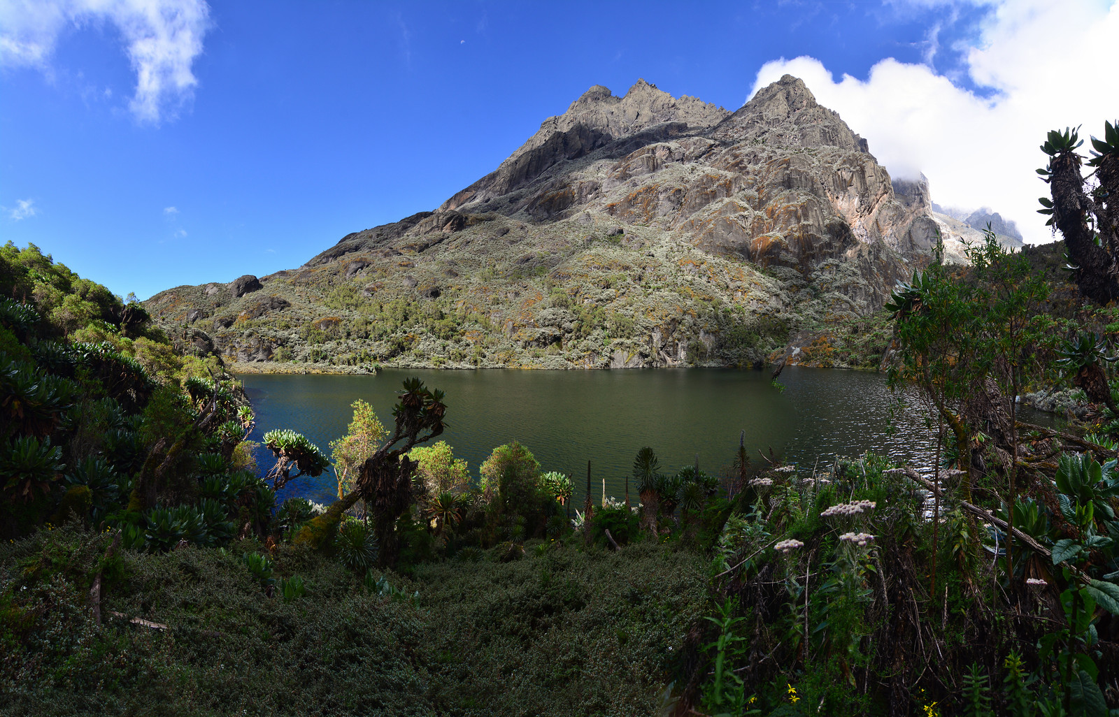
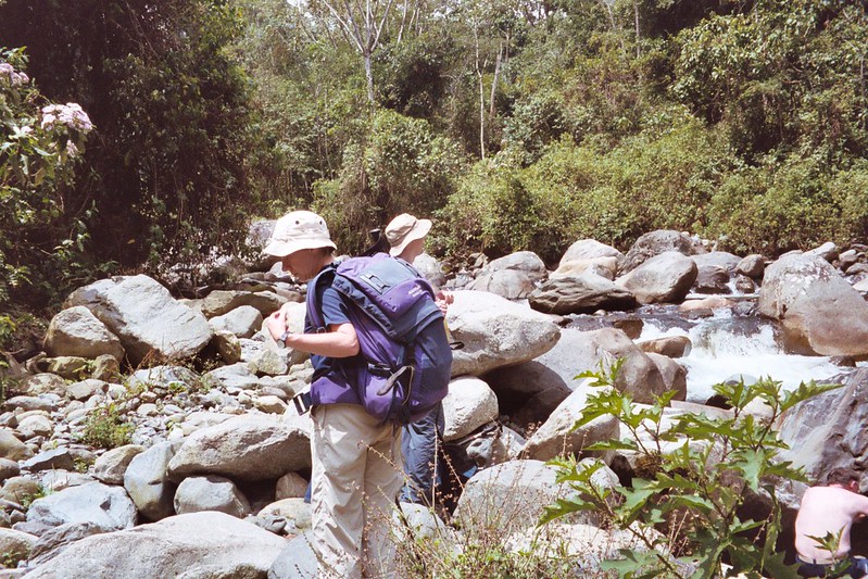
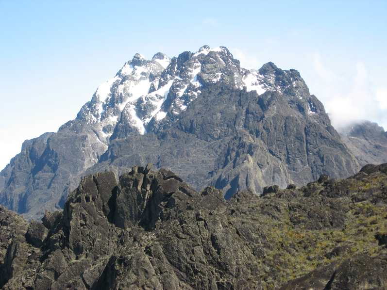
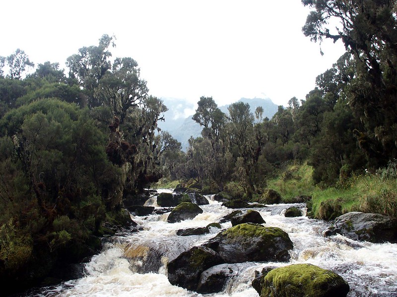
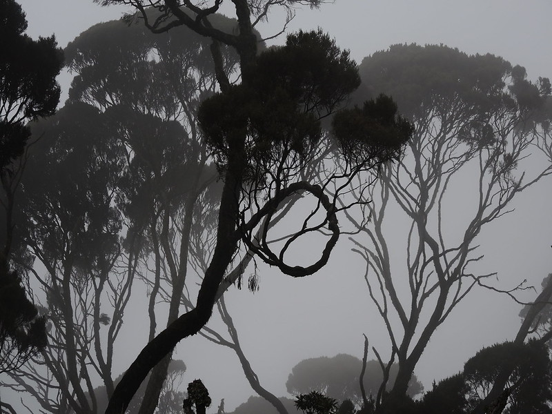
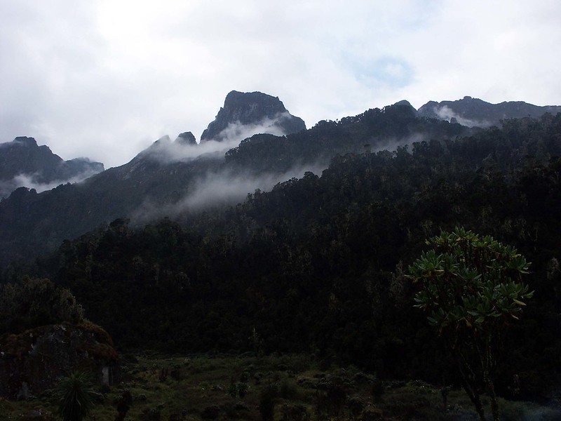
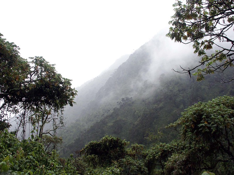
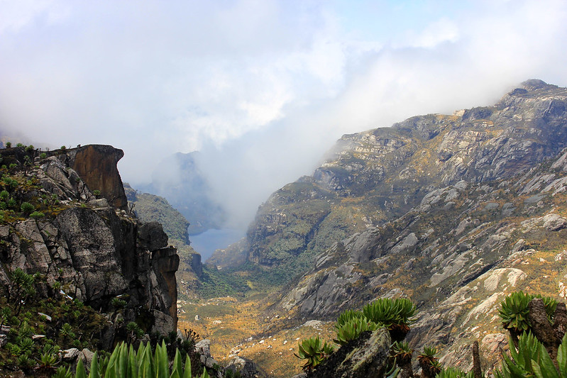
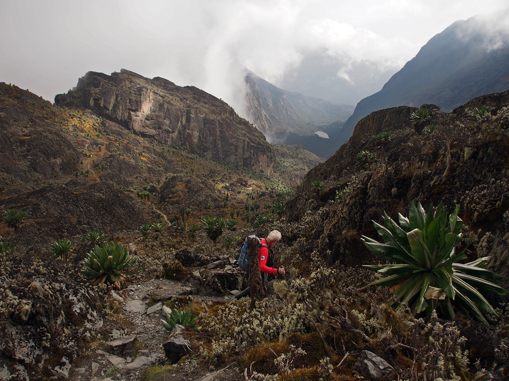
After early breakfast at the Nyabitaba hut, you will trek through thick shrubs and dense forest for approximately 30 minutes to the Kurt Shafer Bridge, the meeting point of the Mubuku and Bujuku rivers. For a few hours, this trek traversing the base tropical forest leads to bamboo zone mixed with montane forests and slippery moss-covered rock outcrops. You will carry on with this hike by ascending to Nyamulejju rock shelter for a lunch break. This also where the first hikers used overnight and camp here, and weather permitting, this point will give you an amazing view of Mount Stanley and Mount Speke. Traversing the alpine forest will lead you to the John Matte camp near river Bujuku and the hut is more famous for hikers because due to the water here being cold and refreshing, people opt to take a bath here while you marvel at the beautiful views of the Margherita glacier which forms at the cap of Mount Stanley that is placed in between Alexandra and Margherita peaks.
Distance covered: Nyabitaba to John Matte is about 11km.
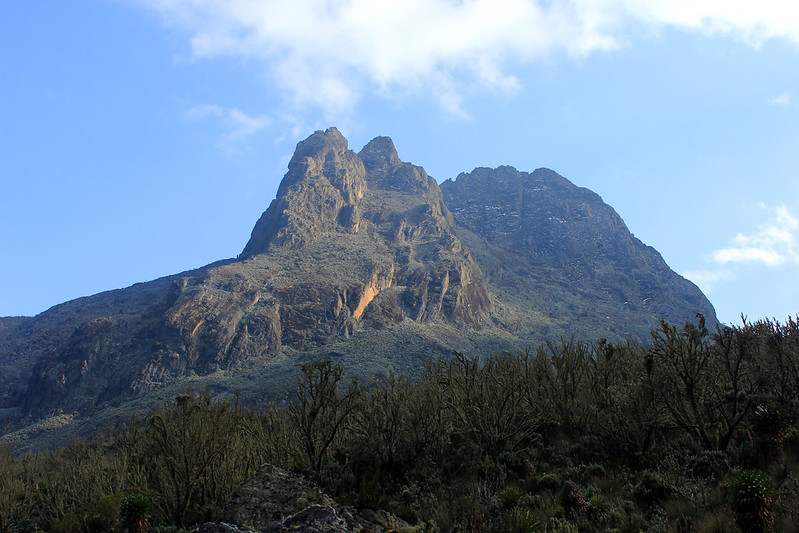
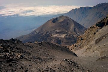
Hike Mount Emin (4798m) – overnight as above
Leave shortly after breakfast for a trek through the alpine forests of the Rwenzori Mountains to the base of Mount Emin then ascend to the peak of mount Emin. Mount Emin’s peak will reward you with incredible vistas of the Rwenzori massif. Return to the camp for dinner and overnight.
Hike mount Gessi – overnight as above
Day 4 of your 12 days Rwenzori hike takes you for a hike to the top of Mount Gessi. After breakfast, trek through this rarely used route taking you to the peak of Mount Gessi then take a brief descent back to camp.
John matte to Bujuku (3930m).
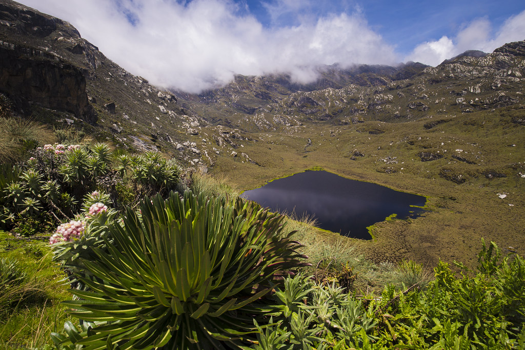
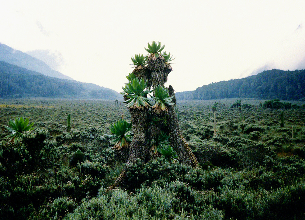
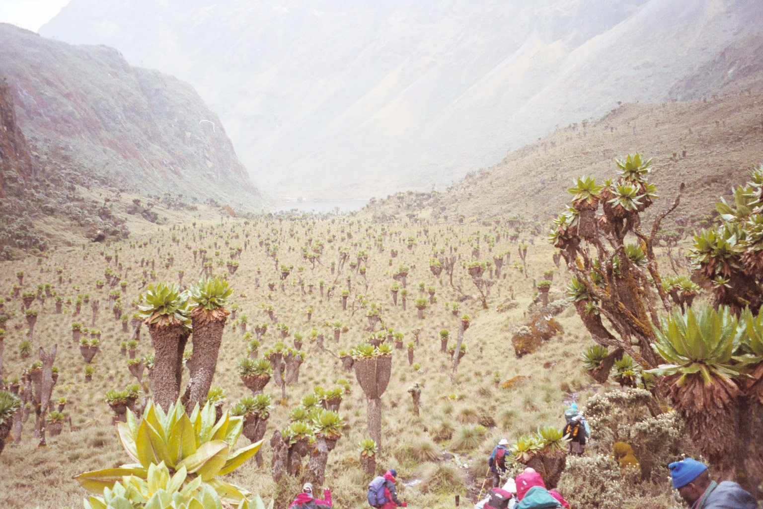
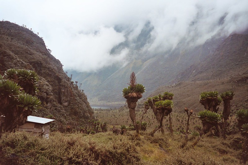
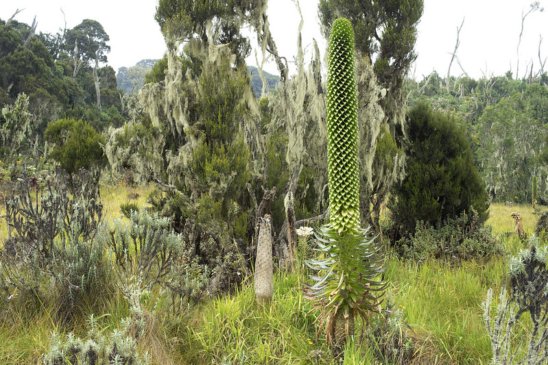
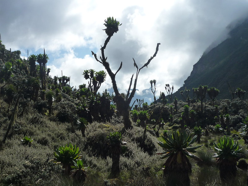
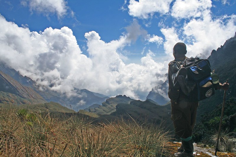
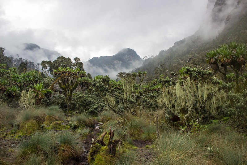
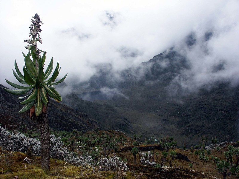
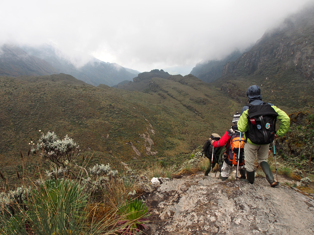
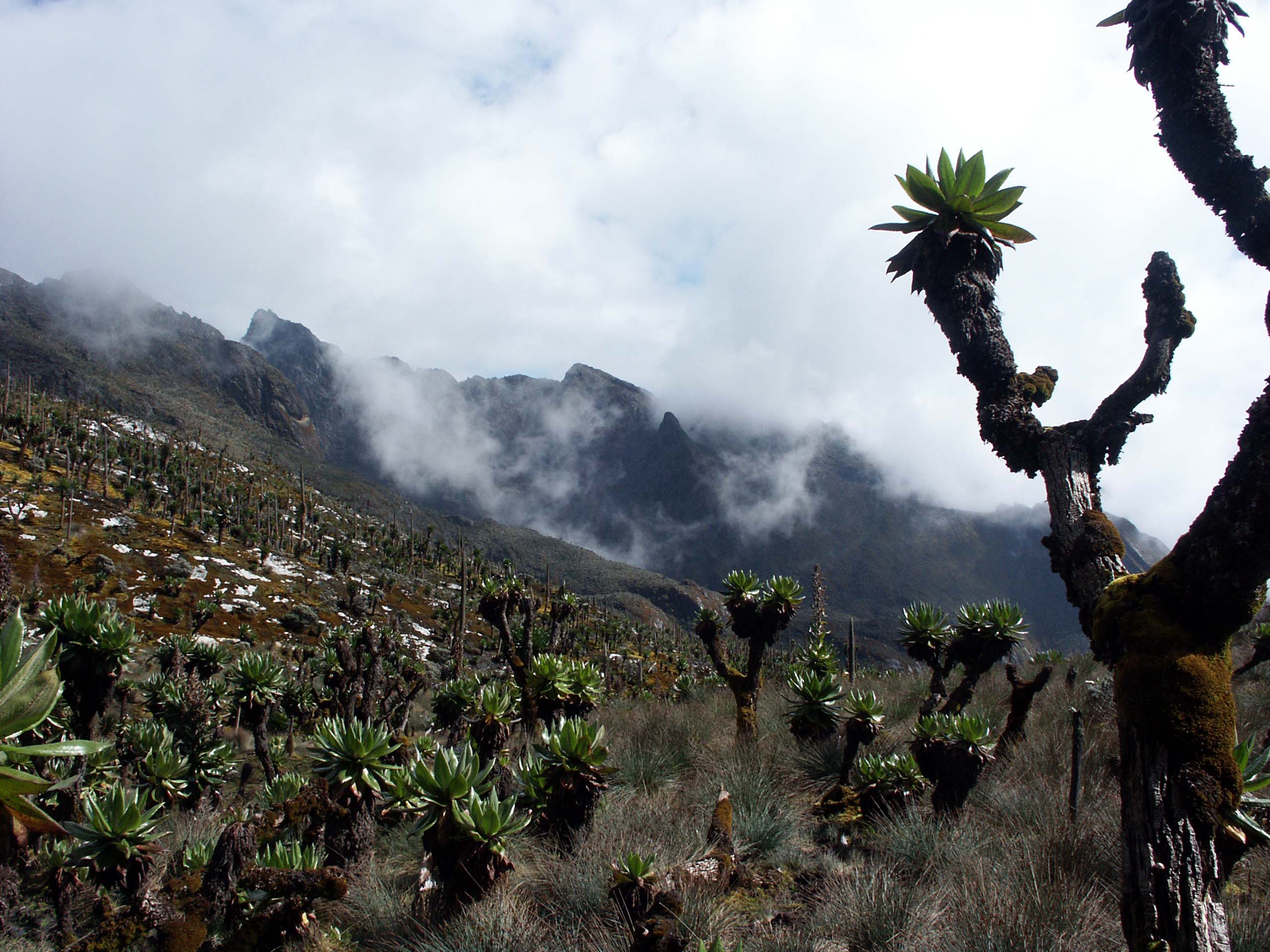
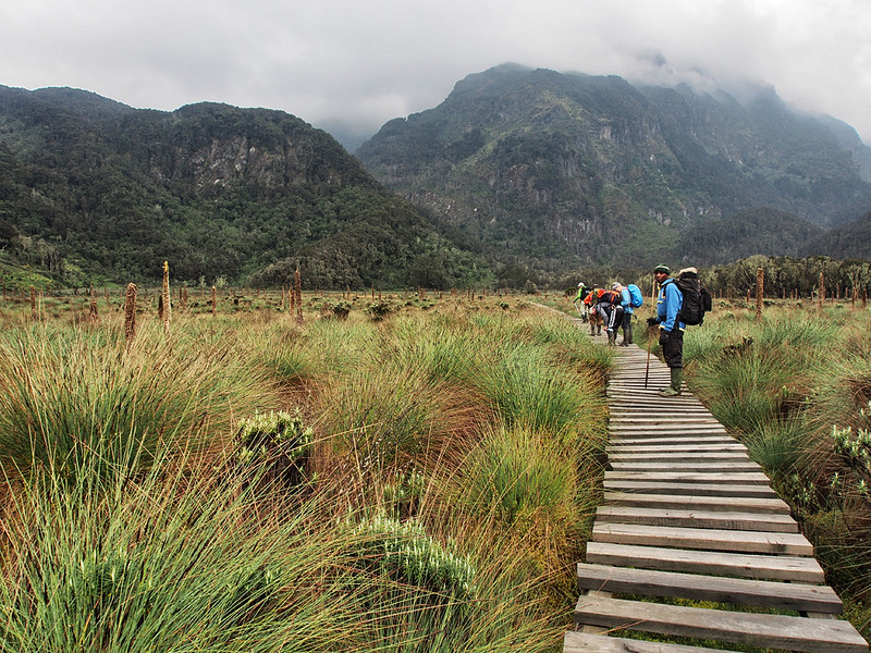
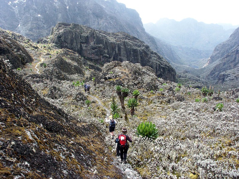
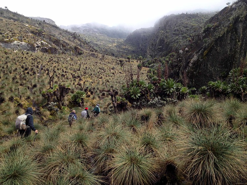
After breakfast at John Matte Hut, you will set out on a trek to cross River Bujuku and traverse the forest leading to the Lower Bigo Bog. This marshy and swampy area is filled with giant lobelias in the valley. Back in the day, the swamps made it harder to trek on Rwenzori since the valley is boggy with the only option to cross these bogs is to leap from one tussock to the other, making it a little bit harder especially for female mountaineers. Currently, there is a walk board contracted over the boggy area, simplifying trekking across this area and even better, as you cross the swamp, you will see giant lobelias, groundsels and a beautiful sight of everlasting flowers.
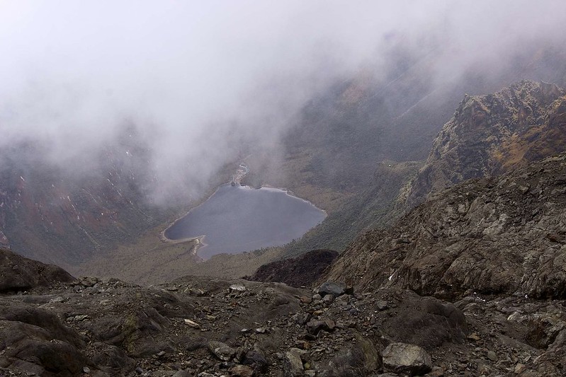
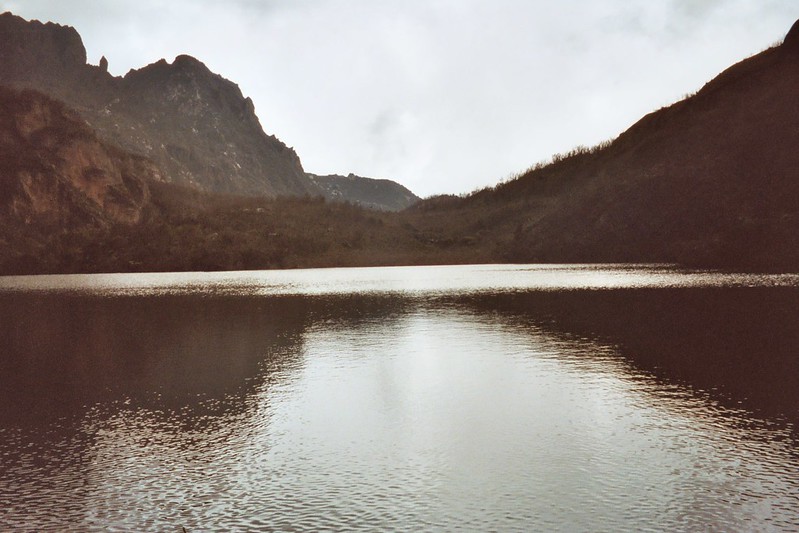
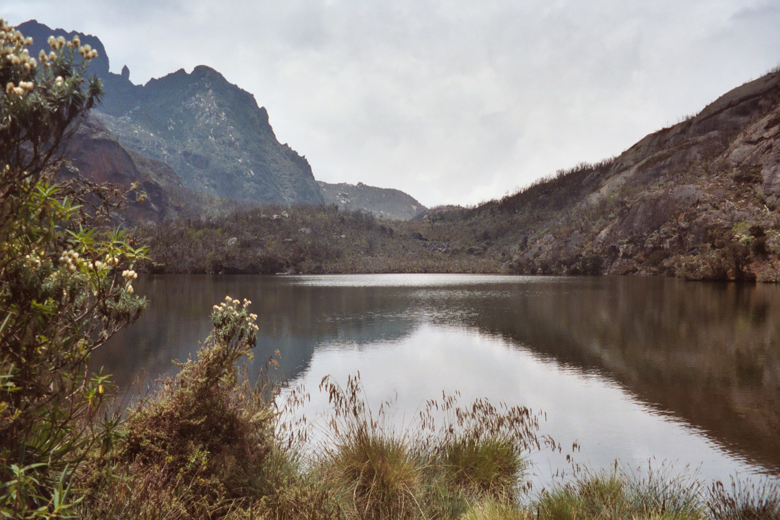
Moving along with the trek take a steep ascent along a ridge up to where the upper Bigo bog begins. There is also a boardwalk laid up and extending up to Lake Bujuku. At the end of the boardwalk, there is a small bit of boggy area that you have to attempt and complete without any boardwalks, this area takes you to Bujuku hut, your resting camp for the night that also has an amazing view of Lake Bujuku, Mount Speke, Mount Baker and Mount Stanley. From here, you can climb to Mount Speke and Mount Stanley.
Distance covered: From John Matte to Bujuku is about 5km. dinner and overnight at Bujuku.
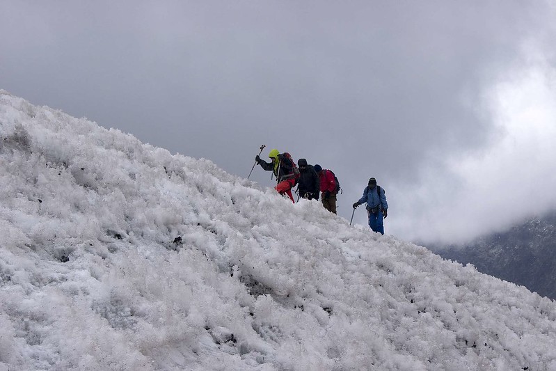
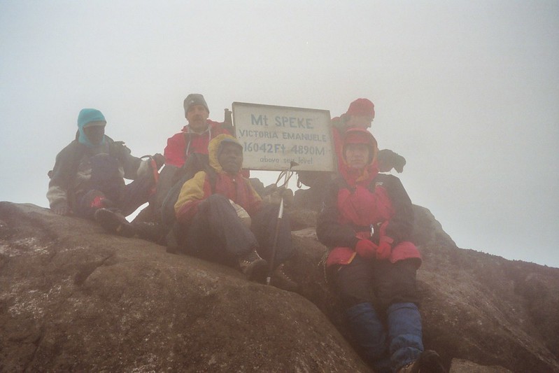
Hike mount Speke and transfer to Elena camp (4563m)
After breakfast at the camp, you will start the hike to the top of mount Speke. This trek is a bit challenging because of being rocky. The top will offer you beautiful views of the Rwenzori features. You will then descend back to the camp where you will have lunch.
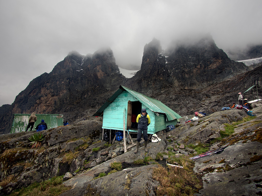
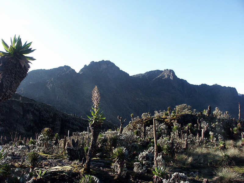
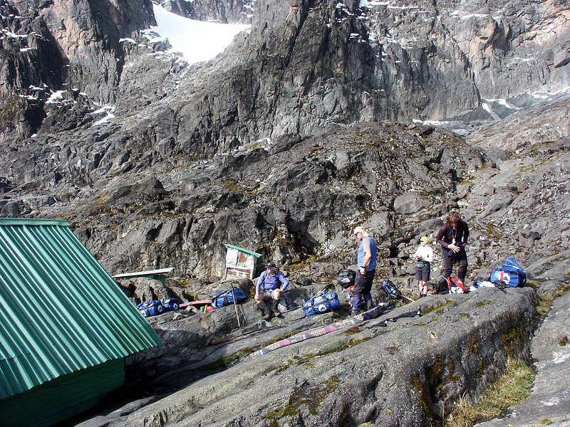
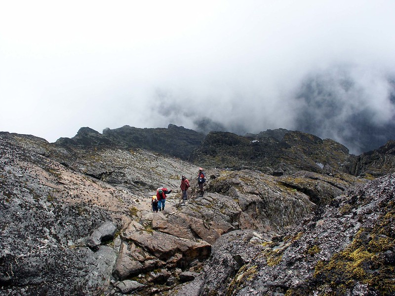
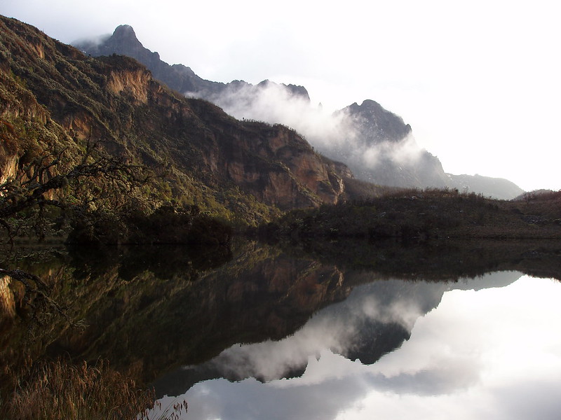
You will move through the sides of the upper Bigo bog. You will then hike through the steep slopes the steep slopes of Lake Bujuku. While climbing Lake Bujuku’s steep slopes on the west, the trail ascends to the 4372 meter Scott-Elliot pass, and you will pass through more swamps and the thrilling Ground gully. You will go over a steep section at the top of the gully using a metal ladder. The trail is then divided into two. The two trails, the left trail leads to Scott-Elliot pass descending to Kitandara Lakes while the right trail heads to the Elena Hut and on a steep trail above large boulders to Mt Stanley. Elena hut is at the rocky part of Mount Stanley and the area is too cold. At this point, you are at the highest mountain of the Rwenzori and you will have a direct view of Mount Baker and Mount Speke. Sometimes it is hard to view these two mountains because they are covered by fog. Have dinner at Elena hut then spend the night.
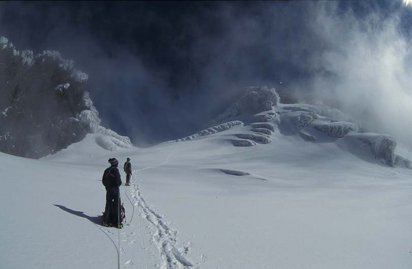
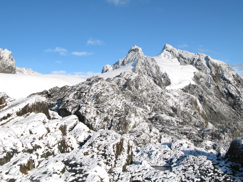
summit Margherita peak and transfer to Kitandara (3979m)
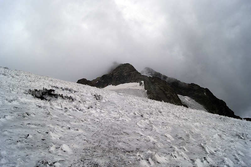
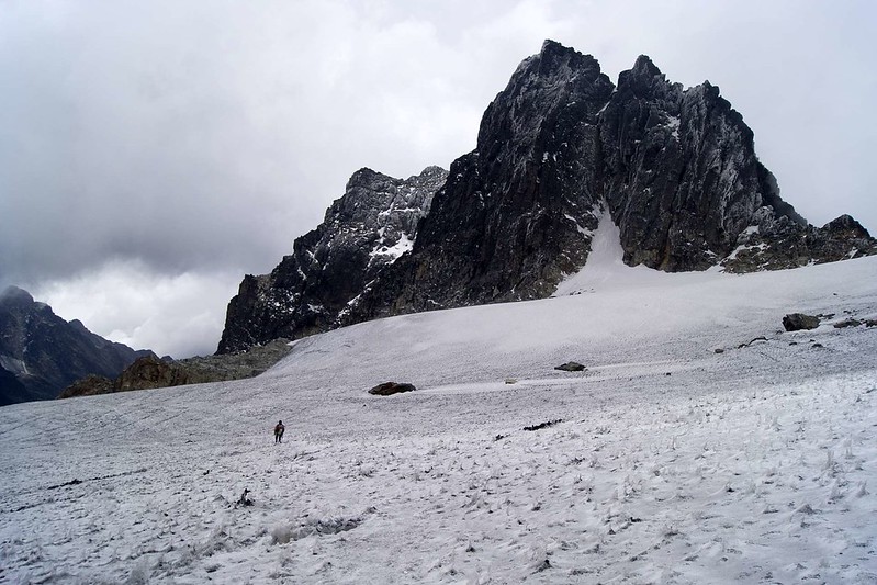
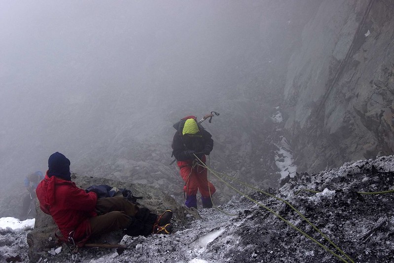
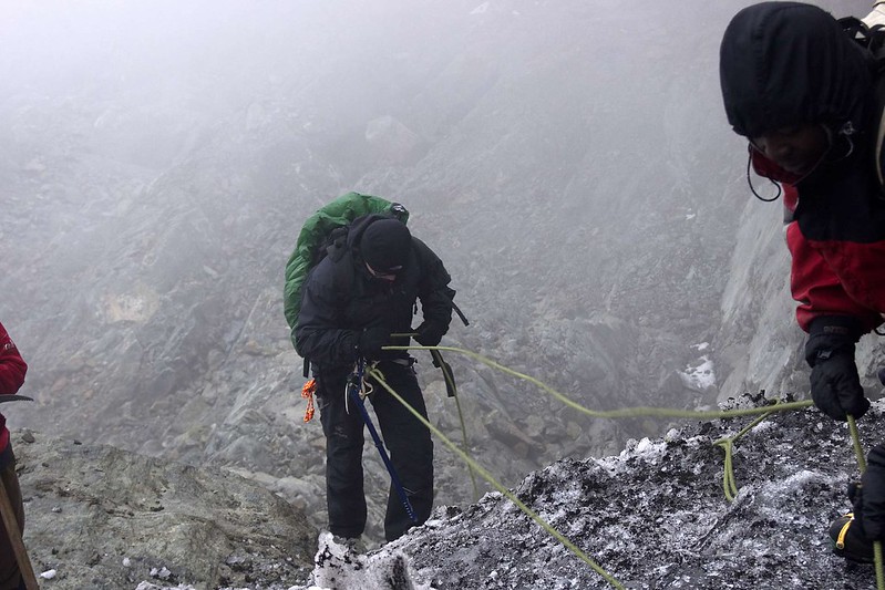
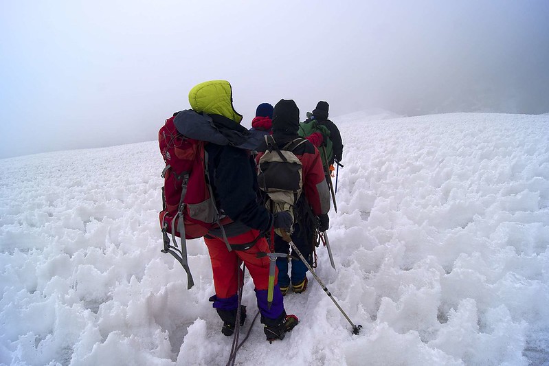
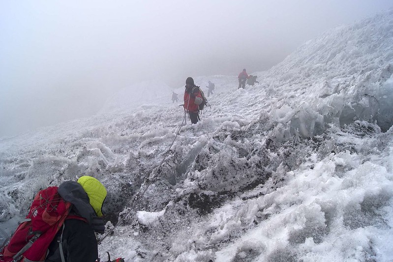
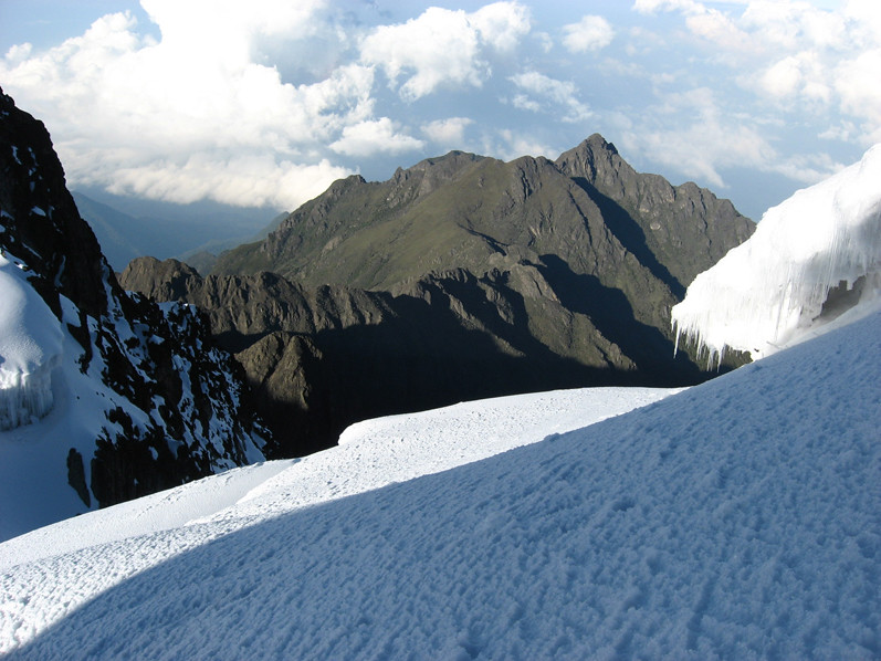
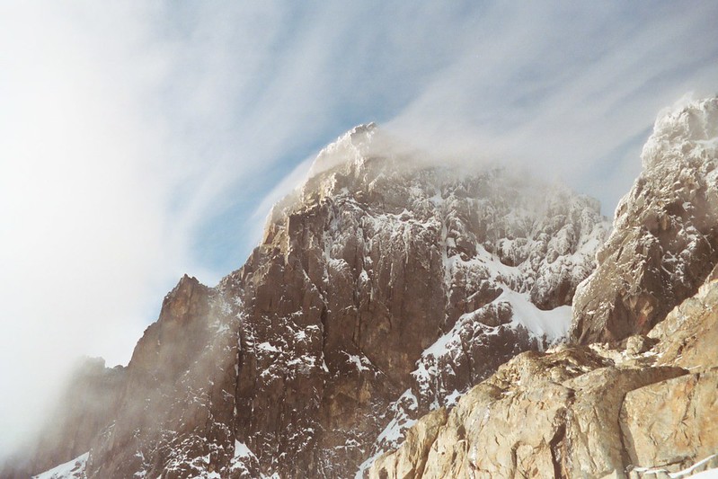
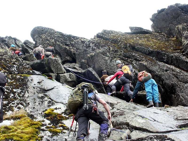
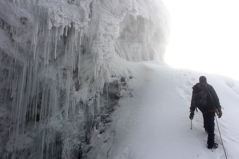
This day you will have to wake up as early as 2am, Have breakfast at Elena hut, be ready in your warmest gear, put on your harness, warm hand gloves and headsock, have your headlamps and helmets and make sure you have sunglasses in the day pack on. Hike to the top of mount Stanley, Magherita peak, through the Stanley plateau. On steep rocky areas, you will use the ropes to help you move. The guide will teach you how to use the equipment while on the ice. On the glacial parts you will be required to use you, crampons, and ice axe.
After moving for a couple of hours after the Stanley plateau glacier, you will reach the bottom of the Margherita glacier. This is the most challenging part of the entire hiking Rwenzori experience. You will hike through this glacier uo to the top of mount Stanley, Margherita peak (5109m). At the top you will have a view of Ireen Lake, mount Speke and the surrounding environment. Then descend to Elena Hut for Lunch and later proceed to descend to Kitandara through the Scott Elliot pass to Kitandara, it is the most beautiful point of the Rwenzori. Have dinner at Kitandara then spend the night. If the group is big, you might spend another night at Elena hut and continue the following day.
hike baker – overnight at Kitandara
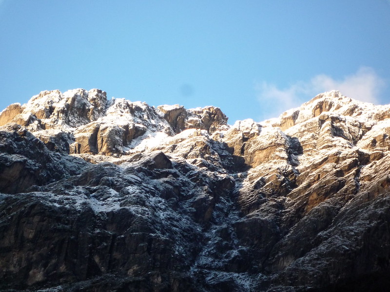
After breakfast at the camp, you will start the trek to the start of Mount Baker hike. Mount Baker is mostly rocky and sometimes the top is covered by snow. You will need good boots since the rocks get wet and slippery, you also have to always watch your steps. While at the top, you will have a view of mount Stanley and Speke as well as beautiful views of the pf the Rwenzori valleys and vegetation. Dinner and overnight at Kitandara camp
hike Luigi Savoia – overnight at Kitandara
After breakfast at Kitandara camp, you will start the trek to the top of Luigi Savoia. The hike involves a steep ascent on solid rock – it is important to follow the advice of your climb guides and not to rush during the ascent. It is normally safe to climb without ropes, but in the event of icy conditions, your guides will employ fixed ropes to ensure a safe ascent. Your reward for summiting will be wonderful views towards the Kachope Lakes below and to Mts Baker and Stanley in the distance.
Kitandara to guy yeoman camp (3505m)
Have breakfast at Kitandara then move through the base of Mount Baker, which can be slippery so you will need to be so careful. From Kitandara, the trail ascends steeply up the headwall, spreading out from the base of Mount Baker and continuing along the south side of the Rwenzori Mountain to Fresh field pass. From the pass, the long muddy descent continues, passing the rock shelter at Bujangolo, the base camp for the historic expedition by the Duke of Abruzzi in 1906.
This will take you around 4-6 hours then reach Guy Yeoman hut which is located at the banks of river Mubuku, have dinner and spend the night.
guy yeoman to Nyabitaba
From your overnight camp, Guy Yeoman, you will go down the mountain and take a descent towards Nyabitaba through the bamboo forests. The trail can be slippery and muddy with very little or nothing to hold on to and your balancing skills will be put to test over the vertical mud or steep rock. Dinner and overnight at Nyabitaba. Duration: 4-5 hours.
Nyabitaba to Nyakalengija
Today marks the end of you 12 Day Rwenzori trek and after a brief break, you will go down the mountain for a 3-hour descent to Nyakalengija. You will traverse the tropical forests that will give you a chance to see various animals like the three-horned chameleon, black and white colobus monkeys and a variety of many bird species. Ruboni community camp will be your resting point where you will make a stop for lunch, dinner and overnight at the same camp.
English speaking trekking guide and Porters
During the trek, you will be accompanied at all times by a Rwenzori Mountains guide. Porters will join the group as well to help to carry the luggage. There will be 1 porter per hiker to carry his/her personal luggage. The other porters carry food, charcoal, cooking utensils, and a gas cylinder among others.
Accommodation
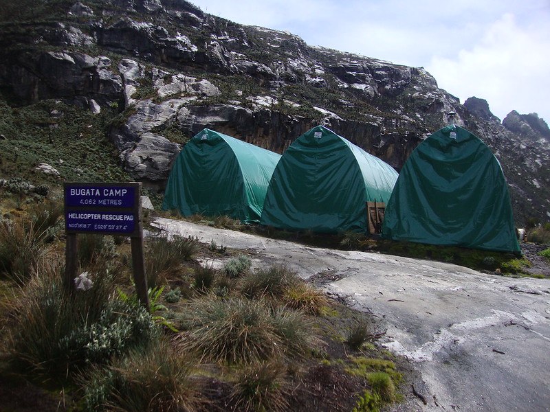
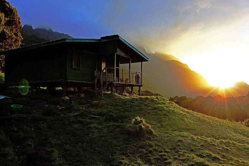
Accommodation during the trek is included in the price. You will spend your nights on the mountain in huts along the main circuit of the Rwenzori, such as the Nyabitaba hut, the John Matte Hut or the Bujuku Hut.
Meals
All meals are included during the trek. Breakfast, lunch, and dinner are served every day while on the trek. There is always powdered milk, chocolate drink, bread, sausages, packed juice, apples, chocolates, beef, rice, Irish potatoes, peas, and sandwiches. Lunch is not included on the first day of the trek.
Permits and Entrance Fees
In order to trek in the Rwenzori Mountains national park, you need a hiking permit and you need to pay the park’s entrance fees. These are included in the price of the trek.
Hiking Equipment
Hiking equipment such as crampons, ice ax, harness, helmet, gumboots are included in the trek.
Not included:
Airfare
You will have to make your way to Kampala, the starting point of this trek. Flight tickets to Uganda are not included in the price of the trek. In order to know which airlines fly to Entebbe International Airport (EBB), you can have a look at their website.
Transfer to Nyakalengija
This trek starts from Nyakalengija. You will have to make your way to this town. If you need help with the transfers, let us know and we can arrange it for you.
Accommodation before and after the trek
Before and after the trek you have to take care of your own accommodation in Kampala.
Travel Insurance
Your international travel insurance is your own responsibility. It is important that your travel insurance also covers adventures at a high altitude. Discuss your itinerary with the insurance company before your trek.
Sleeping bag and other equipment
Sleeping bags are not included in the trek, you will have to bring your own. Other necessary trekking equipment such as trekking boots, and warm gear are not included.
Personal expenses
Any personal expenses that may take place during the trek, such as buying snacks, souvenirs or alcoholic drinks are on your own account.
Water
As you hike the Rwenzori, you will not be provided with bottled water. You will get the water from the rivers and streams in the mountains because it’s clean. The locals drink it and they are okay. But if you don’t trust it, it’s okay to add some water filters to your water to avoid any inconveniences (these won’t be provided by your trekking company).
Tipping
Tipps for the guide and porter are not included in the price of the trek. You decide how much to tip, but if you got a good service from your guide, be generous.