The 7 days Shira route package is seldom used mostly because Shira is an ancient route that does not follow proper acclimatization rules, therefore, we tend to recommend the more recent and improved version of this route, which is the Lemosho Route. The Shira Route, with its starting point near Shira Ridge is a rarely used route. It resembles the Lemosho route in so many ways. In fact, the Lemosho route is the improved version of the Shira route which is an old route.

Shira Route MapAdvantages and Disadvantages of the Shira Route

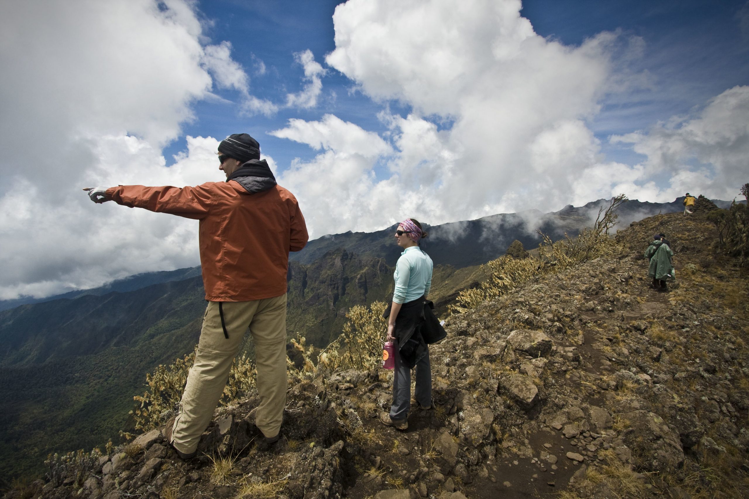
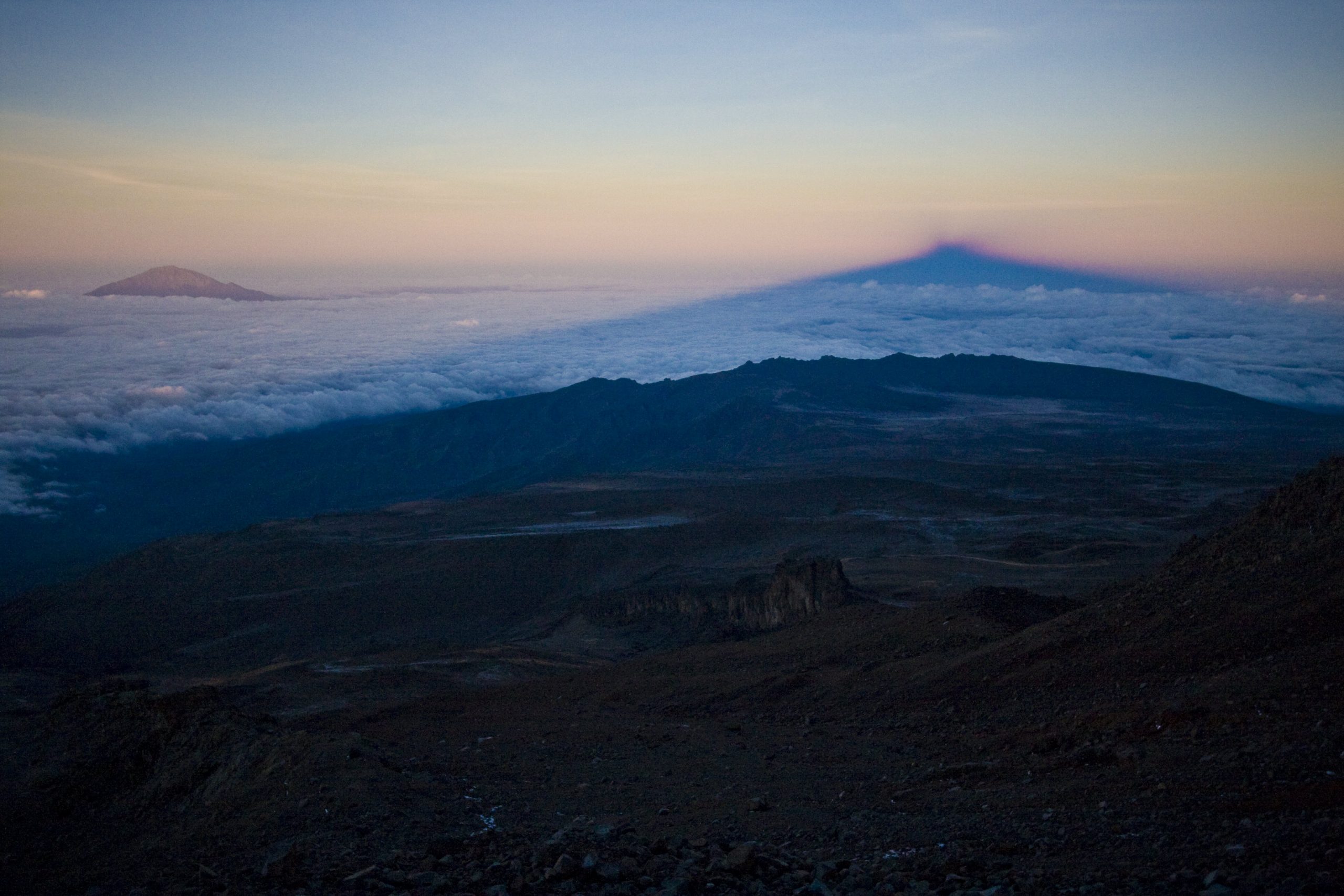
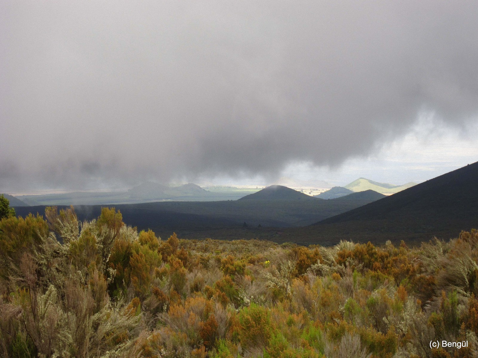
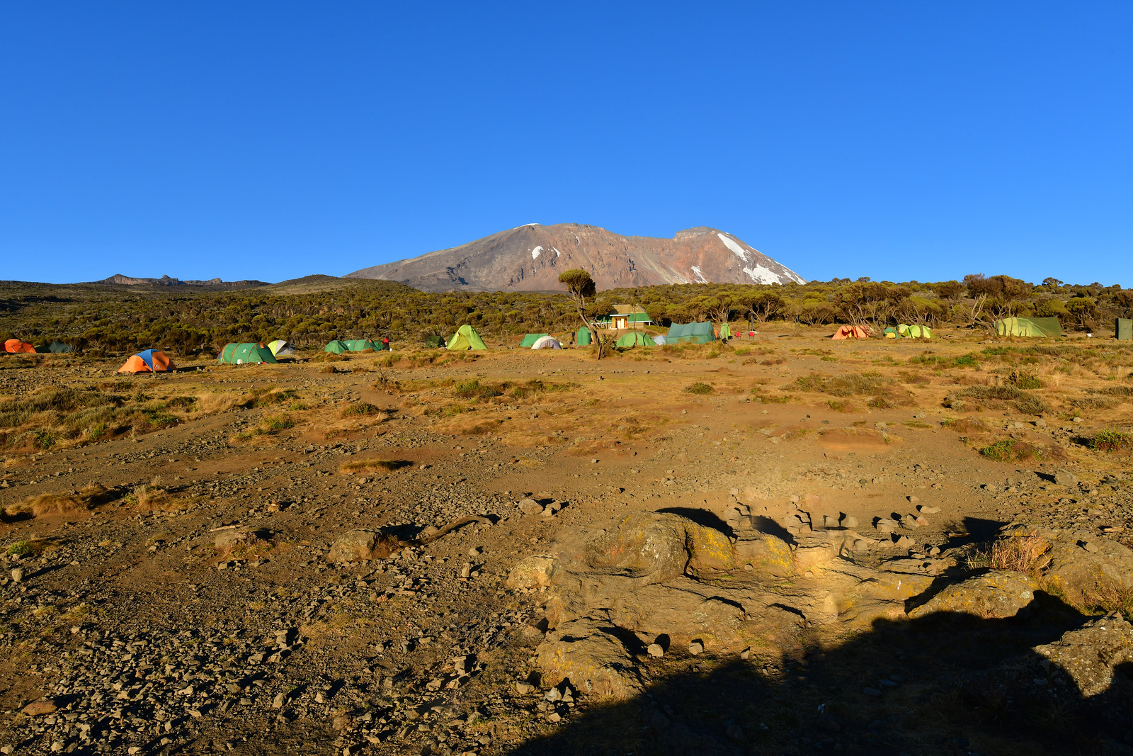
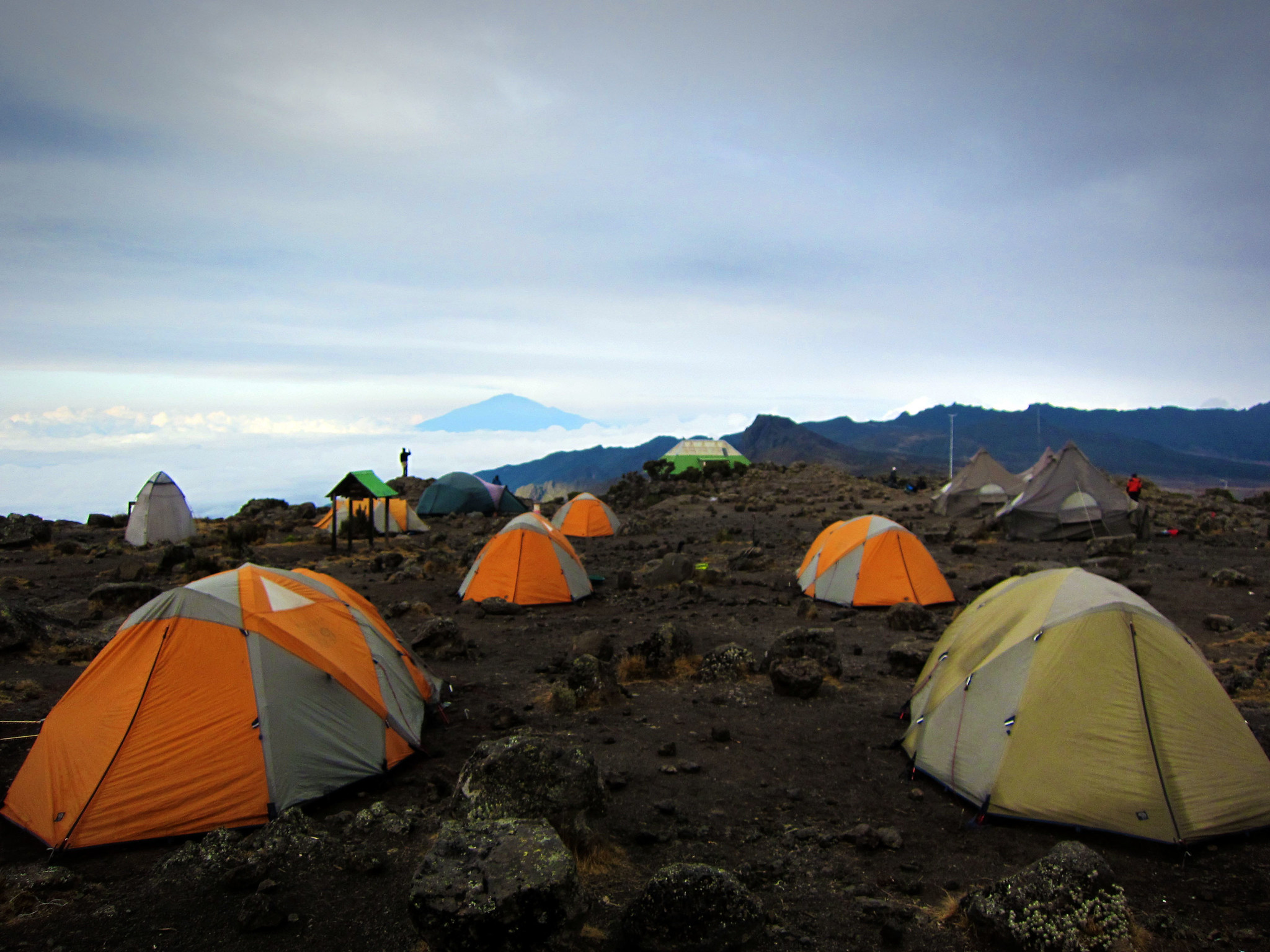
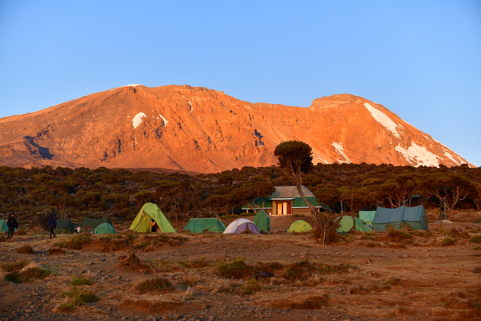
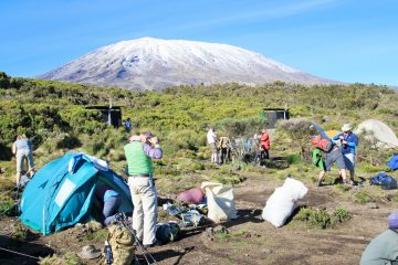
Shira Route’s advantage is that it is very scenic with beautiful vistas and views but the main disadvantage is that its starting point is at very high altitudes making many climbers opt for Lemosho instead of Shira Route.  The route starts at 3,596 meters and is not ideal for hikers that are not experienced, in climbing high altitudes.  To reach the starting point of the Shira Route, you must go there by vehicle and on your first day of camping, you will most likely experience possible altitude sickness. The first camp on Shira is located at an altitude of 3596m (11, 800 ft).

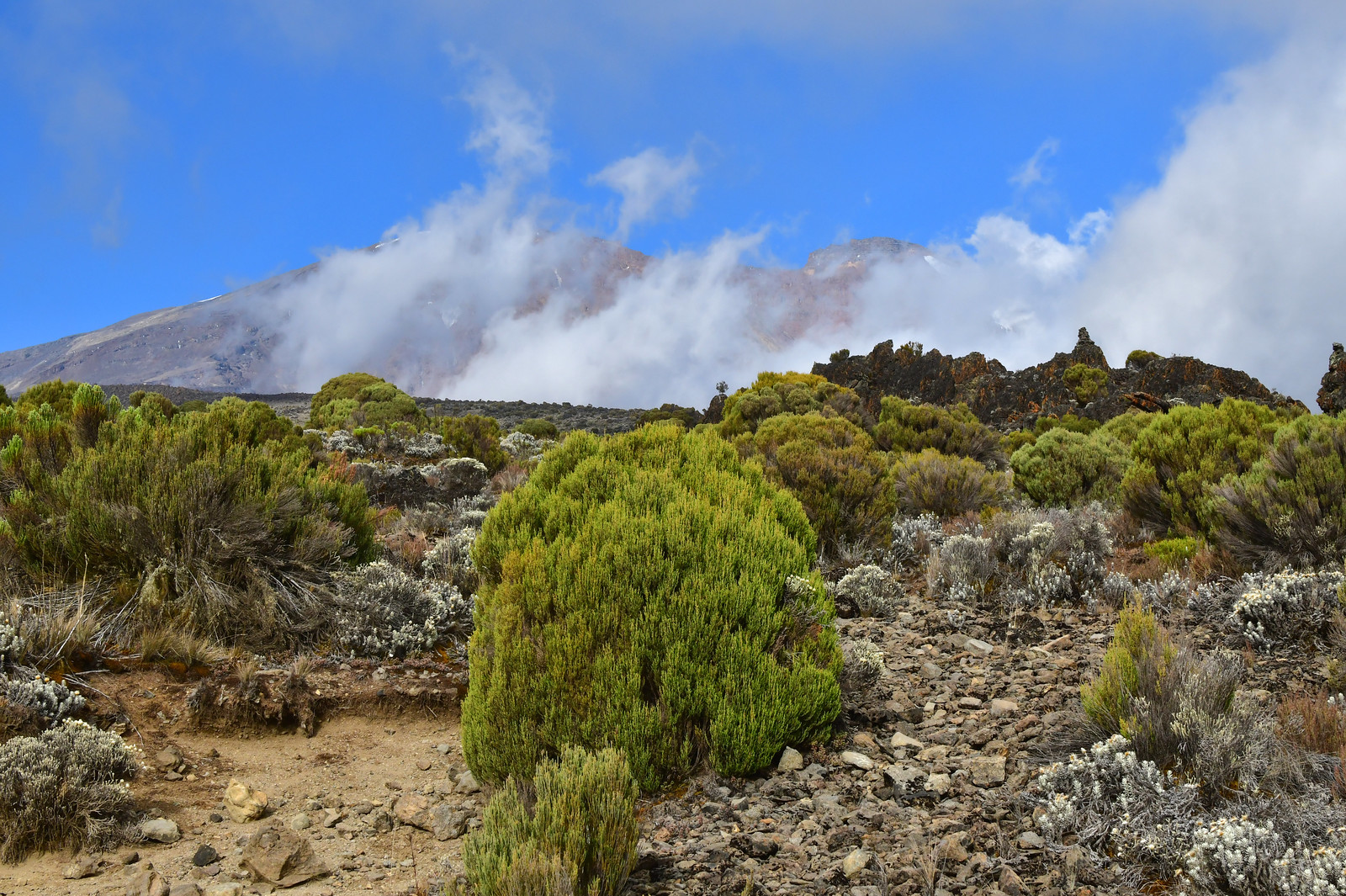
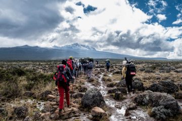
The Shira trail ascent begins to form the western side of Mount Kilimanjaro after a long drive to Shira Ridge which is the starting point.

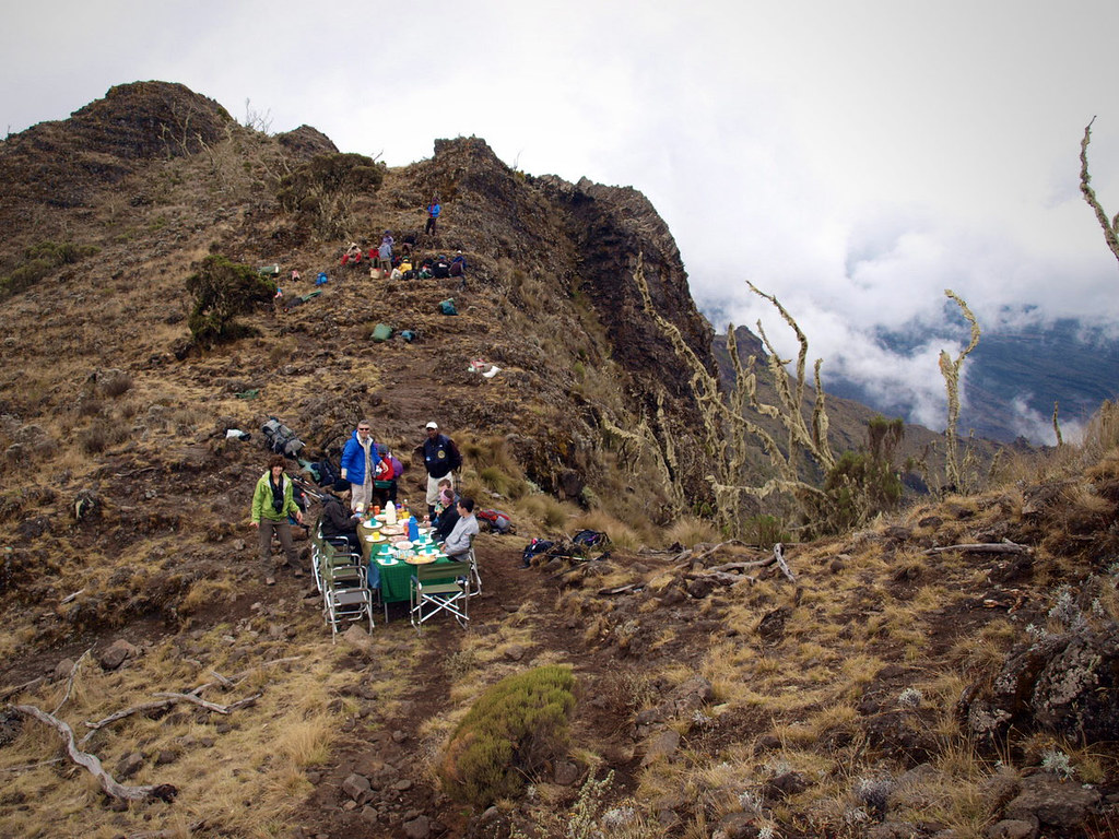
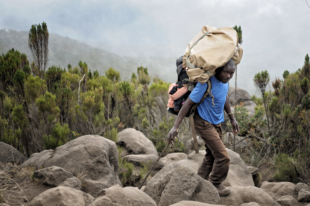
The long drive from Moshi goes through the rainforest zone and the hiking trail begins up to Shira Ridge which is the route’s starting point. The Shira route traverses the expansive and flat, table-like the ground of Shira

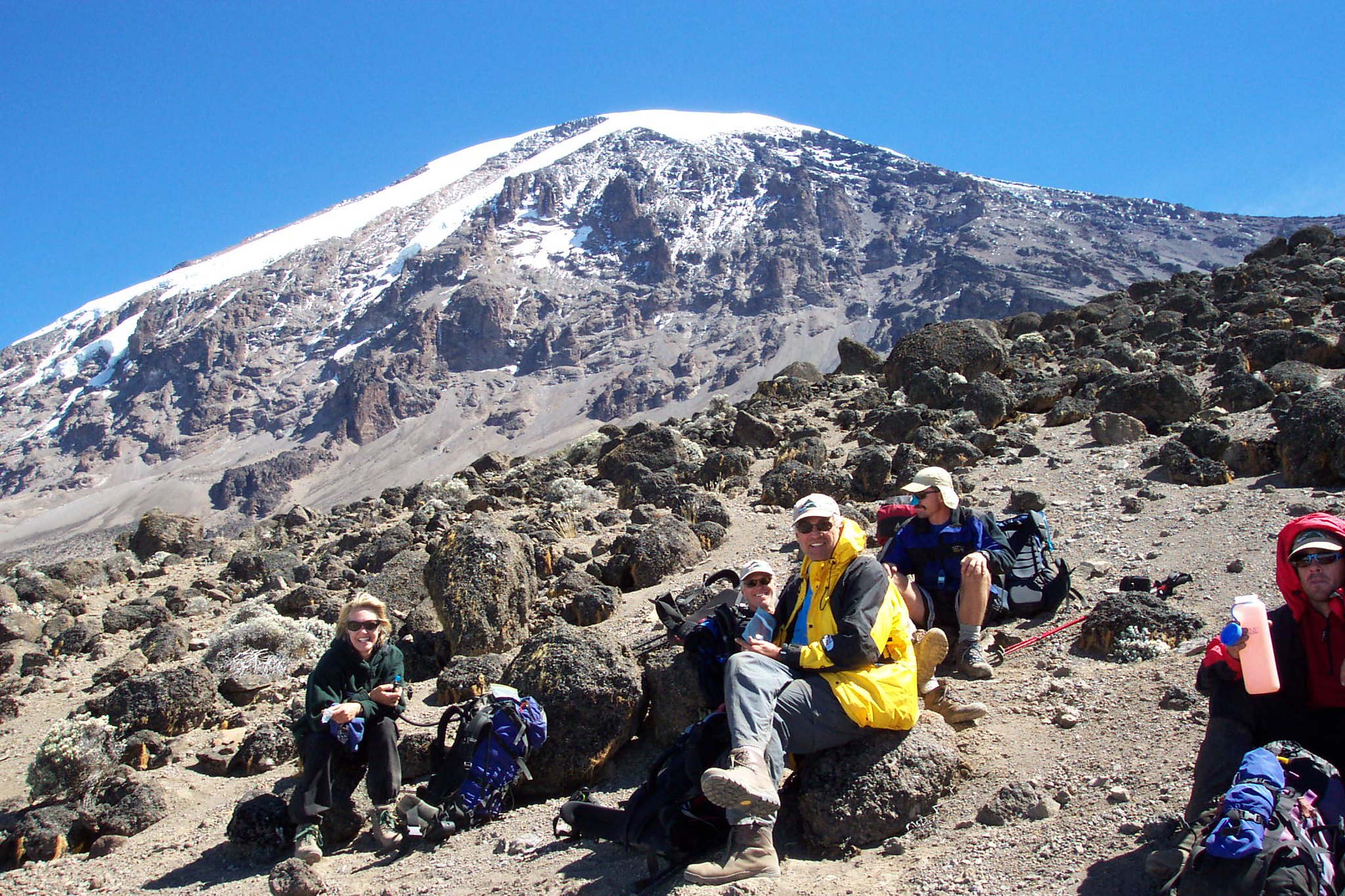
Then the route passes below the Southern Ice Field located on Mount Kilimanjaro’s Southern Circuit and then approaches the mountain’s summit via Barafu.

Normal Trekking Day on Shira Route

Tranquil Kilimanjaro strongly recommends climbers with previous hiking experience on high altitudes with this route, as normal days of hiking days will vary from  6-8 hours of hiking with daily ascents of 900m to 1000m, perhaps with the odd day ascending around 1,100m to 1,200m and climbing at an altitude of over 3,500m.

Shira Route’s Descent

After a successful summiting using the Shira Route, going down Mount Kilimanjaro uses a different descent route called the Mweka Route. Tranquil Kilimanjaro offers two variations of the Shira Route, namely

N:B The eight-day private climb via the Shira Route package adds an extra day at Moir Camp on the third day then proceeds to Barranco Camp on the fourth day of climbing Kilimanjaro.

  • Location: The Starting point for the Shira route is the Shira Ridge with a long drive from Moshi town to the starting point
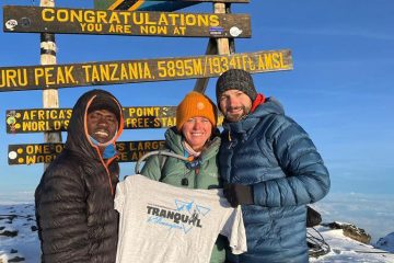
  • Height: The Shira route leads to the summit of the majestic Mount Kilimanjaro. Uhuru Peak at an elevation of 5,895 meters (19,341 feet).
  • Duration: We recommend the 7 days route more but the duration of the Shira route can also take 8 days with an extra day to Moirs hut on day 3.
  • Trail conditions: The trail begins from a relatively high altitude, traversing varied terrain and vegetation zones on the mountain

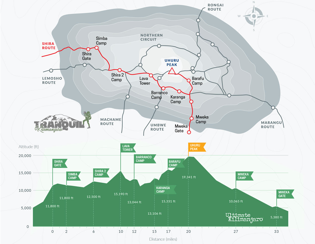
Shira Route itinerary

DAY START ALTITUDE (M/FT) FINISH ALTITUDE (M/FT) TIME (HRS) DISTANCE (KM/MI)
1 Shira Gate 3,600m/ 11,800ft Simba Camp 3,600m/ 11,800ft 1-2 4km/ 2mi
2 Simba Camp 3,600m/ 11,800ft Shira 2 Camp 3,810m/ 12,500ft 2 6km/ 4mi
3 Shira 2 Camp 3,810m/ 12,500ft Lava Tower 4,630m/ 15,190ft 4-5 7km/ 4mi
Lava Tower 4,630m/ 15,190ft Barranco Camp 3,976m/ 13,044ft 2-3 3km/ 2mi
4 Barranco Camp 3,976m/ 13,044ft Karanga Camp 3,995m/ 13,106ft 4-5 5km/ 3mi
5 Karanga Camp 3,995m/ 13,106ft Barafu Camp 4,673m/ 15,331ft 4-5 4km/ 2mi
6 Barafu Camp 4,673m/ 15,331ft Uhuru Peak 5,895m/ 19,341ft 7-8 5km/ 3mi
Uhuru Peak 5,895m/ 19,341ft Mweka Camp 3,068m/ 10,065ft 4-6 12km/ 7mi
7 Mweka Camp 3,068m/ 10,065ft Mweka Gate 1,640m/ 5,380ft 3-4 10km/ 6mi

Shira route success rate

The success rate for using the Shira route is considerably high but only recommended for experienced mountaineers since the starting point of the Shira route, the Shira Ridge is set at high altitudes.

Additional information

DifficultyChallenging
Day1

Starting Point: Shira Gate to Simba Camp

Elevation: 11,800 ft to 11,800 ft

Distance: 4 km/2 miles

Hiking Time: 1-2 hours

Habitat: Heath

Drive to the Londorosi gate from Moshi town where the starting point of the Shira Route, the Shira Ridge is located. The drive from Moshi to the Londorosi gate takes approximately 4. Once you reach the gate of Londorosi you will be quired to go through the paperwork to gain entry and double-check your equipment while the guides and porters also prepare the essential equipment.

Proceed to the Shira Gate by driving where the route’s climb officially begins. The trek traverses scattered shrubs and giant heather until it approaches Simba Camp.

Day 2

Simba Camp to Shira 2 Camp

Elevation: 11,800 ft to 12,500 ft

Distance: 6 km/4 miles

Hiking Time: 2 hours

Habitat: Heath

The second day will make it easy for you as the slope is very gradual, helping with acclimatization. The trail goes through the Shira Plateau, located in the heath and moorland zone. The path is very scenic as it takes you to the Shira Cathedral. Then we take a scenic path to the Shira Cathedral, a gigantic rock structure that is surrounded by pyramid-shaped and high pointed rocks, before settling at Shira 2 Camp.

Day 3

Shira 2 Camp to Lava Tower

Elevation: 12,500 ft to 15,190 ft

Distance: 7 km/4 miles

Hiking Time: 4-5 hours

Habitat: Alpine Desert


Lava Tower to Barranco Camp

Elevation: 15,190 ft to 13,044 ft

Distance: 3 km/2 miles

Hiking Time: 2-3 hours

Habitat: Alpine Desert

We wake up early morning and after breakfast, head eastwards towards a rugged ridge and eventually to the lava Tower, a 300ft towering giant made out of rocks with is on the southeastern side of the mountain. A hike to the Senecio Forest is done by descending towards the Barranco Camp. The trip to the Senecio Forest is very scenic at an altitude of about 13,000 ft. This descent after going up is done to help with acclimatization and combating altitude sickness.

Day 4

Barranco Camp to Karanga Camp

Elevation: 13,044 ft to 13,106 ft

Distance: 5 km/3 miles

Hiking Time: 4-5 hours

Habitat: Alpine Desert

We begin the fourth day on Mount Kilimanjaro by further climbing down into a ravine located below the famous Barranco Wall. day by descending into a ravine to the base of the Great Barranco Wall. We ascend the steep cliff which requires no technical skills necessarily though it measures 900 ft tall. After climbing the Barranco Wall, we pass through a chain of hills and meandering valleys that lead to the Karanga valley below. After descending to the Karanga Valley, we then climb to the Karanga Camp. The fourth day is a short-day hike to help in acclimatizing.

Day 5

Karanga Camp to Barafu Camp

Elevation: 13,106 ft to 15,331 ft

Distance: 4 km/2 miles

Hiking Time: 4-5 hours

Habitat: Alpine Desert

We leave Karanga Camp in the morning and connect with the Mweka Trail at the junction as we proceed to Barafu hut via a rocky trail. Reaching Barafu Camp marks the end of the Southern Circuit of Mount Kilimanjaro, a region famous for having 360 degrees of panoramic views and scenic. The overnight camp for today is the Barafu Camp, where Mawenzi and Kibo peaks are visible from here. We relax after a long day of trekking as we enjoy early dinner and ponder about the next day which is the summit.

Day 6

Barafu Camp to Uhuru Peak

Elevation: 15,331 ft to 19,341 ft

Distance: 5 km/3 miles

Hiking Time: 7-8 hours

Habitat: Arctic


Uhuru Peak to Mweka Camp

Elevation: 19,341 ft to 10,065 ft

Distance: 12 km/7 miles

Hiking Time: 4-6 hours

Habitat: RainForest

Summit Day, Shira Route

The final push towards the Uhuru Peak summit on Mount Kilimanjaro begins at midnight or shortly after midnight. This is the most mentally and physically challenging segment of your Mount Kilimanjaro climb. The midnight summit attempt comes along with a few challenges here and there like strong winds and cold. We climb into the darkness for a few hours with short breaking intervals in between. Once you reach Stella Point at an elevation of 18,900 ft, you will be rewarded with stunning views of the sun rising from the horizon, one of the best sunrise views you have probably ever seen rising over the Mawenzi peak.  Finally, your effort pays off as you reach the main summit point of Uhuru peak (5,895 m) this is the highest point in the whole of Africa and the highest point of any free-standing mountain in the world.

Shira Route Descent

Going down the mountain from the main summit takes a different approach, using the Mweka Route, we now descend to the Mweka Hut campsite, making a brief stop at Barafu Camp for lunch. The rocky descent trail can be a little bit hard on the knees, this is where the trekking poles come in handy. Mweka Camp is located in the rainforest zone, a region that is usually wet most of the time. Later on in the evening, you will enjoy our last dinner on Mount Kilimanjaro and a well-earned sleep.

Day 7

Mweka Camp to Mweka Gate

Elevation: 10,065 ft to 5,380 ft

Distance: 10 km/6 miles

Hiking Time: 3-4 hours

Habitat: Rain Forest

This marks the last day of the 7-day Shira route itinerary and we descend to Mweka Gate where we will be awarded or summit certificates for accomplishing our goal.

Meanwhile, a vehicle awaits to pick us up from the gate, at Mweka gate in Mweka Village, ready to return to the hotel/lodge in Moshi

The cost for the whole 7 Days Shira route includes and excludes the following items

7 Days Shira Route Price includes

All transfers to the mountain and back to your Arusha hotel

Professional, experienced, mountain guides

Guides, Porters, Cook salaries and park fees

Quality, waterproof, four-season mountain sleeping tents

Sleeping Mattress

All meals while on the Mountain

Quality Mess tents with table and chairs

Large portions of fresh, healthy, nutritious food

Clean, purified drinking water

Conservation fees (part of park fees)

Camping or Hut fees (part of park fees)

Rescue fees (part of park fees)

VAT (18% charged by the Government)

Surcharge for online payment of deposit (5%)

Price Excludes

Airport transfers

Accommodation in Arusha

Tanzania Visa

Gratuity

Personal Expenses (e.g. laundry, telephone, beverages, etc.)

Meals not listed above

Optional Tours (short safari after your climb etc)

How do I prepare for the Shira route?

You will need to engage in exercise climbing high altitudes as Shira Route is not advisable for first-timers, this is a route that requires great fitness levels and previous experience in climbing high altitudes. The starting point of Shira itself begins at considerably higher altitudes as compared to the other routes.

When should I climb the Shira route?

Since Mount Kilimanjaro can be climbed all year round, you can climb Shira Route any time of the year provided you have the right equipment and waterproof gear just in case it gets cold and wet during the rainy and wet seasons between the months of April, May and November. The best time though is during the months between January-march, and June-October, the dry and warmer months.

What should I pack and what equipment do I need?

Tranquil Kilimanjaro may supply some of the gear, like the tents, sleeping pads/mattresses, etc but you may need to come with some personal gear most of which are waterproof, and mountain wear like boots for hiking, sunglasses, medication, and not disposable water bottles and headgear

How to get to the Shira Route?

Mountain climbers coming from the UK, the US, Australia or Canada and other parts of the world can opt to fly into the Kilimanjaro International Airport, which we strongly recommend and also happens to be the closest international airport near Mount Kilimanjaro. You can also choose to fly to other airports near Tanzania like the Jomo Kenyatta International Airport in Nairobi or Julius Nyerere International Airport in Dar es Salaam, Tanzania.

What are the climbing requirements for the Shira route?

First of all, the Shira route is not like the other routes, it requires experienced hikers with careful planning and vigorous training in order to reach the peak of Mount Kilimanjaro using this route. We do recommend the longer version of this route to add extra time/day for acclimatization purposes, this will ensure you catch minimal altitude sickness symptoms.

What permits do I need for the Shira Route?

Your Shira Route cost covers all the entrance fees to Mount Kilimanjaro and any permits required, all you need to pay for is your international ticket and visa fees. To find out more contact us here.

Shira Route 7 Days
Shira Route 7 Days
Shira Route 7 Days
Shira Route 7 Days
Shira Route 7 Days
Shira Route 7 Days
Shira Route 7 Days
Shira Route 7 Days
Shira Route 7 Days
Shira Route 7 Days
Shira Route 7 Days
Shira Route 7 Days