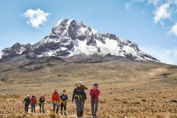
On Mount Kenya, there are eight primary hiking routes, all of which top the lowest peak, Point Lenana at 4,985 meters (16,355 ft). The bulk of the 15,000 yearly tourists to the mountain top the lower peak, but individuals with technical climbing skills can also summit the second peak, Nelion, and the highest point, Batian.
Hikers typically pick several routes for their ascents and descents, with the Sirimon-Chogoria (six or seven days) and Sirimon-Naro Moru (five days) alternatives being the most popular.
The Burguret Route, the Timau Route, the Meru Route, and the Kamweti Route are all less-traveled paths that require special authorization from the Kenya Wildlife Service.
The following are brief explanations of the primary routes for climbing Mount Kenya.
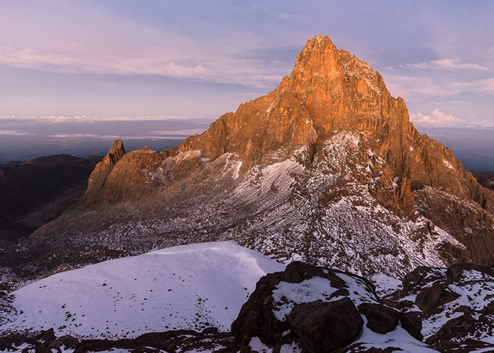
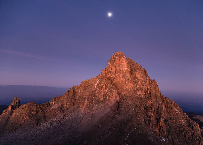
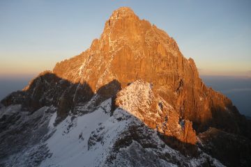
Mount Kenya has three main peaks: the two highest (Batian and Nelion) are extremely difficult and are seldom climbed, whilst the third summit, Point Lenana, is a hiking peak. Other summits on the massif offer challenging rock climbs as well.
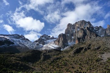
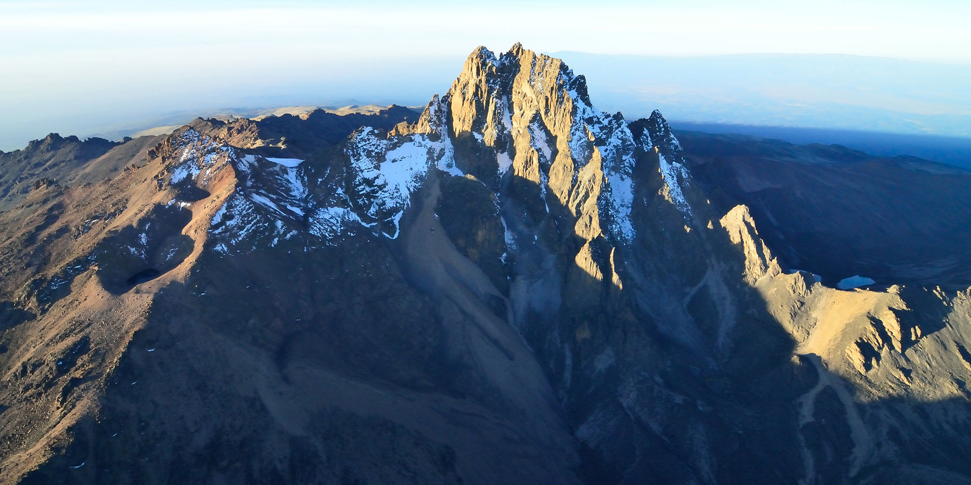
Peak Lenana, on the left, is 4895 meters high, while Batian, at 5199 meters, is the mountain’s highest point.
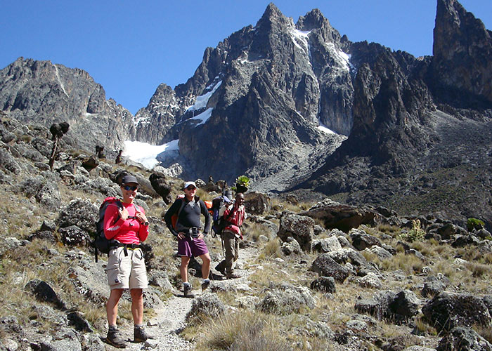
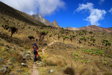
On the mountain, there are three main routes that serve 90 percent of all trekkers: Naro Moru to the west, Sirimon to the northwest, and Chogoria to the southeast. Most individuals use a mix of these three to get up and down.
On all three, you can camp or stay in huts, and the walk up to Point Lenana and back takes around 5 days.
Burguret on the West, Timau on the North, Meru on the North East, Ithanguni on the East, and Kamweti on the South are the other five less-climbed routes. Because of the presence of wild animals, the National Park frequently asks Rangers to attend a group. These pathways lack official park gates, making route discovery considerably more difficult.
The mountain is easily accessible; there is an excellent road from Nairobi, and the travel takes around four hours.
On the west side, most people base themselves in Naro Moru, while on the east, they base themselves in Chogoria town or Embu.
Mount Kenya is a dormant volcano with only a single primary vent. The major peaks lie in the center, with ridges and valleys radiating outward from the tops like spokes on a wheel. The trekker ascends scree and rock to the glaciated top of Lenana, shown below on the right hand side, after following the valleys up to the massif.
The two major peaks are the remnants of volcanic lava that crystallized at the main vent, and the Summit Circuit route around them in a fairly circular way.
A minor sub-peak to one side of the major summits is Point Lenana.
All of the major routes have a number of huts.
Sirimon – Old Moses Camp, Liki North Camp, Shiptons Camp
Naro Moru – Met Station, Mackinders Camp, and Austrian Hut immediately below Pt Lenana are the key camps on the western ascension routes.
Mount Kenya Route Distances
According to statistics, roughly 15,000 people climb the mountain each year, with the great majority opting for Pt Lenana, the mountain’s third summit at 4985 meters, which is reasonably simple to reach. Only a few hundred people visit the challenging peaks of Nelion and Batian each year.
Around 90% of the walkers take the Naro Moru, Sirimon, and Chogoria routes. As a result, they have manned park entrances as well as cabins and Rangers at the campgrounds. The remaining routes, Burguret, Kamweti, and Timau, draw only 5% of the total number of visitors and are significantly more remote, with just modest amenities and campsites.
| Name | Starting From | Distance | Start Altitude |
| Sirimon | North-North-West | ~25km | 2650m |
| Naro Moru | West | ~20km | 2400m |
| Chogoria | East | ~20+10km | 2850m/1700m |
| Burguret* | West-North-West | ~25km | 1500m |
| Timau** | North | ~35km | ~3300m |
| Kamweti** | South | ~25km | ~3000m |
Walking Routes on Mount Kenya
There are eight different hiking trails that lead to the main summits. The Meru, Chogoria, Kamweti, Naro Moru, Burguret, Sirimon, and Timau Routes are all clockwise from the north. Chogoria, Naro Moru, and Sirimon are the most commonly visited, and so have staffed gates. The Kenya Wildlife Service must get specific authorization to utilize the other routes.
The most common routes to point Lenana, the highest point accessible without skilled rock climbing, are listed below.
Meru Route
This path follows the Kathita Munyi river from Katheri, south of Meru, to Lake Rotundu. It does not lead to the summits, but rather to alpine moorland on the mountain’s slopes.
Chogoria Route
On the Chogoria Route, the Gorges Valley is a prominent landmark.
From Chogoria town, this path goes to the peaks circuit. The 32 km (20 mi) between the forest gate and the park gate is frequently traveled by car, although it is also possible to walk. The forest is home to a variety of species, including safari ant columns that straddle the trail, monkeys in the trees, and the possibility of spotting elephant, buffalo, and leopard.
The road is in poor condition, necessitating cautious driving and walking. The bamboo zone begins at the park entry, with grasses reaching a height of 12 metres (39 feet).
Once within the park, the path winds through rosewood woods with lichens clinging to the tree branches. The path splits at one point, with the smaller track going to a trail that leads up Mugi Hill and over Lake Ellis.
A tiny bridge crosses the Nithi brook at the trackhead. (The Gates Waterfall may be reached by following the creek downstream for a few hundred meters.) The walk ascends a hill above the Gorges Valley, with views of the summits, Lake Michaelson, The Temple, and Delamere and Macmillan Peaks across the valley.
The Hall Tarns are located directly on the trail and 200 meters (660 feet) above Lake Michaelson.
As the trail continues, it passes the Nithi River’s flat head and then the hill steepens. The trail divides, with one branch leading west to Simba Col and the other south west to Square Tarn. Both of these locations are on the Peak Circuit Route.
Kamweti Route
This trail follows the Nyamindi West River and is the longest into the summits.
Although it is a limited path, it is occasionally used.
Naro Moru Route
Many hikers who attempt to reach Point Lenana follow this path. It takes only three days to climb and has bunkhouses at each camp, so no tent is required.
Although one portion is known as the Vertical Bog, the terrain is typically nice.
The trail begins at Naro Moru town and leads up the hill between the Northern and Southern Naro Moru Rivers, past the Park Headquarters. The Meteorological Station is located near the road-head and is accessible during the dry season. On the Peak Circuit Path, the path descends through the Northern Naro Moru Valley to Mackinder’s Camp.
Gathiuru Route
It begins at Gathiuru and mostly follows the North Burguret River before continuing up the Peak Circuit Path to Hut Tarn. It’s the quickest way to go to Peak Lenana. The Gathiuru Community Forest Association is in charge of its management.
Human-wildlife conflict has always plagued the residents of the region. They needed to accept the fact that God had blessed them with a magnificent mountain and abundant fauna from which they could make a living. They banded together to create the Gathiuru Community Forest Association, a non-profit organization dedicated to preserving the two major natural resources on which they rely for a living. Tourists would have to pay and be facilitated at the Mt Kenya Royal Cottages in order to access the path. This is a resort located just across from the Nanyuki airfield that has partnered with the organization to help advertise the route to locals so that everyone benefits.
The Gathiuru Route is rich in fauna and flora, animals, and scenic beauty.
Sirimon Route
This route begins 15 kilometers (9.3 miles) east of Nanyuki on the Mount Kenya Ring Road. The gate is 10 kilometers (6.2 miles) down the route, which may be walked or driven by four-wheel-drive vehicles.
The path ascends through the trees. Because there is no bamboo zone on the mountain’s northern side, the forest eventually transforms into a moorland with enormous heather. At Old Moses Camp, the track stops and becomes a trail. This climbs the slope before separating into two directions. The least used way around the edge of the Barrow leads to Likii North Hut on the left.
With huge lobelia and groundsels strewn about, the vegetation becomes sparse. Before rejoining the main trail ascending the Mackinder Valley, the path rises over a hill. Just before reaching Shipton’s Camp, Shipton’s Cave may be located in the rock wall to the left of the steep route.
It is possible to ascend the slope right in front of Shipton’s Camp to the site of Kami Hut, which no longer exists, or to follow the river up to Lower Simba Tarn and then to Simba Col. Both of these are on the Peak Circuit Path.
Timau Route
This is a limited access path. It begins near Timau Village, adjacent to the Sirimon Route, and follows the edge of the forest for a long distance. It used to lead to the highest point on the mountain that could be reached by car, but it hasn’t been utilized in years. In a few hours, you may walk from the trackhead to Halls Tarns, then take the Chogoria Route to the Peak Circuit Path.
Peak Circuit Path
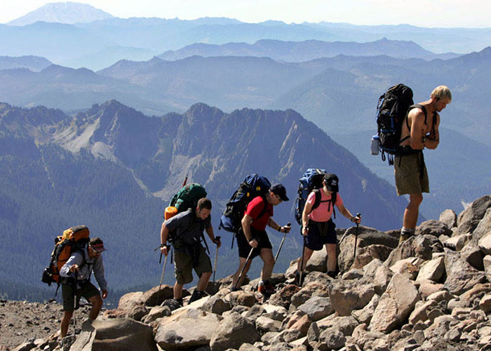
This is a 10-kilometer (6-mile) circuit that circles the main peaks, with a height gain and loss of nearly 2,000 meters (6,600 ft). It is possible to walk it in one day, although it is more normal to take two or three.
It may also be used to connect several ascending and descending paths. There is no technical climbing on this route.
Advanced technical Mount Kenya Routes
Mount Kenya’s highest peaks, Batian and Nelion, are recognized for being among of the greatest difficult climbing alpine peaks in the world. On Mount Kenya, there are about 35 reported difficult climbing routes; this guide will focus on some of the more popular, guided technical climbing routes.