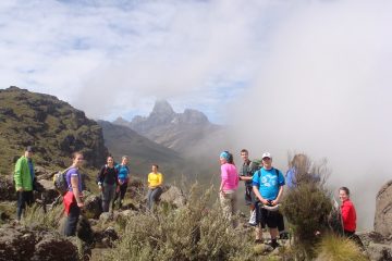
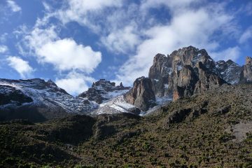
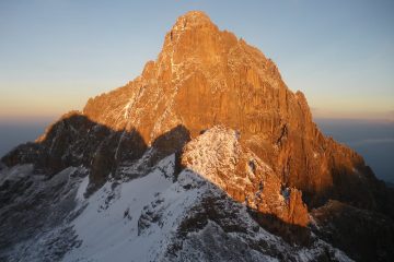
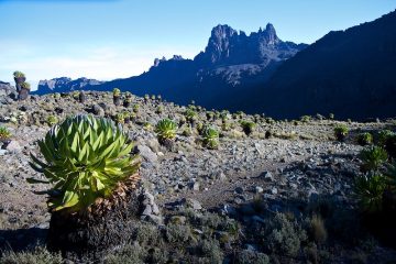
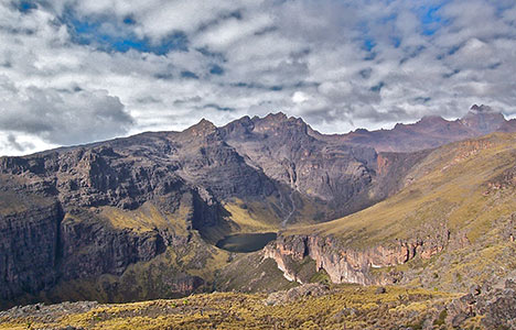
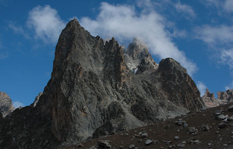
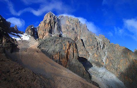
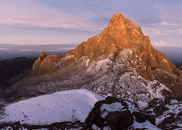
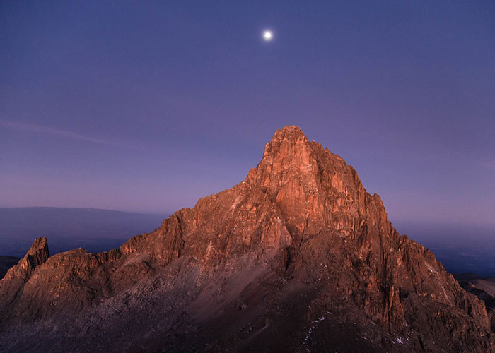
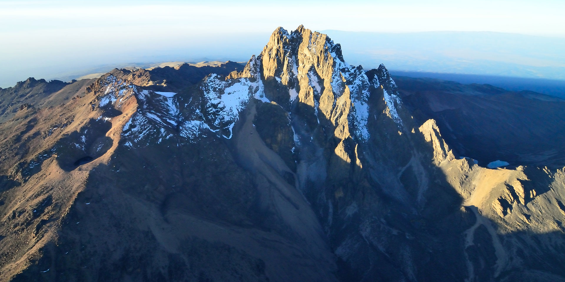
Mount Kenya peaks consist of three main distinctive volcanic cones at the summit, namely, Batian, Nelion, and Point Lenana, all of them graced with glaciers at the crown.
Nearly all of Mount Kenya’s summits have volcanic origins. The majority of the peaks are situated close to the mountain’s center. These summits are rugged, giving them an Alpine aspect. The tallest peaks and gendarmes are typically found in Alpine terrain where ridges meet. Only a few mosses, lichens, and tiny alpine plants may be found growing in the rock cracks of the middle summits. The volcanic plugs farther from the core summits are coated in volcanic ash and soils. These summits have typical vegetation for their band of vegetation.

Batian (5,199 meters or 17,057 feet), Nelion (5,188 m or 17,021 feet), and Pt. Lenana are the tallest summits (4,985 m or 16,355 ft). The distance separating Batian and Nelion, the Gate of the Mists gap, is just 250 meters (270 yards) (5,144 metres or 16,877 ft). The next highest peak is Coryndon Peak (4,960 m or 16,273 ft), however, unlike the summits before it, it is not a part of the central plug.

Pt. Piggot (4,957 meters or 16,263 feet), Pt. Dutton (4,885 meters or 16,027 feet), Pt. John (4,883 meters or 16,020 feet), Pt. John Minor (4,875 meters or 15,994 feet), Krapf Rognon (4,800 meters or 15,748 feet), Pt. Peter (4,757 meters or 15,607 feet), Pt. Slade (4,750 meters or 15,584 feet), and Midget Peak (4,700 m or 15,420 ft). These all feature steep pyramidal shapes.

Terere (4,714 m or 15,466 ft) and Sendeyo (4,704 m or 15,433 ft), which form a pair of twin peaks to the north of the main plug, are two notable rugged outlying summits. They combine to create a large parasitic plug.

The Hat (4,639 m or 15,220 ft), Delamere Peak, Macmillan Peak, and Rotundu are a few further noteworthy summits.

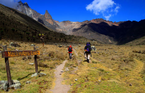
Between the base and the top, there are many belts of vegetation.

Different kinds of woodland cover the lower slopes. The huge lobelias, senecios, and a distinct variant of the rock hyrax are just a few of the many alpine species that are unique to Mount Kenya.

Mount Kenya’s Main Summits

Batian, Nelion, and Point Lenana are the three peaks that makeup Mount Kenya, and each one is distinct in height. Although there are other peaks, these are the main summits on the mountain.

The mountain is an extinct volcano composed of three main peaks: Batian, Nelion, and Point Lenana. Here’s a brief overview of each peak:

Book Now
Mount Ololokwe Hike

Mount Ololokwe - Samburu Sacred Table Mountain Hike

A visit to the table like Mount Ololokwe will leave you mesmerised, not just from the towering table-like mountain, but
Mount Longonot climb, Kenya

Mount Longonot Day Hiking

Climb Mount Longonot in Kenya with Tranquil Kilimanjaro, a remarkable dormant volcano that overlooks the magnificent scenery of Kenya's Lake

Batian Peak

Expert rock climbers and mountaineers typically ascend Batian peak.
The north face approach, which is used to climb Batian Peak, is most effective from July to September. A second, somewhat easier alternative is the southwest ridge route, which is most effective from December to March.

  • Batian is the highest peak of Mount Kenya, standing at an elevation of 5,199 meters (17,057 feet) above sea level.
  • It is a technical climb and requires mountaineering skills, including rock climbing and rappelling.
  • The summit is accessible via various routes, including the Normal Route, North Face Standard Route, and South Face Standard Route.
  • Batian is characterized by rugged terrain, steep cliffs, and challenging rock formations.
  • Climbing Batian is a significant achievement and attracts experienced mountaineers from around the world.

Nelion Peak

Nelion Peak is a lesser twin peak of Batian Peak that rises to a height of 5,188 meters (17,021 feet). Nelion is rather difficult, requiring ascent via several rock pitches in order to reach the summit.

  • Nelion is the second-highest peak of Mount Kenya, with an elevation of 5,188 meters (17,021 feet) above sea level.
  • It is slightly lower than Batian but is also a technical climb, requiring advanced mountaineering skills.
  • Nelion is located adjacent to Batian and is often climbed in conjunction with Batian as part of a multi-day expedition.
  • The climbing routes on Nelion are similar to those on Batian, featuring steep rock faces and challenging terrain.
  • Climbing Nelion offers stunning views of the surrounding landscape and is a rewarding experience for skilled climbers.

Lenana Point

The third peak on Mount Kenya, Point Lenana, rises to a height of 4,985 meters (16,354 feet). Because it needs minimal technical climbing abilities, it is a favorite peak among climbers on Mount Kenya.
There are several ways to get to Point Lenana, but climbing it is rather physically demanding, thus climbers must be in good physical shape.

  • Point Lenana is the third-highest peak of Mount Kenya, with an elevation of 4,985 meters (16,355 feet) above sea level.
  • Unlike Batian and Nelion, Point Lenana is not a technical climb and can be reached by trekking routes from various directions.
  • It is the most popular destination for hikers and trekkers aiming to summit Mount Kenya.
  • There are several trekking routes leading to Point Lenana, including the Naro Moru Route, Sirimon Route, and Chogoria Route.
  • Climbing Point Lenana offers breathtaking panoramic views of the surrounding mountains and valleys, making it a popular choice for adventurers of all skill levels.

BATIAN & NELION – MOUNT KENYA’S TECHNICAL SUMMITS

After the technically challenging peaks of Nelion and Batian, Point Lenana is the third-highest point on Mount Kenya. These peaks are divided by a sizable notch known as the gate of the Mists, which is a portion of the same sizable body of granite.

The challenging peaks can be reached through two principal “standard” routes. As the peak lies nearly on the equator, the sun shines on the north faces during the summer in the UK and the south faces during the winter. However, notice that there aren’t truly summer and winter seasons on the equator; instead, there are only very dry and rainy seasons. In order to avoid having your hands and feet becoming numb from being in the shadow and hanging off a chilly rock, you climb the routes that are in the sun. In general, you would travel to Batian through the North Face in the UK Summer and by the South Side in the UK Winter.

The most common approach to Batian is via the south-eastern face of Nelion, which entails traversing Nelion and the Gate of the Mists.

OTHER PEAKS ON MOUNT KENYA

Below are some of the lower grade peaks on Mount Kenya with their corresponding grades.

  • Midget Peak SW Gulley; UIAA III+
  • Point John SE Gulley; UIAA III
  • Point Peter NE Gulley/Ridge; UIAA III
  • Point Dutton NW Face; UIAA II
  • Delamere Peak N Face; UIAA II
  • Point Pigott NW Face; UIAA III
  • Sendeyo S Face; UIAA III
  • Tereri NW Ridge; UIAA II
  • Krapf Rognon SE; Grade 3 Scramble
  • Point Melhuish; ~Grade 3 Scramble
  • Shipton’s Peak; ~Grade 2/3 Scramble
  • Tilman Peak; ~Grade 2/3 Scramble
  • Grigg Peak; ~Grade 2/3 Scramble
  • Sommerfelt Peak; ~Grade 2/3 Scramble
  • Castle Hill; ~Grade 2/3 Scramble

Climbing to the main summit peaks of Mount Kenya

Starting with Shipton’s Camp, you climb straight up to Kami Hut, then descend sharply to Oblong and Hausberg Tarn for a quick break. You then continue up the sandy scree to Hausberg Col.
After taking a break, continue walking straight between the two tarns until you reach the bottom of a steep scree slope that leads to a col with Nanyuki tarn at its base.
The path ascends a short rocky part, crosses a small col to reach Hut Tarn, then turns right to reach Two Tarn Hut. The path trends left and drops from the col passing below Arthur’s Seat, trends to reach Nanyuki Tarn, passes to the left of the tarn, and climbs a short rocky stretch (4,490m).

The route then travels around the tarn’s right side, ascends a bolder to a scree overlooking Teleki Valley, then descends via a treacherous scree slope to reach Mackinder camp (4,200m).
The road to Austrian Hut can be seen twisting up the big scree slope on the opposite side of the valley as Mackinder’s trend northwards meets a path coming from American Camp. Follow this plainly cairned trail around the head of a valley. Reach Tooth Col by ascending steeply after navigating a big buttress and a stretch of boulder scree. From this col, it is possible to view down into Georges Valley and Hall Tarns.

Following cairns trending left and down towards Simba Tarn, the trail then descends to Square Tarn. It then dips sharply down the lower Simba Tarn before cutting over to the shiptons’ camp. The entire circle takes eleven hours to hike. The trip should be broken up into two halves by staying one night at the Mackinder’s camp in the Teleki Valley (4,200m).
Where there are paths, we remain on them. This guards against soil erosion and safeguards the nearby plants.

In order to avoid creating new trails when hiking in areas without existing trails, we should spread out our effect (do not hike in a single line). When we need to rest, we go to places with less evidence of human habitation, such rocks or barren land. Sitting on vegetation causes it to be destroyed.

Mount Kenya Routes

Climbing Mount Kenya