The Kamweti Route is approached from the south by driving up through the forest zone from Kutus settlement to the Forest Castle Lodge. You may either start your journey from the lodge or drive another 6 kilometers up to the Kamweti Forest Station, which is located at roughly 2600 meters. From here, it’s as much about building a trail as it is about following one for around 6 kilometers through bamboo and huge heather until emerging onto a ridge and continuing on to the head of the Kiringa river, which comes out of a great basin in the hillside.
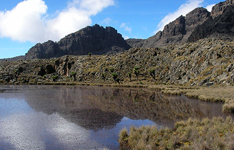
The heath thins out for the following 10 kilometers or so as the route approaches The Scoop, which is located at the end of a long ridge that leads to the summits. From here, you may either continue the ridge to Austrian Hut via Tilman Peak or walk west around Lake Hohnel to MacKinders Hut.
Hiking the Kamweti Trail
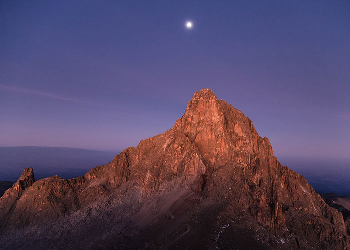
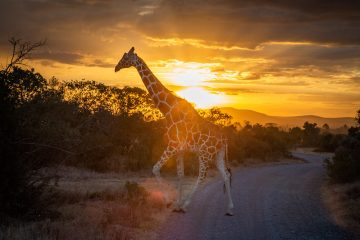
Mt. Kenya is Africa’s most magnificent mountain.
We’re talking about awe-inspiring alpine lakes and rock formations, as well as golden moorlands and waterfalls, to mention a few.
There are other options to choose from, but if you like the less-trafficked road, this is the trail for you.
The trek provides you a complete understanding of each mountain zone.
The walk includes a day in the rain forest, two days in the bamboo forest, and two days in the golden moorland before ending in the alpine desert. Here’s a taste of what to anticipate from the path. Please remember that you must walk the entire trail to get the complete experience.
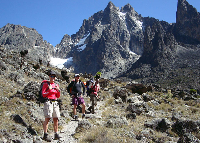
The walk begins at the well-known Castle Lodge, which offers views of the major peaks.
The sound of the river gushing down is soothing, and the birds chirping make you feel at ease. Take a break on one of the historic bridges with a view of the waterfalls.
At the 8-kilometer mark, a diversion through the thicket of wild berries leads to a steep slope to a swimmable pool at the bottom of the Ford Falls, which flow from the Gathiba River.
Old Kamweti Camp
The camp is located in a clearing with historic colonial houses at the border of the bamboo zone.
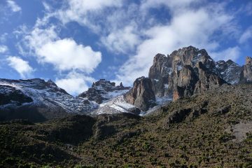
On a clear day, the camp provides a fantastic view of the Batian and Nelion peaks, and breakfasting here as the sun rises over the summits is a magical experience.
Sagana River Camp
From here on out, the route is solely dedicated to detecting animal tracks, primarily elephants… imagine bamboo woods embracing each other… Sagana River Camp is reached through a canopy walk.
The huge rocks in the river offer vantage points to just sit, converse, and learn from nature, and camping here allows for longer moments of connection. Set at the edge of Sagana River camp is one of the favorite spots on this route; the huge rocks in the river offer vantage points to just sit, converse, and learn from nature, and camping here allows for longer moments of connection.
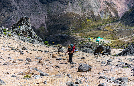
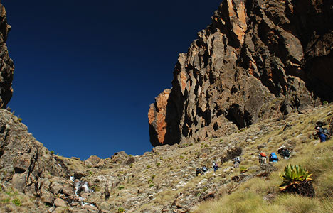
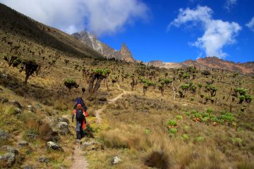
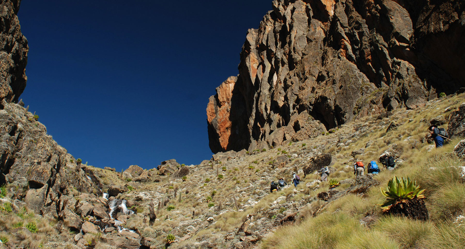
Further up, the bamboo forest gives way to huge heather, and the stroll beneath these moss-covered trees is breathtaking…the heart is astonished, restored, and invigorated all at once.
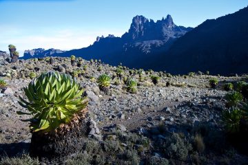
The Golden Lures of the Moorland
After a day and a half through bamboo forest and enormous heather, it’s arguably the country’s longest moorland trek…
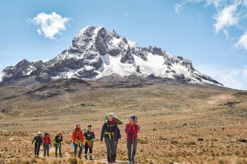
The wide terrain is very refreshing, and it’s great to be able to see the peaks again.
Thegu Valley
Thegu River flows through the Thegu Valley. It’s a golden yellow valley that dazzles when the sun shines in the morning or evening.
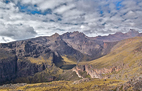
Lake Howell
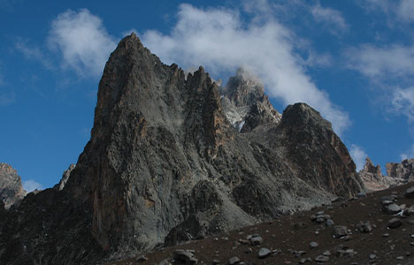
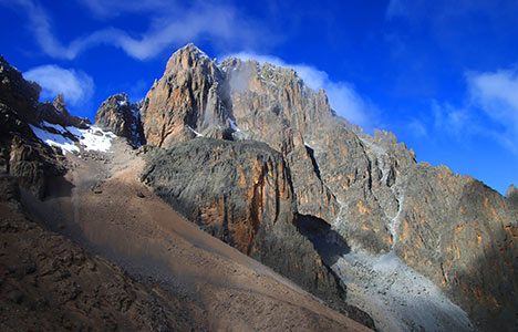
Lunch beside the lake is by far the highlight of climbing Mt. Kenya by this trail; with a massive volcanic rock formation in the background and the main peaks (Batian Nelion, Lenana) beyond, it’s a site you’ll want to spend your whole lunch break.
Teleki Valley
As the moorland diminishes, we approach the big Lobelia zone shortly after lunch near the lake.
We reach Teleki Valley to join the Naromoru Trail as the sight of the lake fades, bringing the vistas of Batian and Lenana even closer.
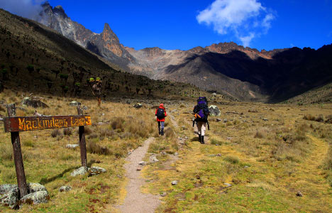
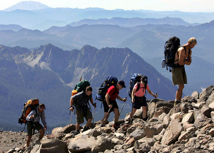
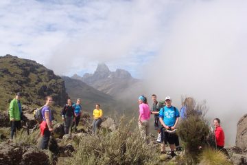
Push for the Summit
The Kamweti and Naromoru paths share Mackinders camp as a base camp. It’s one of the longest summits, requiring roughly 4-6 hours to reach Point Lenana.
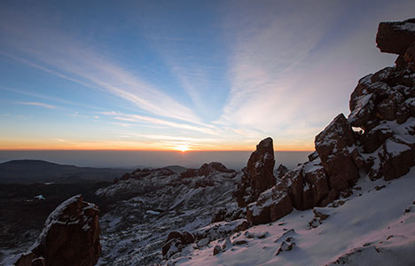
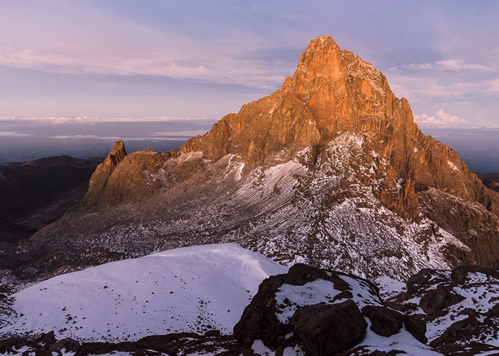
Mt. Kenya, sunrise near Point Lenana
Starting at 2 a.m., try to be to Point Lenana at 6.20 a.m. to witness the sun pierce the earth’s edge from the 3rd highest point.
Lewis Glacier
On the mountain, this is the only glacier of any magnitude. They sat on the left side of the trail from Austrian Hut for our last push to the top (4700m Asl).
A cable stretches all the way up to Point Lenana at roughly 4800 meters above sea level.
This is the world’s highest via Ferrata, and the cable aids hikers in securely navigating the summit’s final steep stretch.
Point Lenana
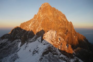
It is the third-highest point and the only trekkable summit of the three main peaks, while the other two, Nelion and Batian, are only accessible by (technical)climbing.
Depending on the schedule, one can choose to descend through the Sirimon or Chogoria trails, each with its own unique charm.
You will soon have the opportunity to experience this path, which will begin on November 20th and last for six days. If you would like to join us on this infrequently traveled trail, here are the information. Other packages in Mt. Kenya may be found here.
We also offer interesting treks every Saturday throughout the year; to be a part of the adventure excursions, grab a copy of the adventure calendar to help you prepare ahead.
Kamweti Waterfalls
The lovely waterfalls may be seen on the Mt Kenya slopes. The journey takes you over two hours from Nairobi to the Castle Forest Station, where the adventure begins with a stroll through the tranquil forest to the lovely Kamweti Falls and return. The path is quite difficult, with deep montane forest, luxuriant groves of huge bamboo, and muddy conditions when wet.