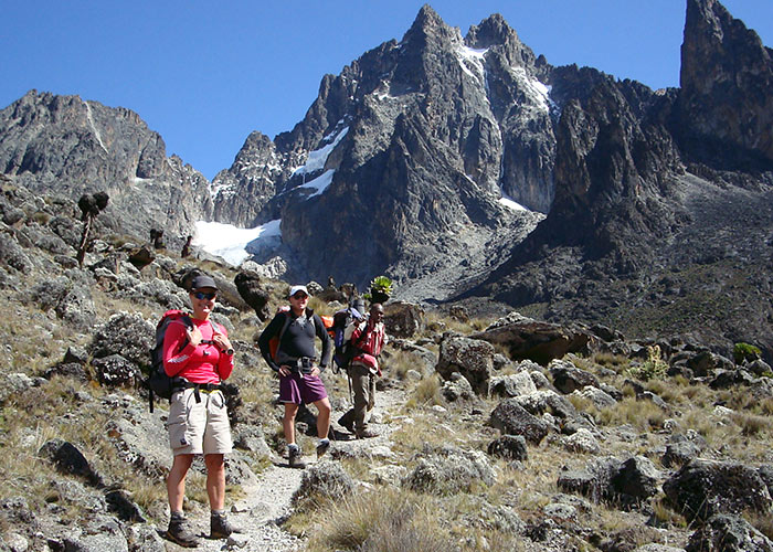
The Sirimon Route is reached from the mountain’s northwestern corner, and the Kenya Wildlife Service operates the Sirimon National Park Gate at the road’s end, where you may pay your fees and find lodging. The route is commonly regarded as one of the simpler ones because it rises steadily with only a few tougher portions before reaching the summit camp. It is also the most popular route at the moment, however it is far from congested. Old Moses Hut (3400m) and Shiptons Hut (3400m) both include dormitory rooms, bathrooms, and camping areas (4200m).
On the first day, the route follows a vehicle track, the second day open moorland and the MacKinder Valley, and the third day the North approach to Point Lenana.
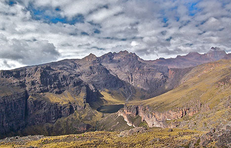
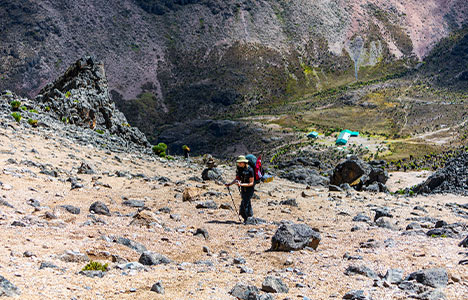
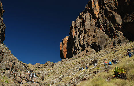
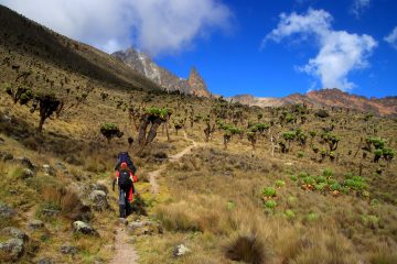
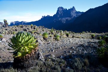
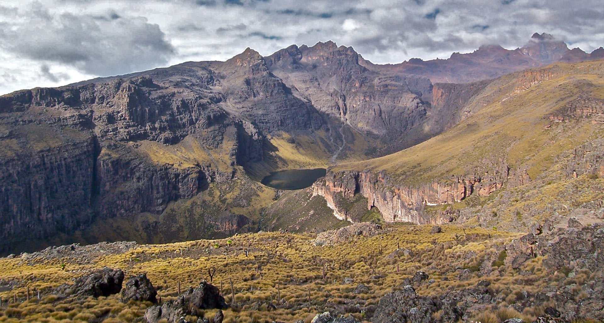
On this road, the woodland is scant, and the bamboo zone is hardly visible. The alpine heath and moorland are where you’ll spend the majority of the second day. If the weather is fine, crossing the ridge into the MacKinder Valley is a fantastic perspective, and the approach to the summits down the famous U-shaped MacKinder Valley may be stunning. The enormous Lobelia and Groundsel that are typical of Mt Kenya Flora may be seen in abundance in the MacKinder Valley. Shipton’s cave or hut is also a good place to watch Rock Hyrax.
- This path is the most convenient and picturesque way to reach the northern side of the central peaks, including Batia, Nelion, and Lenana. The trail is 15 kilometers long and leads to Meru from Nanyuki town. This path has several benefits that make it more appealing and pleasant.
- It is located on the northwestern flank of Mt. Kenya and receives little rain, making it drier than other routes for the most of the year.
- The Old Moses camp, at 3300 meters, and Shipton’s camp, at 4200 meters, are the only permanent sites (overlooking the main peaks)
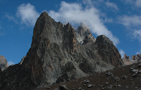
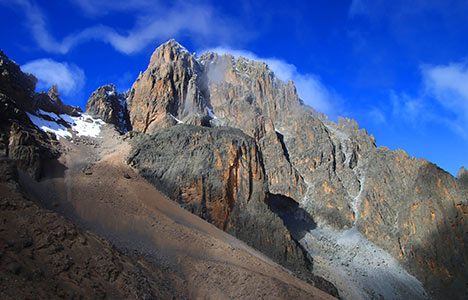
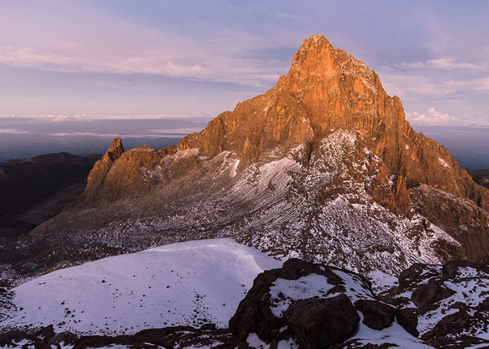
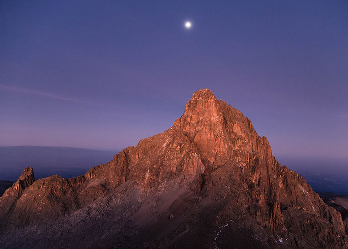
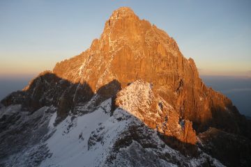
- From the Shipton camp in the Mackinder valley, you can see all of the main peaks, including Terere and Sendeyo, two old parasitic vents of the main summits.
- You may always replenish your bottles of water, and you have the opportunity to cross the Equator both in Nanyuki and on your route to Old Moses Camp.
From base to summit, this is the most off-the-beaten-path and physically feasible route on the northern side of the core peaks, taking three to four days.
It is the driest part of the country, escaping much of the rain that falls on the mountains. Nonetheless, there is plenty of drinking water and there is always plenty to refill bottles.
The road travels through unusual, wildlife-rich yellowwood woods that give way to moorland — there is no bamboo forest on this portion of the mountain.
A typical hiking route from Point Lenana to Sirimon through the Chogoria crossing is as follows:
This is a common plan that includes one necessary camping night and combines the two most picturesque routes, Sirimon through Chogoria.
Mount Kenya – Sirimon Itinerary (5 Days)
Day 0 (Optional): Arrive in Nairobi and spend the day at the Base Lodge.
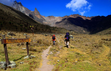
Day 1: Arrive in Nairobi and pass through the Sirimon Park gate. Hike through the jungle and bamboo for 3–4 hours before arriving at Old Moses Hut for the night.
Day 2: Long trip over moorlands to the base of the peaks (may be broken into two days of trekking) (7 hours). Shipton’s Hut is a great place to sleep.
Day 3: Rise early to view the dawn from the peak of Point Lenana. Descend to Minto’s camp and relax or explore the Gorges Valley for the day. Minto’s campground is a great place to sleep.
Day 4: Depart for Meru Mount Kenya Lodge through the left bank of the Gorges Valley. 5 – 6 hours
Day 5: Return to base via the Chogoria Forest, where car transfers to Nairobi or Base Lodge are available.
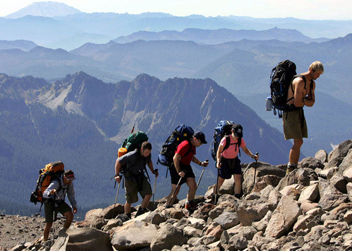
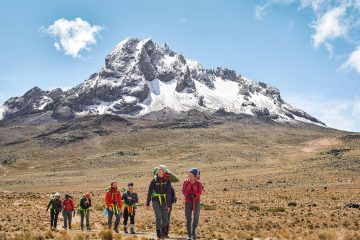
Hikers typically pick several routes for their ascents and descents, with the Sirimon-Chogoria (6 or 7 days) and Sirimon-Naro Moru (5 days) alternatives being the most popular. Hikers will be able to view far more of the mountain as a result of this.
Accommodation Huts on Sirimon Route
Likii North Hut is a small bothy that sleeps eight and provides little more than shelter.
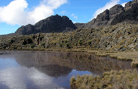
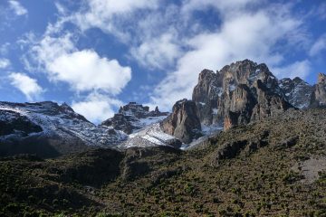
Shipton’s Camp is one of the larger huts on the mountain. It is close to the little climbed Terere and Sendeyo, which are seen in the background.
- Sirimon Bandas (2,650 metres (8,694 ft))
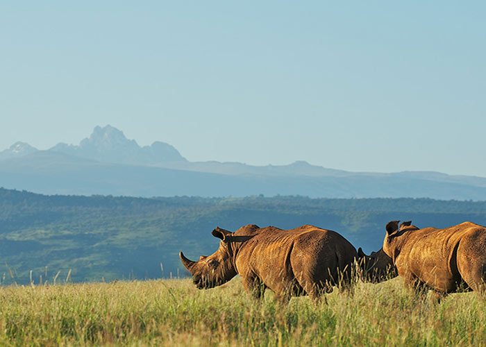
- Sirimon Bandas are located inside Mt Kenya National Park, near Sirimon Gate. Two bedrooms, a kitchen, a dining room, a bathroom, and a balcony are included in each banda. There is hot water available. The surrounding region is home to a variety of animals, including hyenas, zebras, antelope, baboons, and a variety of bird species. Despite the fact that the bandas are only outside the gates, park fees must be paid.
A campground with flowing water and steep drops is located near to the bandas.
- Sirimon Bandas are located inside Mt Kenya National Park, near Sirimon Gate. Two bedrooms, a kitchen, a dining room, a bathroom, and a balcony are included in each banda. There is hot water available. The surrounding region is home to a variety of animals, including hyenas, zebras, antelope, baboons, and a variety of bird species. Despite the fact that the bandas are only outside the gates, park fees must be paid.
- Old Moses Camp (3,400 metres (11,155 ft))
- Bantu Utamaduni Lodge is in charge of Old Moses Camp. It has dorms, a huge campground, and lodging for guides and porters.
- Liki North Hut (3,993 metres (13,100 ft))
- Liki North Hut was formerly little more than a makeshift shelter to keep the elements at bay, but it currently lacks a roof and so no longer serves as a shelter. There is, however, space to camp, a modest toilet, and water from a nearby river. It’s on a less-traveled trail between Old Moses and Shipton’s Camps, and it may be used as a base for ascending Terere and Sendeyo, or as a rest stop on the way to Shipton’s Camp.
- Shipton’s Camp (4,236 metres (13,898 ft))
- Bantu Utamaduni Lodge is in charge of Shipton’s Camp. Many rock hyrax live there, as well as striped mice, a variety of sunbirds, and Alpine Chats. Mountain Buzzards soar over the sky. Giant groundsel dominates the vegetation, although there are also numerous flowers including lobelia. A view of Points Peter and Dutton from the skyline, with Batian looming above them. Thompson’s Flake and Point Thompson are also visible, with Point Lenana on the other side of the Gregory Glacier. The Krapf Rognon stands in front of the major peaks, with the Krapf Glacier behind it.