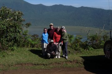
Mount Hanang, at 3418 meters, is Tanzania’s fourth tallest peak, behind Kilimanjaro, Meru, and Lolmalasin. It is a prominent feature in Hanang district, which is roughly a 4-hour drive south of Namanga, the country’s northern border. Small craters, Lake Balangida, the Mangati plains reaching to the south, and the Rift Valley escarpment stretching to the north. Hanang District is located in the Manyara area, approximately 242 kilometers south of Arusha.

It was only in recent years that Mt. Hanang was granted the designation of Nature Forest Reserve, despite the fact that it has been a protected area in some form or another for many generations.
Mount Hanang is a mountain located in the Hanang district in the Manyara region. It is a volcanic peak.

After Mount Kilimanjaro, Mount Meru, and Loolmalasin peak in the Ngorongoro highlands, it is the fourth highest mountain in Tanzania, reaching an elevation of 3,420 meters above sea level. It is classified as the fourth tallest mountain in Tanzania.

Mountain Hanang is a dormant volcano that may be found in the Great Rift Valley, approximately 250 kilometers away from the capital city of Arusha. Volcanoes that are considered to be “quiet” yet have the potential to erupt again in the future are known as dormant volcanoes. The term “dormant volcano” refers to a volcano that has been “silent” for a number of years but has recently erupted or shown signs of activity.

It was only in recent years that Mt. Hanang was granted the designation of Nature Forest Reserve, despite the fact that it has been a protected area in some form or another for many generations. An enclave of evergreen montane forest on the mountain’s higher slopes is protected by its forest reserve, which covers an area of 58.66 square kilometers and safeguards the forest community.

The tall mountain, which is located amid the normally semi-arid landscape of Hanang district and the districts and regions that surround it, has formerly served as an important source of fresh water for the people and animals that are located on its slopes.

How many days can you hike Mount Hanang?

The mountain, which rises to 3418m atop difficult inclines, may be reached in two days or in one day if you want to soak in the scenery.

Three routes are available: the Giting Route, which begins in Giting Village, the Ngendabi Route, which offers a variegated scene, and the shortest Katesh route, which begins in Katesh.

Mt Hanang is located in the Hanang District of the Manyara Region, 242 kilometers southwest of Arusha, Tanzania. Two prominent ethnic groups cohabit in the region: the semi-nomadic southern Nilotic Datoga (also known as Barbaig) and the agricultural southern Cushitic Iraqw. The Iraqw have pioneered commercial farming in the area.

Mt Hanang may also be a thriving habitat for 400 kinds of birds, providing superb birding opportunities along remote trails. Hikes with a tour guide from Datoga might be arranged, as well as bike trips to remote places.

Activities and things to do at Mt Hanang

Tourists may also have the opportunity to participate in local pottery and brick manufacturing, as well as brew local beer. You’ll also get a tour and experience firsthand development efforts in dairy farming, water purification, and cow husbandry.

Tanzania Hikes

2 days Mount Hanang trek

2 Days Mount Hanang Trek

With a height of 3,417 meters above sea level, Mount Hanang is Tanzania's third-highest peak after Kilimanjaro and the Meru

One Day Kilimanjaro Trek to Mandara Hut- Marangu

The 1 day hike to Kilimanjaro's Mandara Hut, the first accommodation point along the Marangu route begins with an early

4 Days Mount Meru Trek

This 4 Days Mount Meru trek is a marvelous opportunity to climb the second highest mountain in Tanzania which is located

One Day Hike on Kilimanjaro to Shira Plateau

Experience a one-day trip to Mount Kilimanjaro's Shira Plateau. Climbing Mount Kilimanjaro is a challenge that many would love to

Hanang People

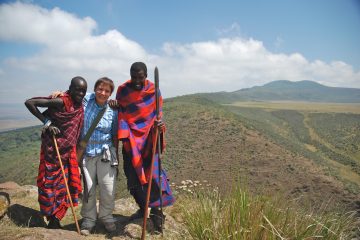
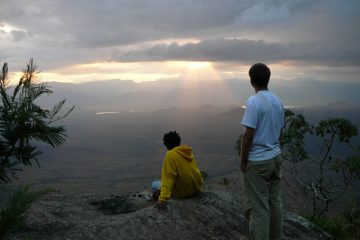
The Barbaig and the Iraqw are the two primary ethnic groups that live in this area. Visitors are welcome to mingle freely with the Barbaig, also known as Mang’ati, who live in the Mang’ati plains. 400 bird species will greet you on your walks in the region if you are interested in bird watching.
The Barbaig are classed as Nilotes, whereas the Iraqw are classified as southern Cushites.
Both have a diverse and fascinating culture.

Barbaig women are often dressed in goatskin skirts and blankets. Men are frequently clad in black cloth and wield spears while they wander about. Colorful cotton blankets are commonly worn by Iraqw people.
Subsistence and commercial farming are the primary economic activity in the Hanang district. The Iraqw are the ones that do it the most. Pastoralists are the Barbaigs’ main occupation. The Iraqw raise animals as well, though they are not as reliant on them as the Barbaigs are.

Hanang’s residents have the following to offer:

  • A unique cultural trek in Barbaig
  • A once-in-a-lifetime opportunity to climb Mount Hanang
  • Cycling adventures to far-flung locations
  • An opportunity to take part in local brick and pottery manufacturing, as well as beer brewing.

English-speaking guides who are familiar with the region can assist you.

Barbaig culture will be explained by a Barbaig native guide.

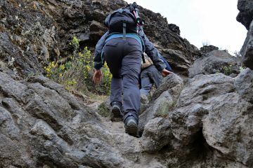
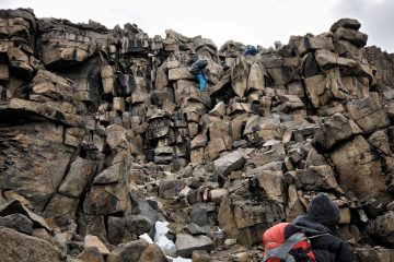
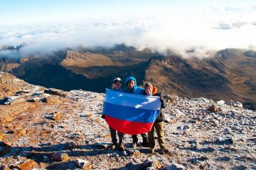
Mount Hanang Climbing Routes

There are three established routes for hiking Mount Hanang in Babati, Tanzania and they include, Katesh Route, Ngendabi Route and the Giting Route.

Katesh Route

The Katesh route, which runs from Katesh to the southwestern ridge, is the quickest and most common ascent: five to six hours to the summit, camping at 3000m, and a three- to four-hour descent the next day. If the physical effort is more essential than the delight, you may go up and down in one day, but start early. Allow time to organize transportation from Babati to Katesh as well as pay the forest fee, so budget at least two days.

Allow time to organize transportation from Babati to Katesh as well as to pay the forest charge, so plan on spending at least two or three days overall.

Ngendabi Route

Descending through the Ngendabi trail, or rising along it then descending to Katesh, is suggested for a change of scenery. The trip begins 16 kilometers (3 hours) northwest of Katesh at Ngendabi hamlet. Accommodation in Ngendabi is provided on an ad hoc basis by primary school teachers, but should not be relied upon.

Giting Route

The Giting route, which starts at Giting hamlet on the mountain’s northeast flank, is the principal alternative to the Katesh and Ngendabi climbs. Because of the terrible road, you may require your own 4WD. You’ll also need to pay the forest charge at Katesh initially. Accommodations are available along the way.

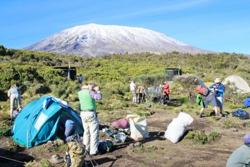
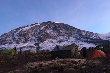
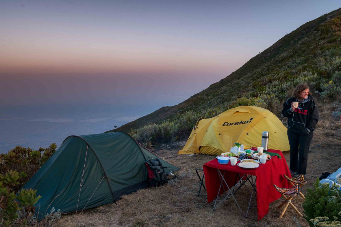
Accommodation & camping options at Hanang

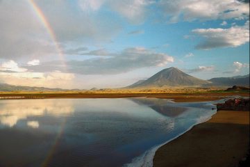
For years, accommodations along this route have been planned to take advantage of the stunning views of Lake Balangida; inquire as to whether this has finally occurred in Babati.
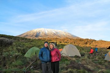
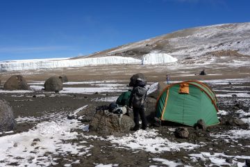
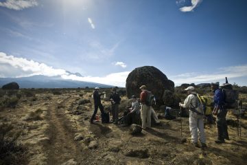
All routes allow camping, but you must be completely self-sufficient; bring plenty of water because there is none at the peak and no guarantee of any lower down. Don’t underestimate the mountain: at 3417m, it becomes rather chilly, so dress appropriately.

Camping at Mount HanangHow to get to Mount Hanang

You can get to Hanang by road in two ways, by public transport, and by private transfers. We can advise and provide both modes of transport to help you get to the Hanang mountain.

Public Transport to Mount Hanang from Arusha

From Arusha, there are various ways to go to Mount Hanang. To begin, there is a public transportation van or vehicle that runs from Arusha to Katesh, and you may get out in Katesh and walk the short distance to the tourism office. In Babati, you may need to change vehicles depending on your bus, however, your driver can clarify this for you.

Private Transfer

The second alternative is to book a private shuttle, in which case we will give you a very nice van with air conditioning, wifi, and a driver who will assist you with arranging everything once you reach at Longido.

Why choose Mount Hanang vs Mount Meru & Mount Kilimanjaro?

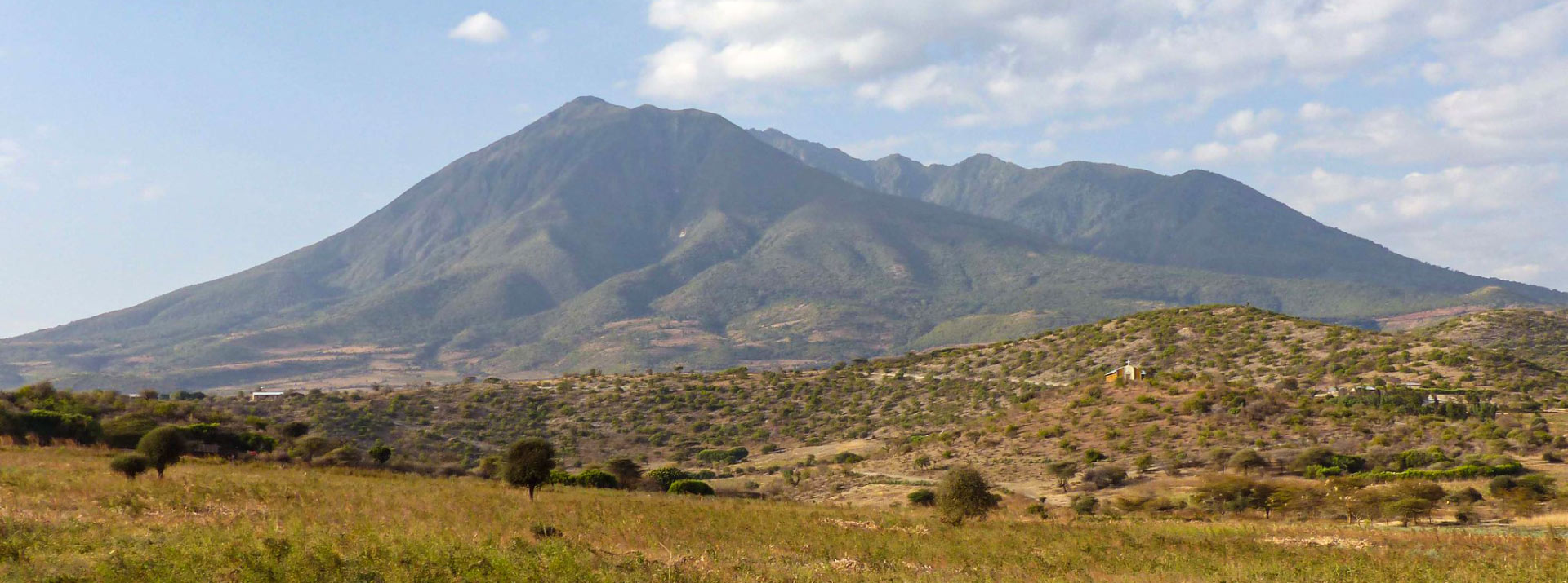
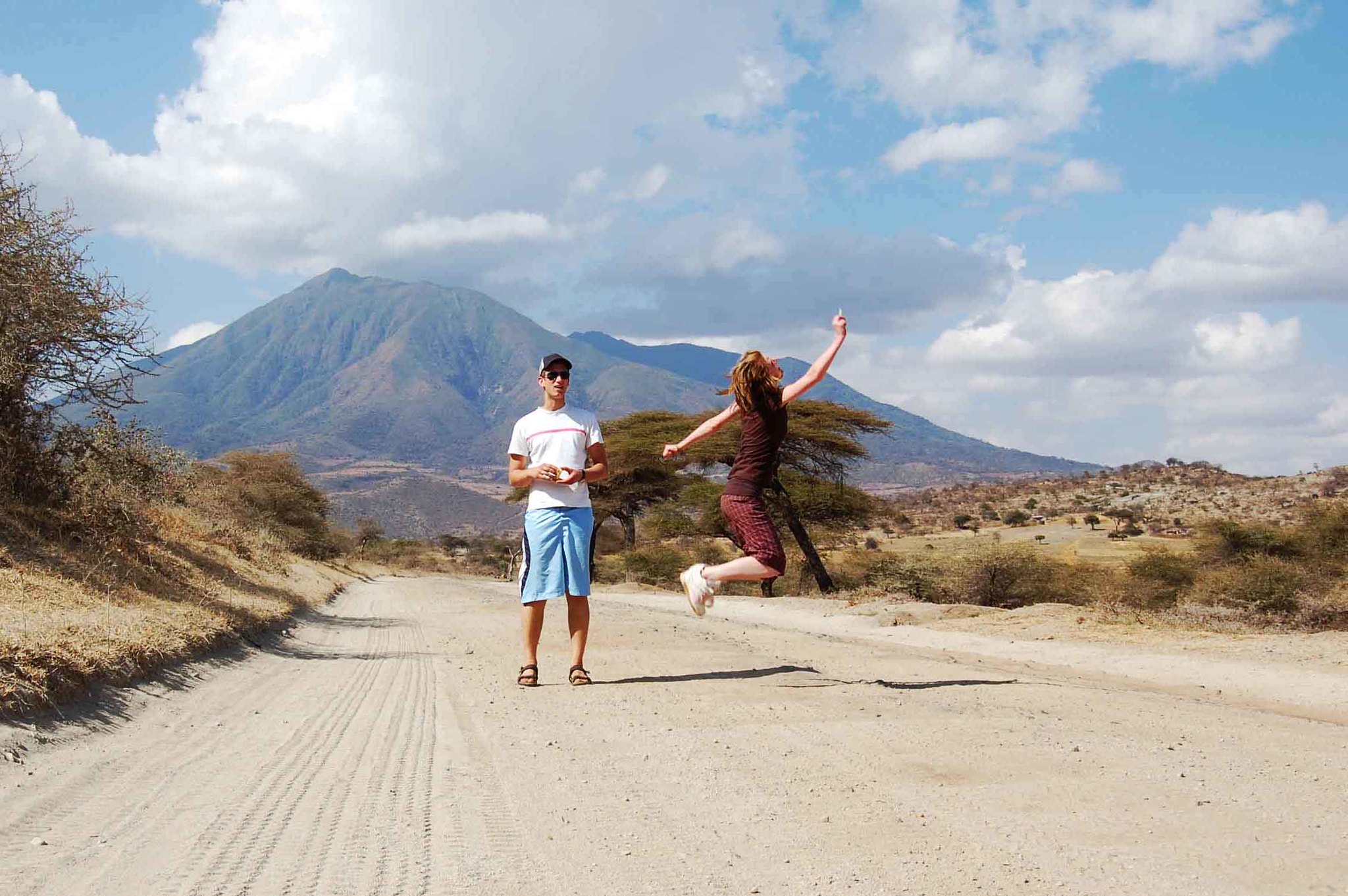
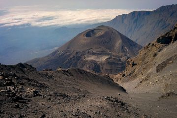
Mount Hanang is the third highest mountain in Tanzania (3417m), and because it is not located inside a national park, it is more affordable and the cheapest option to climb in Tanzania making it perfect for people on a limited budget and people that just want to have a short adventurous hike in a small amount of time.

Do you need a guide to climb Mount Hanang?

Yes, we would recommend a local guide as some paths on the trails are overgrown and these local guides know the way around the mountain very well.
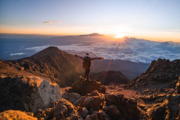
Hiking Mount Hanang

Hiking, cultural excursions, and bird viewing are some of the activities available in the Mount Hanang region.

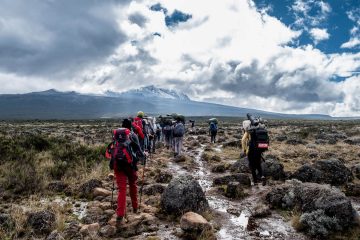
The Jorodom Route, Katesh route, Gendabi route, and Giting route are the routes that hikers use to reach the top of Mount Hanang. The ascent takes roughly 5 to 6 hours, while the descent takes 3 to 4 hours. Climbers might also choose to stay at the mountain camp the next day before descending.

The shortest hiking path on Mount Hanang is the Katesh trail, which reaches the peak from the southwestern side.

The Gendabi trail, which approaches the mountain from the northwestern side and begins at the top, is quite picturesque with great views.

The Gendabi route, which begins in the Gendabi hamlet and climbs the peak from the northwestern side, is quite attractive with wonderful views. Descending from this path also provides a chance to experience Hanang’s landscape.

The Giting road approaches Mount Hanang from the northeast, beginning at Giting settlement, some 240 kilometers from Arusha town.

Mount Kilimanjaro Tours

Uhuru Peak via Lemosho Route
Best seller!

8 days Lemosho Route Itinerary

You get an extra day to acclimatize on Mount Kilimanjaro if you choose the 8-day Lemosho route plan. The Lemosho
7 days Machame Route
Popular!

7 days Machame Route Itinerary

The 7-day Machame Route gives you an advantage over the 6-day Machame Route since it gives you ample time to

6 Days Marangu Route

The more advantageous option for ascending Mount Kilimanjaro via the well-known Marangu route is the 6-day Marangu route plan. For

9 days Northern Circuit Route

The 9 days Northern Circuit Route is one of the easiest routes on Mount Kilimanjaro. It is a recently introduced

7 Days Rongai Route

This is a 7 days Rongai route itinerary variation with an extra day for acclimatization. Gradually sloping towards the summit,

9 Days Crater Camp via Lemosho Route

This 9-day crater camp trek combined with the 8-day Lemosho route climb is a unique and ultimate Kilimanjaro experience. Crater

7 days Lemosho Route

The shorter 7-day Lemosho route variant does not include the extra acclimatization day as the 8-day Lemosho route itinerary. The

6 days Machame Route

For mountain climbers with prior climbing expertise and the capacity to acclimate more quickly, the 6-day Machame route is advised

6 Days Rongai Route

This 6-day route uses the Rongai Route to get you to the top of Mount Kilimanjaro. Treks up the Rongai

5 Days Marangu Route

The Marangu route, which is the mountain's oldest and most popular path, is used in the five-day Marangu route itinerary.

6 Days Umbwe Route

Many climbers, particularly first-timers, dislike the 6 day Umbwe Route Kilimanjaro itinerary for a variety of reasons. It is one

11 Days Western Breach Route

Due to the risks involved in taking this route to ascend the peak, the 11-day Western Breach route itinerary is

7 Days Shira Route

Shira is an ancient route that does not adhere to normal acclimatization guidelines, so the Lemosho Route, which is more

One Day Kilimanjaro Trek to Mandara Hut- Marangu

The 1 day hike to Kilimanjaro's Mandara Hut, the first accommodation point along the Marangu route begins with an early

One Day Hike on Kilimanjaro to Shira Plateau

Experience a one-day trip to Mount Kilimanjaro's Shira Plateau. Climbing Mount Kilimanjaro is a challenge that many would love to

A multitude of streams that originate from the evergreen forests are the avenues via which water can be accessed. Himiti and Gendabi are two of the most important streams, and both of them were inundated the day before yesterday, wreaking devastation on the people who live in Katesh and Gendabi, respectively.

In recent years, the mountain has been marketed for tourism, particularly for mountain climbers. The primary route to the mountain’s peak is through the town of Katesh, which was the location that was hit the hardest by the catastrophic floods that occurred early yesterday morning. The floods resulted in the deaths of at least twenty people and injuries to a large number of others.