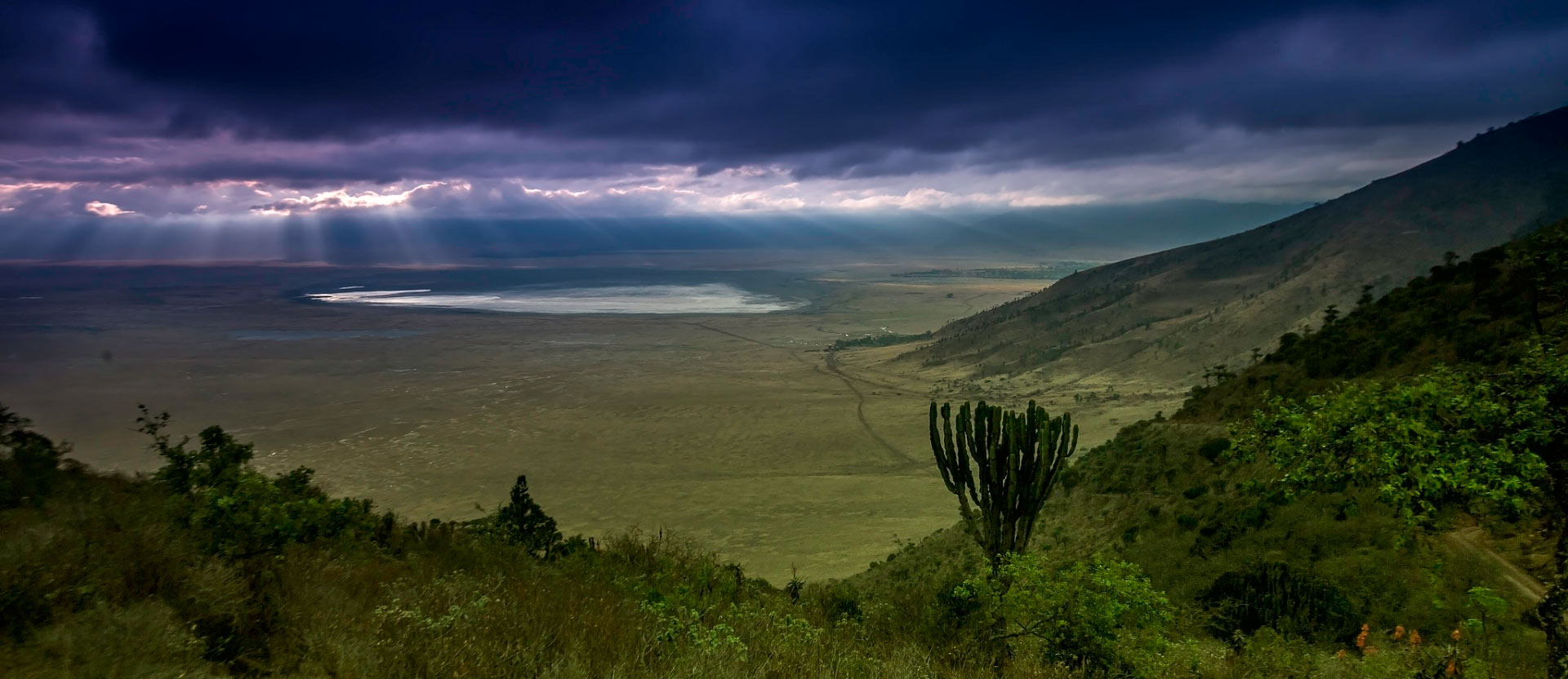
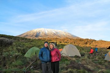
Trekking in the Highlands of the Ngorongoro Crater
A walk through these highlands of the Ngorongoro Conservation Area will undoubtedly provide you with an unforgettable experience.
The Highlands provide unique access to two lesser-known wonders of the Ngorongoro Conservation Area. On a historic Maasai cattle track to the Olmoti crater, a half-day journey allows you to see birds, butterflies, and a variety of fern species. Hikers can see buffalo, zebra, and bushbuck, as well as the rare elephant.
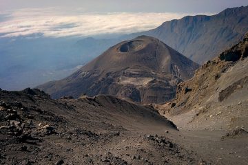
A drive to the Empakaai Crater, followed by a hike into the crater bottom to observe flocks of pink flamingos and the hilly jungle, is another remarkable adventure. You’ll also be able to see features of traditional Maasai life and get a view of Tanzania’s most active volcano, Oldoinyo Lengai.
Adventure hikers will enjoy a safari.
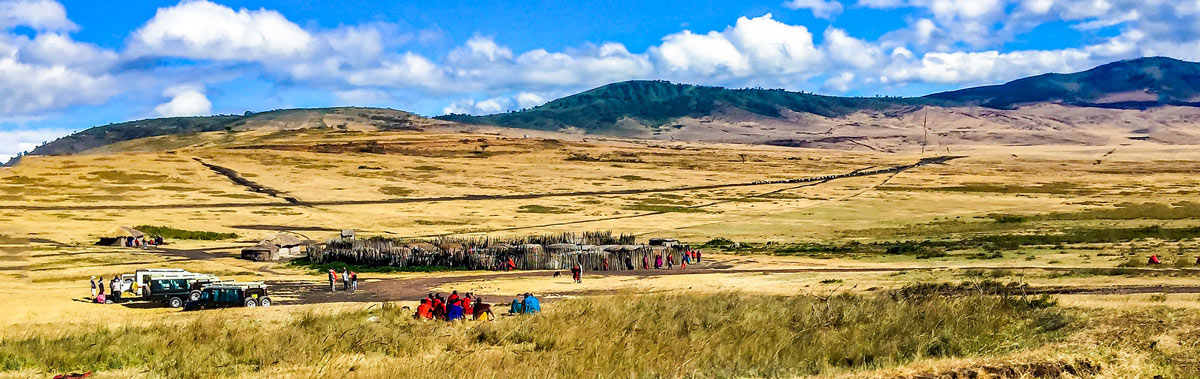
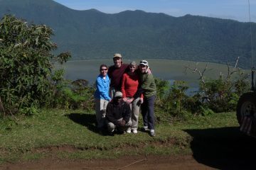
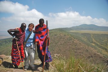
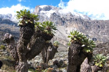
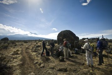
The Ngorongoro highlands safari is designed for those seeking a once-in-a-lifetime adventure in the heart of Maasai territory. You’ll be travelling through Maasai towns and homes, learning about their customs, culture, and way of life. The Ngorongoro Crater Highlands include a diverse range of fauna, as well as woods, grassland with plants, and water sources.
A Flamboyance of flamingos
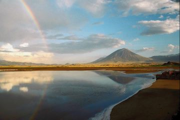
The sight of tens of thousands of flamingos in Lake Natron is sure to astound even the most seasoned safari enthusiast. The many diverse types of birds, the ever-present vistas of the mountains, valleys, crater, and river gorges, and the grazing buffalo, Impala, and Thompson’s Gazelle in Embakai crater will blow your mind, so bring your largest memory card for your camera.
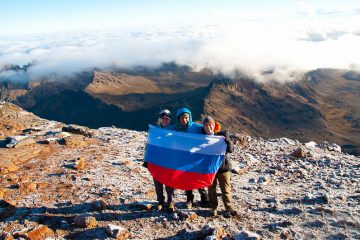
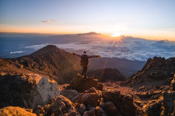
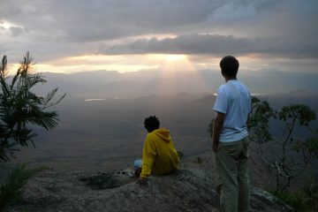
The Crater Highlands trek is not as difficult as climbing Kilimanjaro or Mt Meru; there is a lot of uphill and downhill trekking, but no significant altitude changes, so it should be enjoyable. You will hike all the way to Ol Donyo Lengai, “The Peak of God,” the sacred mountain of the Maasai people.
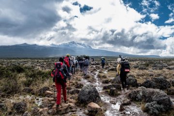
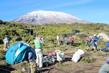
You won’t have to worry about your luggage: you’ll just carry a small daypack, and the rest will be carried by porters and donkeys.
The safari concludes with a night climb to the active volcano Ol Donyo Lengai, a sacred peak for the Maasai people, for a spectacular sunrise perspective of Mount Kilimanjaro. On the safari, you will spend most of the time walking, but you will also drive for some miles. This is because the distance is too great to cover in only five days. For security reasons, your automobile will be with you the entire time. If you or any member of your party falls ill, we must be able to transport you to a hospital as soon as possible.
The Ngorongoro Conservation Area
The Ngorongoro Conservation Region is a protected area and a UNESCO World Heritage Site in northern Tanzania’s Crater Highlands geological area, located 180 kilometres (110 miles) west of Arusha City in the Arusha Region.
Because it is Tanzania’s only conservation area that preserves wildlife while permitting human habitation, the conservation area’s land is multi-use and unique. Land usage is regulated to avoid having a detrimental impact on the animal population. Cultivation, for example, is forbidden at all levels to save subsistence.
The region is part of the Serengeti ecosystem and borders the Serengeti National Park to the northwest, as well as the southern Serengeti plains.
These plains also stretch north into the unprotected Loliondo division, which remains open to wildlife through the Maasai’s transhumance pastoralism. The volcanic mountains to the south and west of the region include the famed Ngorongoro Crater and the lesser-known Empakaai Crater. The rim of the East African Rift wall roughly defines the southern and eastern limits, which also inhibits animal movement in these regions.
Olduvai Lodge: Discover the Cradle of mankind in Ngorongoro
Oldupai Gorge, sometimes known as Olduvai Gorge, is a gorge in the Olduvai Plateau.
The Oldupai or Olduvai Gorges, located in the plains, are also protected within the Ngorongoro Conservation Area. After the discovery of the oldest known specimens of the human species, Homo habilis, as well as early hominidae, such as Paranthropus boisei, it is considered the cradle of mankind.
In the Great Rift Valley, which runs across eastern Africa, the Olduvai Gorge is a steep-sided gorge. Olduvai is a 50-kilometre (31-mile) long crater on the eastern Serengeti Plains in northern Tanzania. It is the driest area of the region, as it sits under the rain shadow of the Ngorongoro highlands. The gorge was called after the Maasai phrase ‘Oldupaai,’ which refers to the wild sisal plant Sansevieria ehrenbergii.
It is one of the world’s most important prehistoric sites, and research conducted there has aided in the understanding of early human evolution. Mary and Louis Leakey pioneered excavation work there in the 1950s, and their family continues it now.
Some speculate that the location was once a vast lake whose sides were buried in successive layers of volcanic ash millions of years ago. Seismic activity redirected a nearby stream, which began to dig through the sediments, revealing seven primary strata in the gorge walls some 500,000 years ago.
All in all, the Ngorongoro Crater highlands offer a lot to travellers and hikers alike, from game drives to cultural walks and, of course, hiking opportunities in the much greater highlands of the Ngorongoro Conservation Area.
Ndutu Migration Area
Ndutu refers to the Ndutu Plains and the seasonal Lake Ndutu, a key wildlife zone in northern Tanzania. This area lies entirely within the Ngorongoro Conservation Area (NCA), specifically on its western edge, where the terrain transitions into the southern fringes of the greater Serengeti ecosystem (though it is not part of Serengeti National Park itself).
The Ngorongoro highlands form the elevated volcanic core of the NCA, centred on the famous Ngorongoro Crater and its surrounding ridges and calderas. Ndutu sits in the lower-lying short-grass plains to the west of this highland zone. The straight-line distance from the Ngorongoro Crater rim to the Ndutu area (including its airstrip) is roughly 85 km (about 55 miles). A typical game drive or transfer route takes 2–3 hours, descending from the cooler, misty highlands through rugged terrain into the drier, open plains.
The plains sit in the rain shadow of the highlands, making them one of the drier sections of the NCA and ideal for the seasonal movements of migratory herds.
The landscape consists of vast open grasslands dotted with scattered acacia trees, patches of woodland, marshes, and two shallow alkaline lakes: Lake Ndutu (seasonal) and the nearby Lake Masek. These features create panoramic vistas and concentrate wildlife during the wet season.
Wildlife of Ndutu
Ndutu is renowned as one of the primary calving grounds of the Great Migration. Between December and April (peaking in January–March), hundreds of thousands of wildebeest, zebra, and Thomson’s gazelle gather here to give birth. The abundance of newborn calves draws large numbers of predators, including lions, cheetahs, leopards, and hyenas. Resident species present year-round include elephants, giraffes, impalas, dik-diks, bat-eared foxes, and a wide variety of birds attracted to the lakes and marshes.
In 1973, archaeologists working on the shores of Lake Ndutu uncovered the “Ndutu cranium” (a fossilised hominin skull) and associated stone tools dating back more than 500,000 years, providing important insights into early human ancestors in East Africa.